Thunderstorms warning as rain dampens expectations of UK’s hottest day
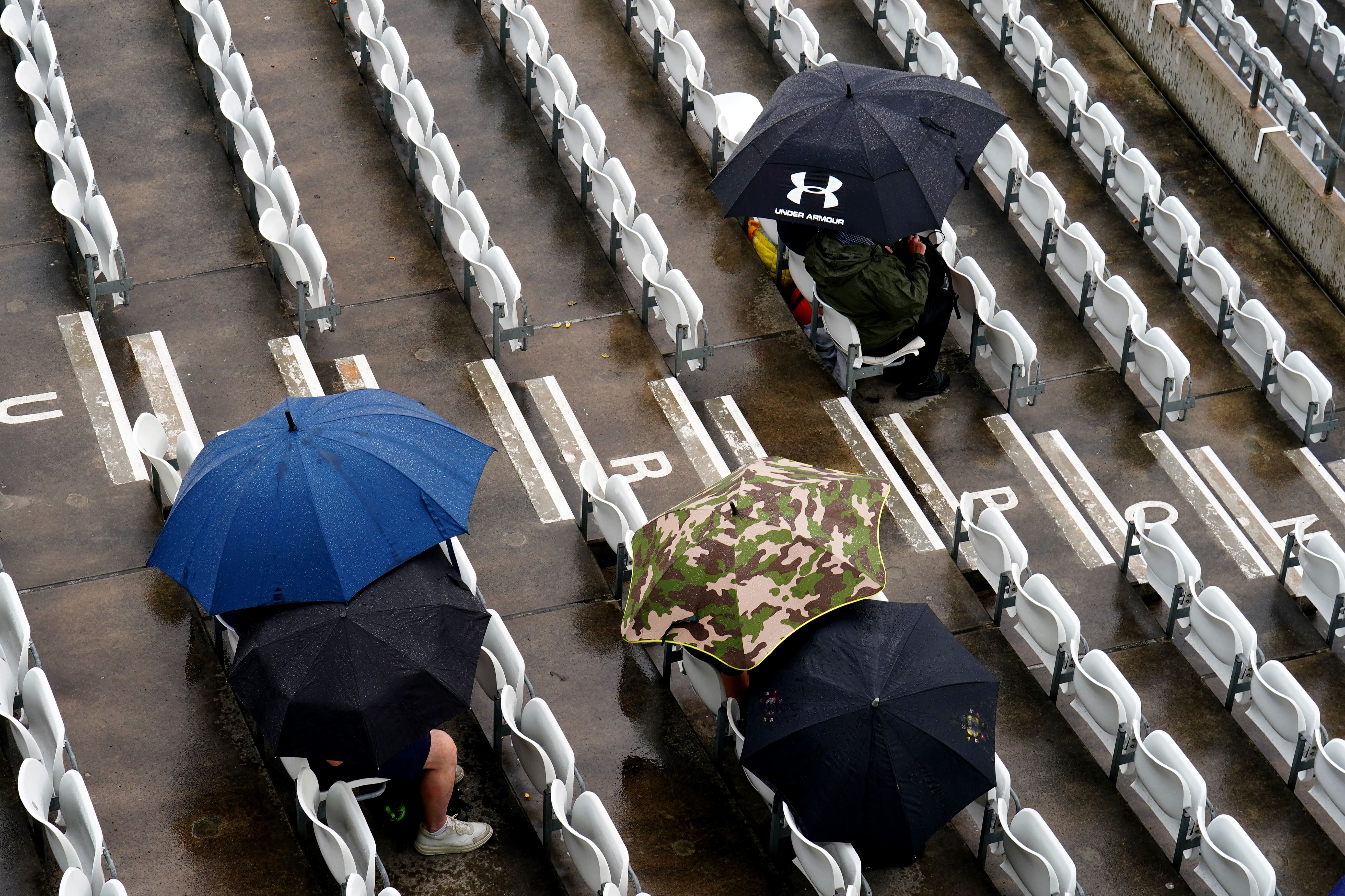
Wimbledon and the Ashes have been be interrupted by the weather.
Your support helps us to tell the story
As your White House correspondent, I ask the tough questions and seek the answers that matter.
Your support enables me to be in the room, pressing for transparency and accountability. Without your contributions, we wouldn't have the resources to challenge those in power.
Your donation makes it possible for us to keep doing this important work, keeping you informed every step of the way to the November election

Andrew Feinberg
White House Correspondent
The UK is facing thunderstorms and heavy rain as forecasts that the country could see the hottest of the year were changed.
Temperatures were initially predicted to reach 33C on Saturday – the hottest temperature this year – but the latest forecast from the Met Office suggested it will reach 30C or 31C in East Anglia.
The forecast for hot weather saw the UK Health Security Agency issue yellow heat-health alerts for six regions until 9am on Sunday: London, the South East, East Midlands, West Midlands, east of England and Yorkshire and the Humber.
A yellow thunderstorm warning is now in place for Saturday until midnight from London to north-west Scotland, and up to 50mm of rain could be seen in the northern part of the Midlands.
Wimbledon and the Ashes Test match at Headingley in Leeds have both been disrupted by the weather.
Simon Partridge, Met Office forecaster, said: “On Saturday we’ve got very warm, very muggy, very humid air across the UK, we now have this cold front which is just starting to move into the warm muggy air.
“Thunderstorms started from about 7am, there’s been very heavy downpours already, we’re expecting it to continue throughout the afternoon, the main focus will be the north of the Midlands.
“Heavy downpours are possible, particularly if you get two or three together in the space of a couple of hours.
“There is the potential for up to 50mm of rain in a few spots, most likely heavy downpours and difficult driving conditions.
“We will be keeping an eye on it in case there’s a need to upgrade the warning this afternoon to amber.”
Cooler air will come through overnight and into Sunday, and temperatures will be lower with a maximum of 25 or 26C predicted, but it will be sunnier.
Showers will develop through Sunday afternoon, with south-west England, Wales and Northern Ireland potentially seeing rain.
Another yellow thunderstorm warning is in place for Northern Ireland on Sunday between 10am and 9pm, and there is the potential for heavy showers, the Met Office said.
Into next week it will be unsettled with rain on Monday and thunderstorms expected on Tuesday and Wednesday.
The temperature will reach the low-to-mid 20s in the early part of next week, the forecaster said.
Mr Partridge added: “It won’t be as warm, as humid, and it will be a bit more changeable which probably won’t be good news for people at Wimbledon.”
Subscribe to Independent Premium to bookmark this article
Want to bookmark your favourite articles and stories to read or reference later? Start your Independent Premium subscription today.