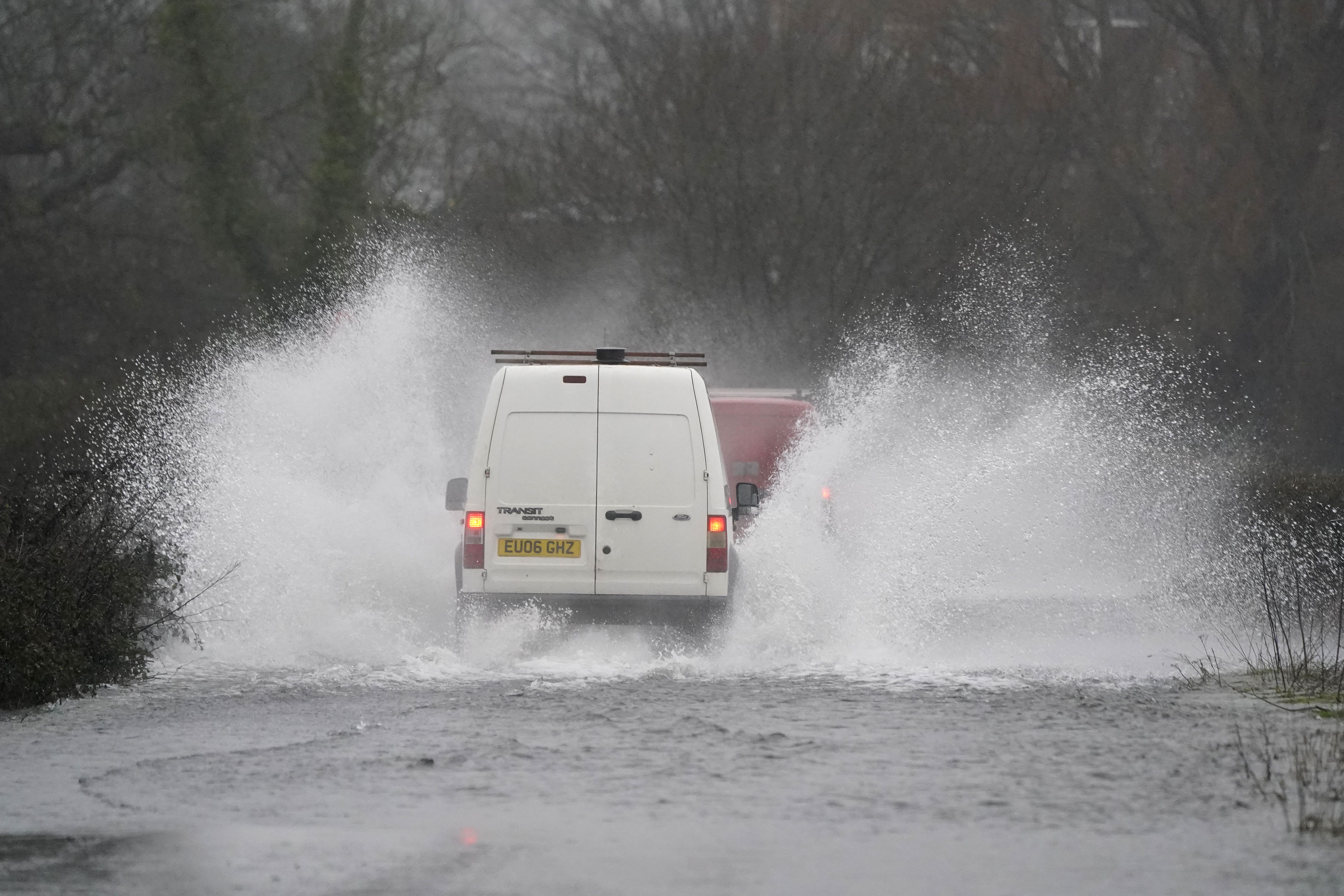
Flood warnings issued across Britain amid ‘persistent heavy rain’
The Met Office has issued three yellow rain warnings across England, Wales and Scotland, and a yellow wind warning for the Northern Isles.

Your support helps us to tell the story
From reproductive rights to climate change to Big Tech, The Independent is on the ground when the story is developing. Whether it's investigating the financials of Elon Musk's pro-Trump PAC or producing our latest documentary, 'The A Word', which shines a light on the American women fighting for reproductive rights, we know how important it is to parse out the facts from the messaging.
At such a critical moment in US history, we need reporters on the ground. Your donation allows us to keep sending journalists to speak to both sides of the story.
The Independent is trusted by Americans across the entire political spectrum. And unlike many other quality news outlets, we choose not to lock Americans out of our reporting and analysis with paywalls. We believe quality journalism should be available to everyone, paid for by those who can afford it.
Your support makes all the difference.Some homes and businesses could be flooded in parts of the UK on Tuesday, forecasters have warned.
The Met Office has issued three yellow warnings for “persistent heavy rain” throughout the day covering much of Wales, north-west England, and south-west Scotland, while a yellow warning for “strong winds” covers the Northern Isles.
Two yellow rain warnings – one stretching from Cardiff to Bangor and another covering Lancashire and southern Cumbria – will remain in place until 8pm.
A third yellow warning for rain covers south-western and central Scotland, including Glasgow and Stirling until 7pm.
The Met Office has said “some disruption” is expected in these areas, including “flooding of a few homes and businesses”, “spray” on the roads, increased journey times on public transport, and “possible” power cuts.
A yellow wind warning over the islands north of Scotland also indicates likely disruption to public transport, and that “some coastal communities will be affected by spray and large waves”, according to the national forecaster.
The warning is in place from 6pm on Tuesday until 10am on Wednesday, with wind speeds predicted to reach up to 50mph within the first few hours of this window.
More wet and windy weather is also on the way in the coming days, with a yellow rain warning covering south Wales and south-west England for 20 hours from 9pm on Wednesday.
Met Office meteorologist Alex Deakin described the outlook for Tuesday as “a rather dull and damp affair” featuring “gusty winds”.
But he added that it will be “milder than Monday”, with temperatures in the double digits for much of the UK.
Mr Deakin said: “The rain will be spreading its way through eastern England and then through Scotland.
“There will be heavy and persistent rain for north-west England and parts of Wales, and, because it has been so wet recently, this extra rain could cause some issues, so we do have Met Office yellow warnings in place.”
He added: “For many it will feel milder than Monday, but there is more wet and windy weather to come through the evening across Wales and western parts of England.
“Rapidly that band of rain should sweep across England and Wales, leaving clearer skies for a time but also plenty of showers coming in.”
Temperatures are expected to reach 13C (55.4F) in Cardiff and Belfast, 12C (53.6F) in London, and 11C (51.8F) in Edinburgh.
More than 140 flood warnings have also been issued across Britain by environment regulators, because saturated ground caused by recent wet weather means that even areas which avoid the worst of Tuesday’s deluge could be at risk of flooding.
The Environment Agency, which covers England, has issued 29 warnings, mostly clustered in Dorset where flooding is “expected”, along with 90 alerts across the country, where flooding is “possible”.
Staff from the agency have been erecting flood barriers at several of the most at-risk scenes, including in the Worcestershire town of Bewdley, which has previously experienced flooding from the River Severn.
Meanwhile, Natural Resources Wales has issued 20 flood alerts across the same areas covered by the Met Office warnings.
The Scottish Environment Protection Agency (Sepa) has issued five flood alerts across south-west Scotland, covering Argyll and Bute, Ayrshire and Arran, Central Scotland, Dumfries and Galloway, and West Central Scotland.
RAC Breakdown has advised motorists to “be on their guard” during the wet weather by driving slowly and leaving a larger space between their vehicle and those ahead.
Rod Dennis, a spokesman for the vehicle repair and insurance company, said: “Rain now appears to be a constant feature of January’s weather, so we urge drivers to be on their guard.
“The dangers of driving in freezing conditions are well known, but it’s easy to underestimate the risk that rain, especially heavy downpours, presents.
“It’s vital people slow down, leave a much larger space between their vehicle and the one in front, and avoid driving through standing water.
“Anyone driving through even very shallow water at speed risks losing control of their vehicle in what is known as aquaplaning, something which drastically increases the chances of an accident.”
For those worried about damage to their home, the National Flood Forum recommends finding out how to turn off your gas, electricity and water supplies, and keeping a list of useful contacts including for your GP and insurance company.
The charity also advises taking detailed photographs of your property before a flood occurs as evidence for any insurance claims, and in the event of a flood, checking on neighbours who could be elderly, disabled or have young children.