Saharan dust cloud hits UK ahead of ‘hottest day of the year so far’
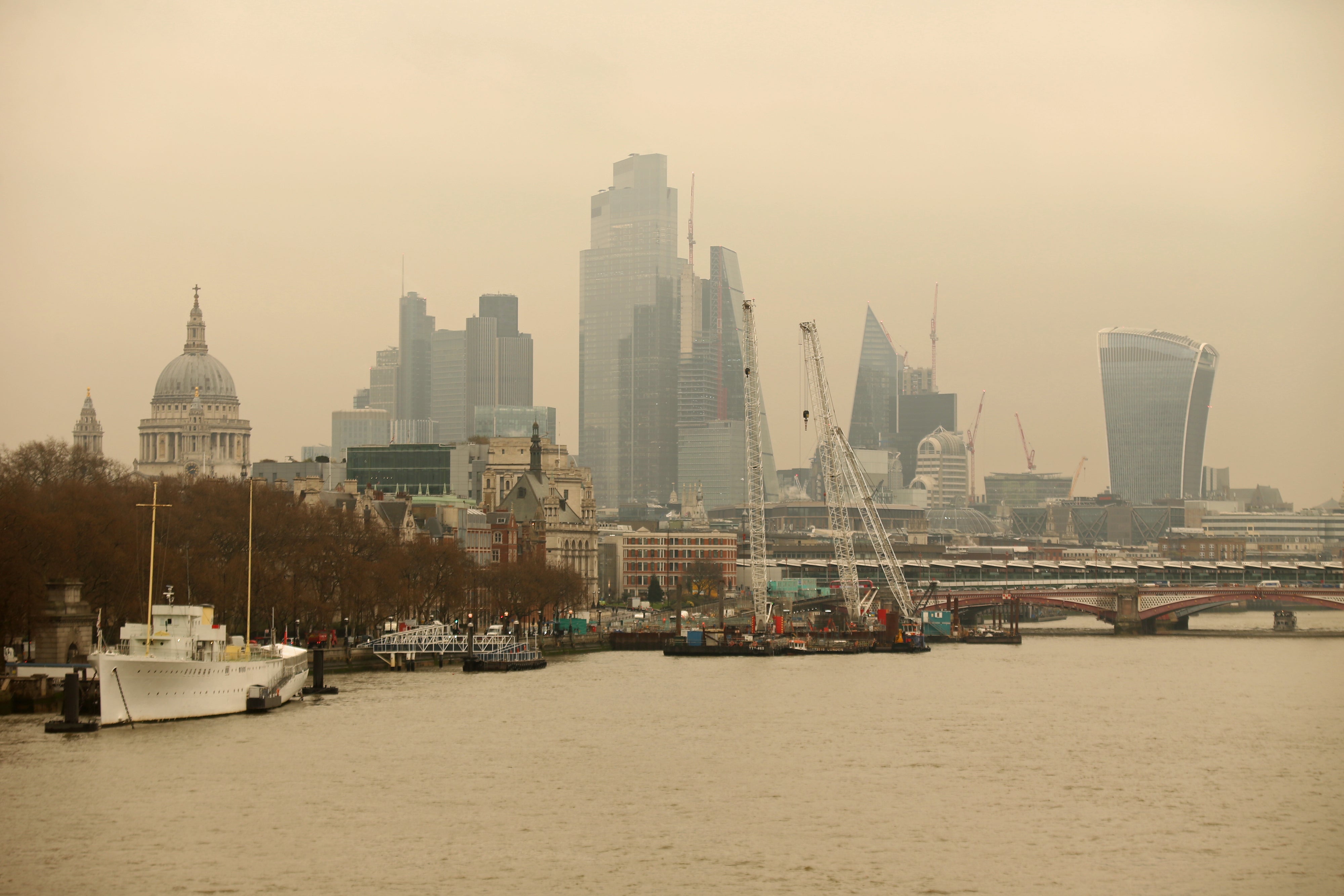
Saharan dust moving across Europe turned the skies orange and red over southern parts of the UK on Wednesday.

Your support helps us to tell the story
From reproductive rights to climate change to Big Tech, The Independent is on the ground when the story is developing. Whether it's investigating the financials of Elon Musk's pro-Trump PAC or producing our latest documentary, 'The A Word', which shines a light on the American women fighting for reproductive rights, we know how important it is to parse out the facts from the messaging.
At such a critical moment in US history, we need reporters on the ground. Your donation allows us to keep sending journalists to speak to both sides of the story.
The Independent is trusted by Americans across the entire political spectrum. And unlike many other quality news outlets, we choose not to lock Americans out of our reporting and analysis with paywalls. We believe quality journalism should be available to everyone, paid for by those who can afford it.
Your support makes all the difference.Saharan dust moving across Europe has hit the UK, turning the skies orange and red over southern parts of the country, forecasters have said.
It comes ahead of what is expected to be the hottest day of the year so far on Saturday, with temperatures set to reach up to 18C in some areas.
The dust cloud, which is about 2km above ground level, hit Sussex, Kent and London on Wednesday afternoon.
The overall impact is “unlikely” to be significant but people in affected areas will be able to see a “red or orange tinge” to the sky, forecasters said.
The dust in the atmosphere causes the light to be more refracted, so you get the dominance of the red and orange tinges of the spectrum
Met Office meteorologist, Dan Stroud, explained the colours were caused by Rayleigh scattering from additional particles in the air.
“The dust in the atmosphere causes the light to be more refracted, so you get the dominance of the red and orange tinges of the spectrum,” he said.
It comes as a plume, named Storm Celia in other countries, sweeps across Europe from the Sahara Desert, blanketing parts of southern Spain and France.
Mr Stroud said the dust is likely to be washed out of the air by an area of cloud and rain pushing eastwards across the West Country on Wednesday evening.
But high pressure building behind the wet weather over the course of the weekend is likely to see southern areas of England treated to a warm spring Saturday.
“We are likely to see some very pleasant spring sunshine, especially for the London and southeast area, during the course of the Saturday,” Mr Stroud said.
“We’re looking at temperatures of up to 16, 17, and perhaps even a rounded 18C could be possible.”
The Met Office told PA the warmest temperature it had recorded so far in 2022 was 17.2C in Pershore, Worcestershire, meaning Saturday could become the warmest day of the year yet.
Rain in England will begin to clear later on Wednesday as many regions turn cold, with patchy frost and some rural mist, the Met Office has said.
Thursday is expected to be sunnier for most of England and Wales, with some wind and showers in the southeast.
Showers, frost and fog are likely to continue hitting some parts of the UK up until Friday.