Third weather alert issued by Met Office ahead of weekend storms and heavy rain
The forecaster warns that damage to buildings as a result of lightning strikes, disruption to public transport and flooding should be expected.
Your support helps us to tell the story
From reproductive rights to climate change to Big Tech, The Independent is on the ground when the story is developing. Whether it's investigating the financials of Elon Musk's pro-Trump PAC or producing our latest documentary, 'The A Word', which shines a light on the American women fighting for reproductive rights, we know how important it is to parse out the facts from the messaging.
At such a critical moment in US history, we need reporters on the ground. Your donation allows us to keep sending journalists to speak to both sides of the story.
The Independent is trusted by Americans across the entire political spectrum. And unlike many other quality news outlets, we choose not to lock Americans out of our reporting and analysis with paywalls. We believe quality journalism should be available to everyone, paid for by those who can afford it.
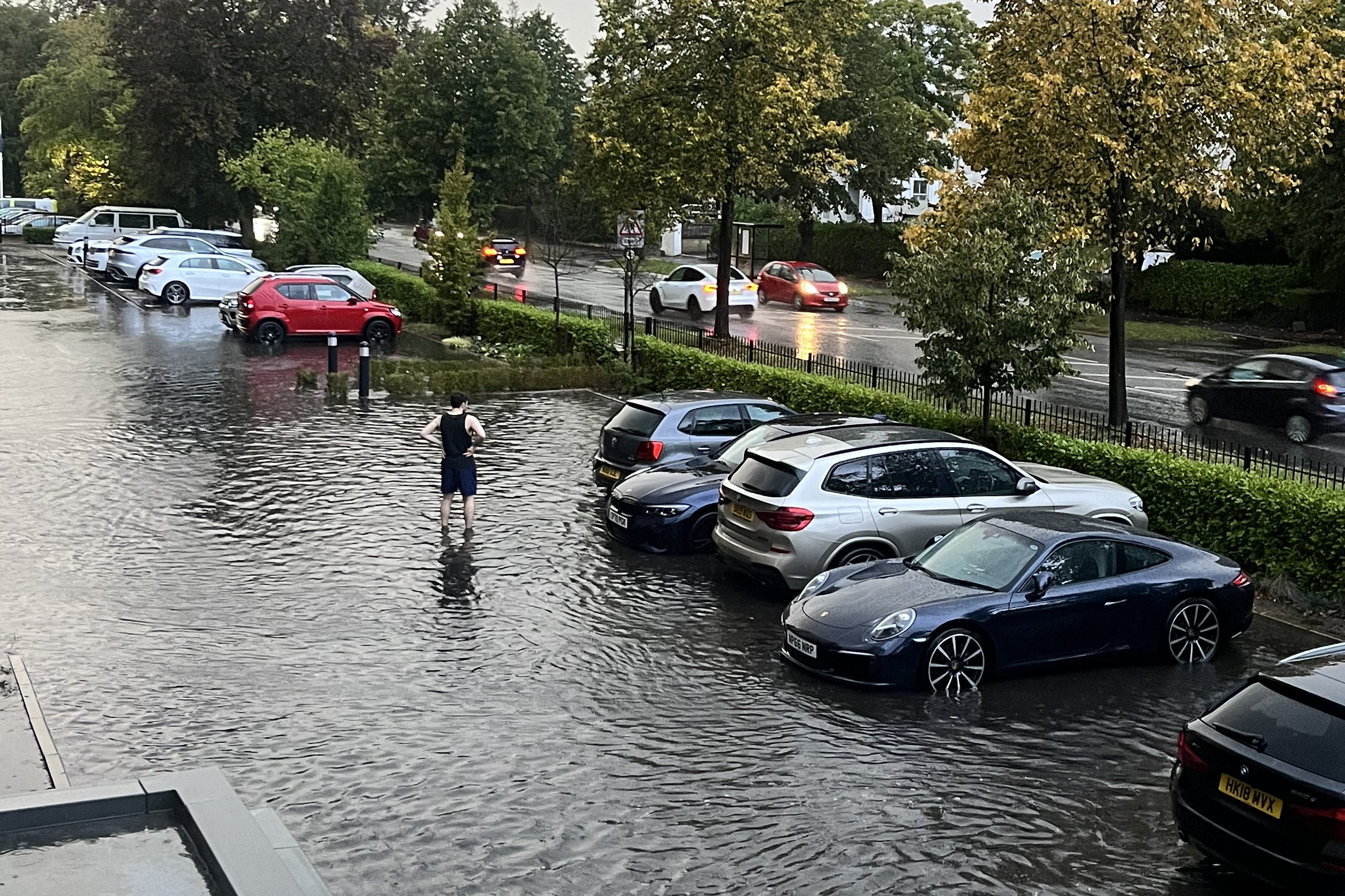
Your support makes all the difference.A further weather warning has been issued by the Met Office ahead of thunderstorms and heavy rain forecast for the weekend.
The forecaster warns that damage to buildings as a result of lightning strikes, disruption to public transport and flooding should be expected within the affected areas.
Friday’s alert for thunderstorms covers most of south-west England, parts of Wales, the Midlands and west London and is in place from 12 noon until 8pm.
These areas may see between 15-24 mm of rain per hour before easing on Friday evening.
The second warning for thunderstorms is in place all of Saturday from 1am until midnight on Sunday. It covers all of Wales and southwest England, the Midlands and parts of south-east England.
A third weather warning for rain has been issued on Sunday for Wales and central south-west England as affected areas could see between 50mm and 70mm of rainfall over a few hours, accompanied by hail and frequent lightning.
The stormy weather follows a warm, dry spell as temperatures reached 25C in Inverness on Wednesday while southeast England saw the same high on Thursday, according to the forecaster.
The Met Office’s chief meteorologist Jason Kelly said: “Thundery downpours have developed across parts of southern England, and will last into Friday evening, bringing frequent lightning, gusty winds, hail and spells of heavy rain.
“The risk of thunderstorms persists into the weekend with potentially longer spells of heavy rain for some along with a continued risk of hail and lightning accompanying the most intense storms.
“The warnings cover the areas of the country most at risk of seeing thunderstorms but not everyone within a warning area will experience a thunderstorm. For many much of the time it will remain dry.”