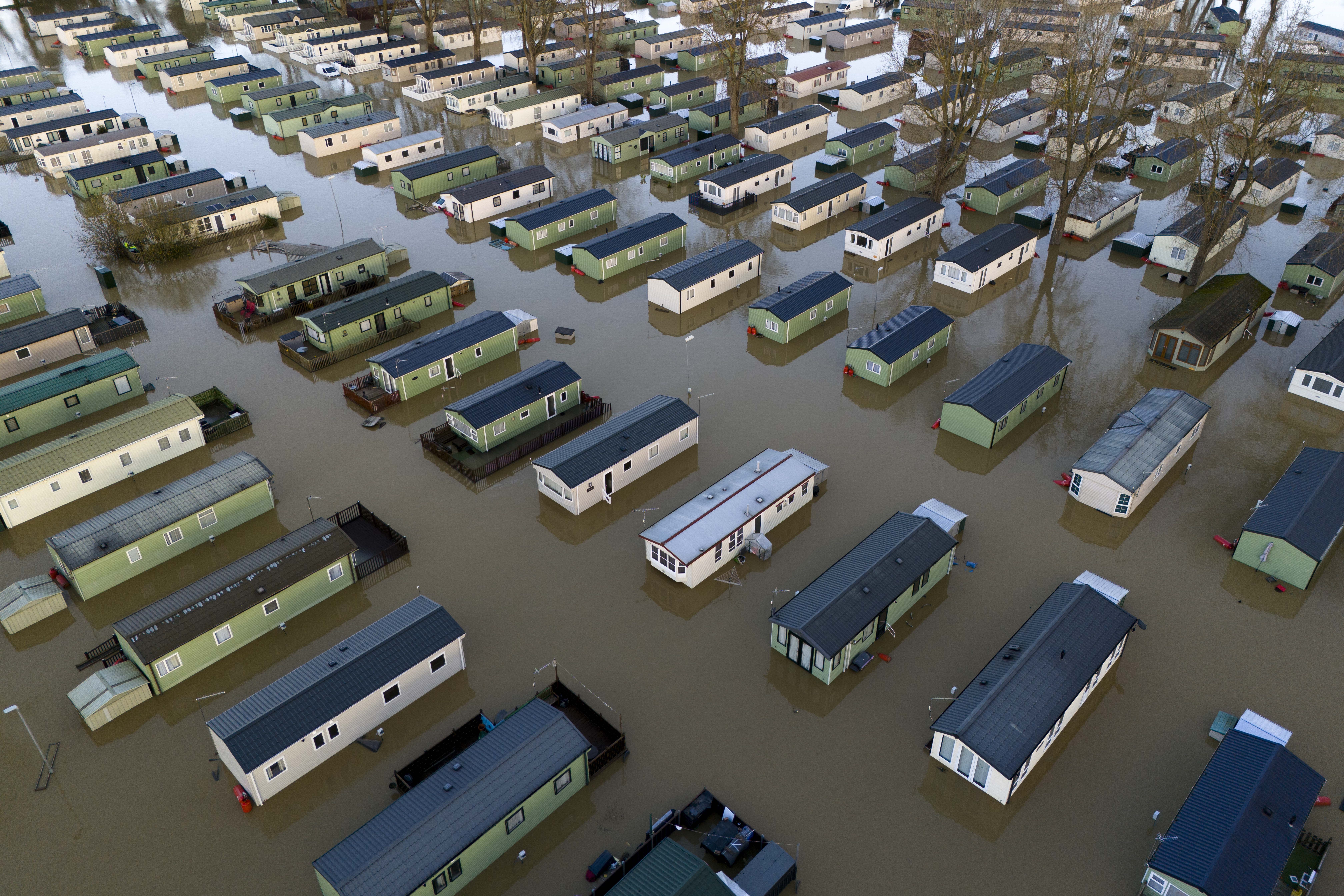
More heavy rain and strong winds to hit UK as Storm Conall named
Up to 50mm could fall in parts of southern England after a new weather warning for rain was issued by the Met Office.

Your support helps us to tell the story
From reproductive rights to climate change to Big Tech, The Independent is on the ground when the story is developing. Whether it's investigating the financials of Elon Musk's pro-Trump PAC or producing our latest documentary, 'The A Word', which shines a light on the American women fighting for reproductive rights, we know how important it is to parse out the facts from the messaging.
At such a critical moment in US history, we need reporters on the ground. Your donation allows us to keep sending journalists to speak to both sides of the story.
The Independent is trusted by Americans across the entire political spectrum. And unlike many other quality news outlets, we choose not to lock Americans out of our reporting and analysis with paywalls. We believe quality journalism should be available to everyone, paid for by those who can afford it.
Your support makes all the difference.More heavy rain and strong winds are set to hit parts of the UK on Wednesday with the arrival of another named storm.
Up to 50mm could fall in parts of southern England after a new weather warning for rain was issued by the Met Office.
It comes just days after Storm Bert left hundreds of homes flooded, turned roads into rivers and saw winds of more than 80mph.
The latest storm, called Conall, is the third of the season and was named by the Dutch Weather Service, which along with the Met Office and
Met Eireann in Ireland name storms so that the communication of severe weather is easier.
There were more than 90 flood warnings and more than 120 flood alerts still issued across the UK on Tuesday evening.
A severe flood warning, meaning there is danger to life, was still in place in Billing Aquadrome holiday park and the surrounding parks next to the River Nene in Northampton.
Chris Wilding, of the Environment Agency, said “significant flooding impacts” are probable in parts of Northamptonshire, with “minor” flooding on the River Severn.
Flooding impacts are not expected to worsen in Yorkshire and the West Midlands over the next few days.
The Met Office has issued a yellow rain warning covering southern England, including Kent, Sussex and the Isle of Wight, and a small area around Plymouth in Devon from 10pm on Tuesday to midday on Wednesday.
The warning area will widely see 15-20mm of rain with 30-40 mm in some areas and a lower chance of 50mm in parts of the south east, with some travel disruption and flooding of “a few homes and businesses” likely.
Additional minor river and surface water flooding impacts are also “probable” in parts of the south and east of England from late on Tuesday and through Wednesday, Mr Wilding said.