UK weather: Snow and ice warnings as Arctic air sees temperatures plunge by 12C overnight
Mercury could plummet to -5C in some places amid return to wintry conditions following balmy climes of 20C
Your support helps us to tell the story
From reproductive rights to climate change to Big Tech, The Independent is on the ground when the story is developing. Whether it's investigating the financials of Elon Musk's pro-Trump PAC or producing our latest documentary, 'The A Word', which shines a light on the American women fighting for reproductive rights, we know how important it is to parse out the facts from the messaging.
At such a critical moment in US history, we need reporters on the ground. Your donation allows us to keep sending journalists to speak to both sides of the story.
The Independent is trusted by Americans across the entire political spectrum. And unlike many other quality news outlets, we choose not to lock Americans out of our reporting and analysis with paywalls. We believe quality journalism should be available to everyone, paid for by those who can afford it.
Your support makes all the difference.Snow and ice warnings are in place in northern parts of the UK as temperatures plummet to -5C.
Colder air is expected to move southwards on Wednesday, bringing a return to wintry conditions following the balmy climes of 20C last week as Britain ushered in the start of spring.
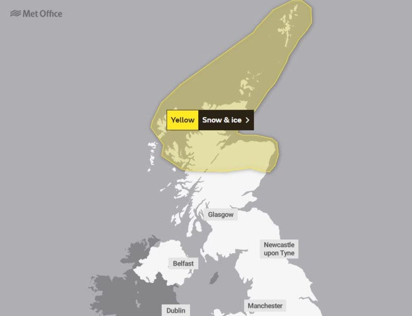
A yellow weather warning for snow and ice covers the north of Scotland until 10am on Wednesday, while an ice warning extends to the northeast of England and Yorkshire and the Humber from 8pm until 10am on Thursday.
The Met Office said snow and hail showers will lead to ice forming on untreated surfaces and hazardous driving conditions.
It warned icy patches on untreated roads, pavements and cycle paths could lead to accidents and injuries, while car, bus and train journey times could be affected by snowfall, which could accumulate up to 5cm on higher ground.


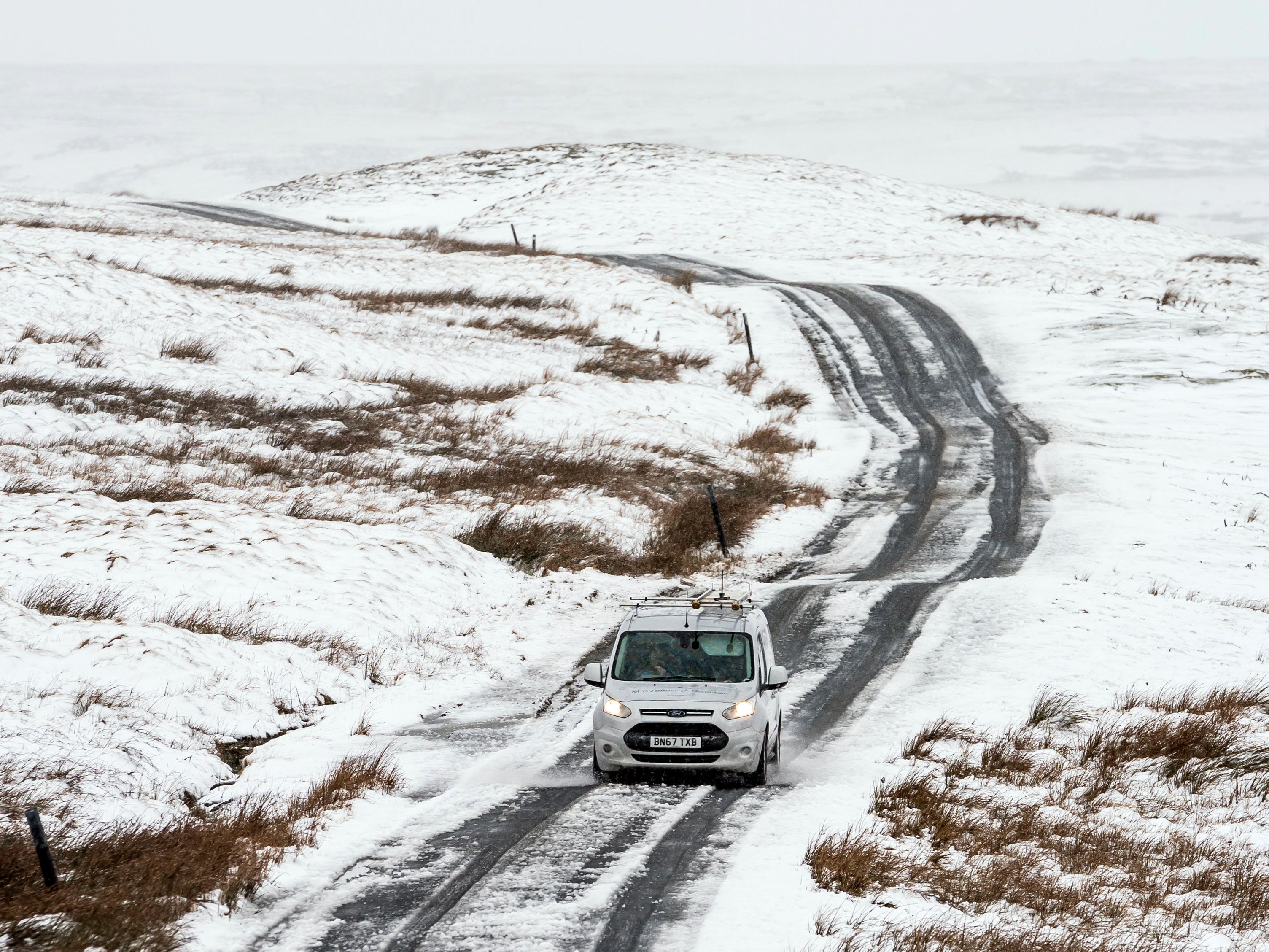
Wintry showers will continue during daylight hours on Wednesday, but additional lying snow will be mostly over higher hills and mountains.
Rain, sleet and snow are expected in many places but it will be milder further south with southwest England and western Scotland seeing the sunniest conditions.
BBC weather forecaster Matt Taylor said Arctic air will make it feel much colder for many on Wednesday, when the “feels like” temperature could be 3-4C colder than the forecast.
The broadcaster is predicting a big drop in temperatures compared to Tuesday, with some areas seeing the mercury drop by as much as 12C.
Temperatures are expected to plunge from 19C to 8C in Porthmadog, 16C to 4C in Manchester and 15C to 6C in Belfast.
A Met Office weather map showed temperatures could fall to -5C in parts of northern Scotland in the early hours of Wednesday.
Images shared online early on Wednesday showed a dusting of snow on gardens and fields in Inverness in the Scottish Highlands, Newbiggin in County Durham and Gammersgill in North Yorkshire.
Met Office forecaster Clare Nasir said: “Warning for snow and ice across the north of Scotland through Tuesday and into Wednesday and eventually Arctic air strings right across the country.
“Let’s look at the broader picture and you can see the yellows just fade away as that weather front sinks down towards more southern areas during Wednesday.
“A warning in the north as that north/north easterly wind delivers snow showers across more northern and eastern areas through Wednesday as well as Thursday. The air generally turning a lot colder with the risk of frost.”
Join our commenting forum
Join thought-provoking conversations, follow other Independent readers and see their replies
Comments