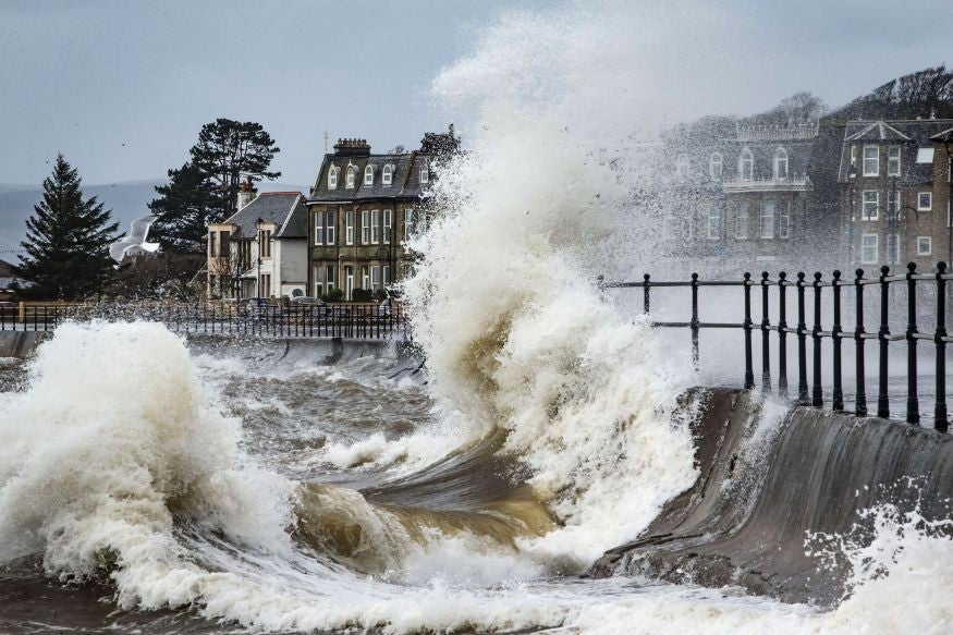
Storm Imogen brings 80mph wind and heavy rain, Met Office says
Southern England and parts of South Wales are expected to be worst hit

Your support helps us to tell the story
From reproductive rights to climate change to Big Tech, The Independent is on the ground when the story is developing. Whether it's investigating the financials of Elon Musk's pro-Trump PAC or producing our latest documentary, 'The A Word', which shines a light on the American women fighting for reproductive rights, we know how important it is to parse out the facts from the messaging.
At such a critical moment in US history, we need reporters on the ground. Your donation allows us to keep sending journalists to speak to both sides of the story.
The Independent is trusted by Americans across the entire political spectrum. And unlike many other quality news outlets, we choose not to lock Americans out of our reporting and analysis with paywalls. We believe quality journalism should be available to everyone, paid for by those who can afford it.
Your support makes all the difference.Parts of Britain have been hit by heavy rain and 80mph winds as Storm Imogen hurtles in from the English Channel.
Southern England and parts of South Wales have been worst hit, with the highest winds in exposed coastal districts.
The Met Office has issued red warnings – meaning "flood is expected" - across England, while amber "be prepared" alerts have been put in place in the North East.
A statement posted on the Met Office website before the storm hit said: “Gusts of 60-70 mph are possible in southern England and parts of south Wales with 80 mph gusts possible in exposed coastal districts.
“Some very large waves are also likely along some coasts, especially along the north coast of Cornwall and Devon. There remains some uncertainty just how far north and east the strongest of the winds will extend.
“Winds are expected to ease through Tuesday leading to a short drier, quieter and colder interlude for many on Wednesday before more wind and rain follows later in the week.”
Imogen comes days after Storm Henry, which ravaged parts of the north of Britain, and Storm Gertrude, which saw winds of more than 100mph cause travel disruption and power cuts.
In 2015, the Met Office launched a project to give severe winter storms human names in order to allow the approach of the storm to be communicated more uniformly.
It explained the move was designed to make the public “better placed to keep themselves, their property and businesses safe”.
Join our commenting forum
Join thought-provoking conversations, follow other Independent readers and see their replies
Comments