UK weather: Met Office predicts heat blast after week of heavy rain
Warmer weather on the way after weeks of rainy, cloudy conditions persisted in parts of the country

Your support helps us to tell the story
From reproductive rights to climate change to Big Tech, The Independent is on the ground when the story is developing. Whether it's investigating the financials of Elon Musk's pro-Trump PAC or producing our latest documentary, 'The A Word', which shines a light on the American women fighting for reproductive rights, we know how important it is to parse out the facts from the messaging.
At such a critical moment in US history, we need reporters on the ground. Your donation allows us to keep sending journalists to speak to both sides of the story.
The Independent is trusted by Americans across the entire political spectrum. And unlike many other quality news outlets, we choose not to lock Americans out of our reporting and analysis with paywalls. We believe quality journalism should be available to everyone, paid for by those who can afford it.
Your support makes all the difference.The Met Office has predicted temperatures could rise above 30C in some parts of the country by the weekend, as thundery downpours give way to sunny spells and warmer weather.
The national forecaster issued a new weather warning for parts of England and Wales, predicting “heavy and persistent” rain that could cause “disruption to transport and infrastructure”.
The yellow alert was issued on Sunday night and will remain in place for 21 hours – until 9pm on Monday.
According to the latest forecast, wet conditions will continue through the night, especially in north England, the Midlands and Wales.
Showers are set to be locally heavy at times, with the chance of thunderstorms still lingering from the day.
However, conditions are likely to improve through the week, with sunny spells, fewer showers, and hot sunshine predicted.
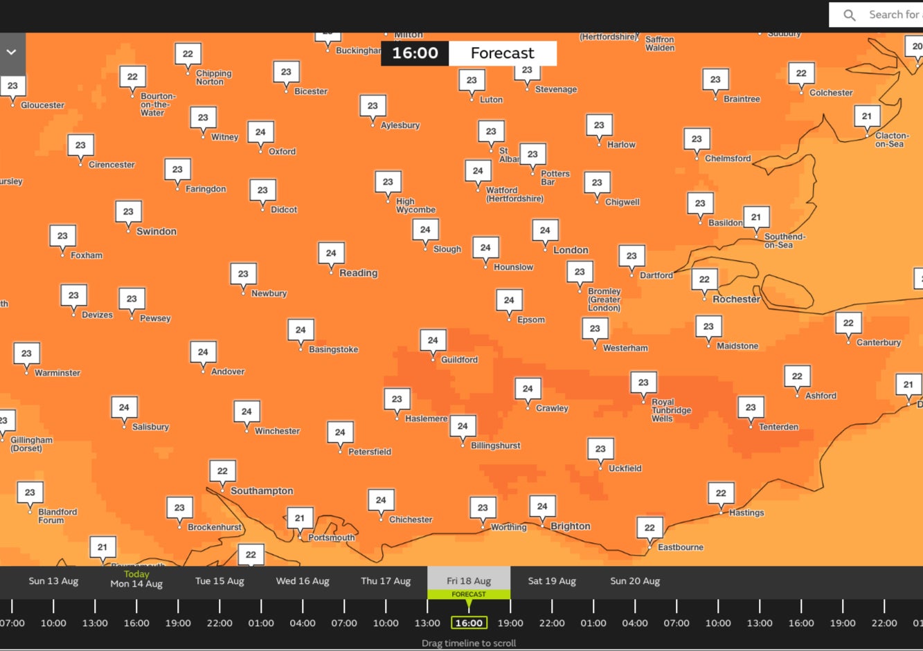
The Met Office has said that temperatures are expected to rise through the week, with mercury likely hitting 32C by the weekend in the southeast – around 6C hotter than Los Angeles on the same day.
“The good news is that low pressure moves out of the way as we go into Tuesday, so it should be a drier day,” forecaster Greg Dewhurst said. “A better chance of seeing some sunny spells, particularly across eastern parts of the UK.”
Mr Dewhurst explained that another area of low pressure to the west of the UK and the Atlantic will start to move toward us, causing temperatures to rise in the south of England by the weekend.
“What that allows to happen is for the winds to turn southerly, and we start to import some higher temperatures from the near continent,” he added.

Last week, another forecaster Dan Stroud said that temperatures will reach the low thirties later this week, most likely on Friday, in and around London, East Anglia and other parts of the south and east.
“By the time we get into Friday and maybe into Saturday we stand a chance of breaking into the thirties,” he added.
According to the Met Office’s long-term forecast, this sunny, hot weather will likely last until 26 August.
The UK has seen a considerably wetter summer this year, as compared with the record-breaking heatwave that swept the country in 2022. Last month was the sixth wettest July on record in the UK and the wettest ever July in Northern Ireland.
The Met Office’s first named storm of the year, Storm Antoni, hit the country earlier this month, as strong winds lashed the UK and nearly half a month’s worth of rain fell in some places.


Join our commenting forum
Join thought-provoking conversations, follow other Independent readers and see their replies
Comments