UK weather: Snow, heavy rain and gales to hit after Storm Brendan brings 87mph winds
Flood warnings issued and airlines forced to divert flights
Your support helps us to tell the story
From reproductive rights to climate change to Big Tech, The Independent is on the ground when the story is developing. Whether it's investigating the financials of Elon Musk's pro-Trump PAC or producing our latest documentary, 'The A Word', which shines a light on the American women fighting for reproductive rights, we know how important it is to parse out the facts from the messaging.
At such a critical moment in US history, we need reporters on the ground. Your donation allows us to keep sending journalists to speak to both sides of the story.
The Independent is trusted by Americans across the entire political spectrum. And unlike many other quality news outlets, we choose not to lock Americans out of our reporting and analysis with paywalls. We believe quality journalism should be available to everyone, paid for by those who can afford it.
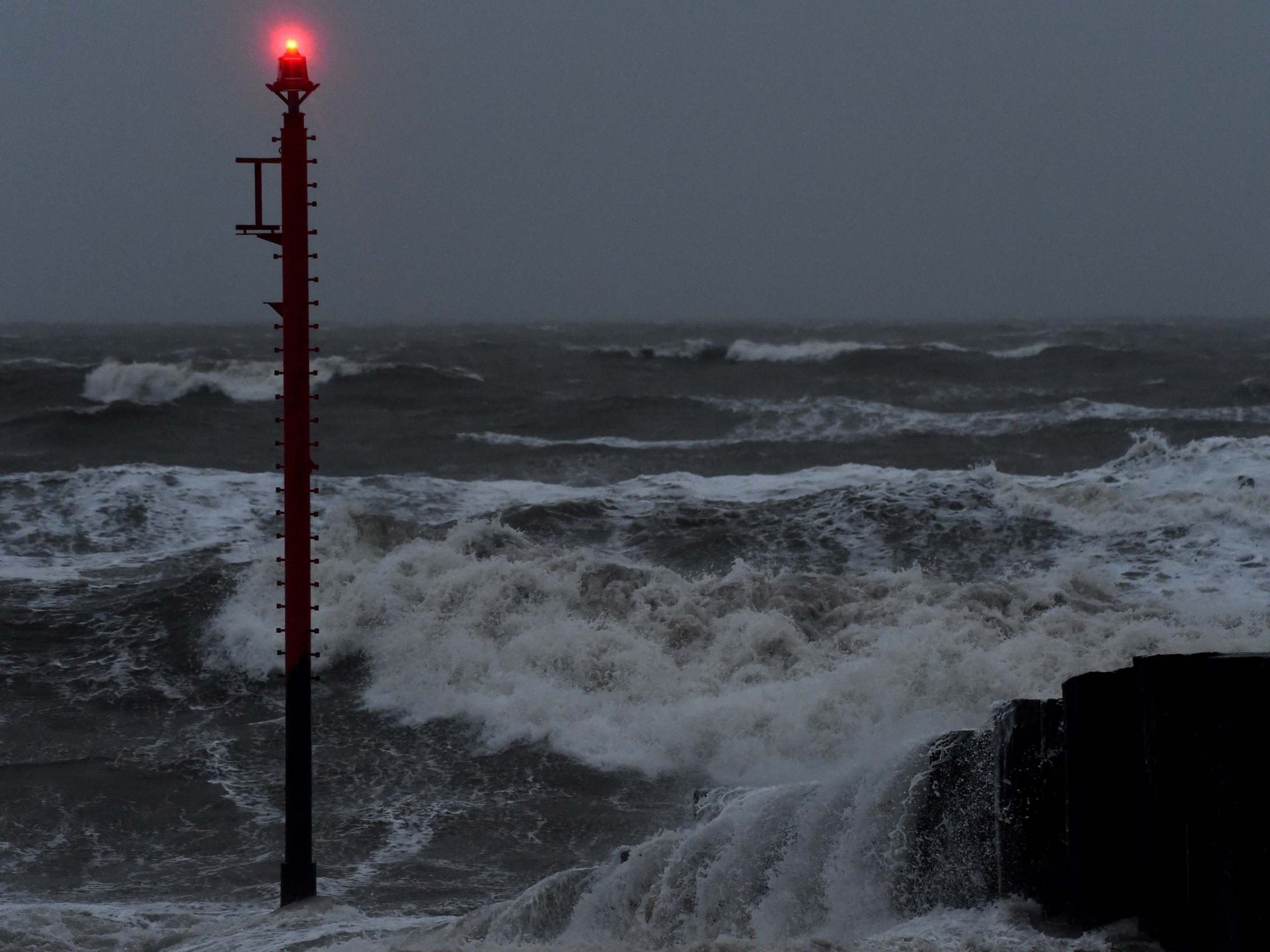
Your support makes all the difference.Forecasters are warning of snow, heavy rain and gale-force winds in the wake of Storm Brendan.
Winds of up to 70mph are expected to persist across much of England and Scotland throughout Tuesday while heavy rain will hit London and the South East by the afternoon.
Airlines were forced to divert flights scheduled to land at Gatwick overnight as gusts of up to 87mph battered the country.
There are currently four weather warnings in place for snow and ice, wind and rain.
Travel disruption is expected in Scotland, where forecasters are warning of ice and wintry showers until 1pm and winds of 60-70mph until midnight.
A weather warning for wind also covers the whole of England from 12pm until midnight, while a rain warning is in place for the South East from 1pm until 9am on Wednesday.
There are also seven flood warnings and 80 flood alerts in place across England, 31 warnings and 16 alerts covering Scotland, and eight alerts in Wales.
Met Office forecaster Alex Burkill said wet and windy weather will come up from the South West on Tuesday afternoon – although it will no longer be classed as Storm Brendan.
He said: “It’s not too far away so we’re still under the influence of it, but this new feature is going to bring some heavy, persistent rain across much of the UK with very strong winds.”
Mr Burkill said the gales were much less likely to reach Monday’s highs of more than 80mph, but inland areas could be hit with gusts of more than 50mph.
He added: “For many, Tuesday will actually be a windier day than today, despite the fact Monday was named and Tuesday isn’t.”
Although the rest of the week looks unsettled, conditions are set to be drier and brighter come the weekend.
After plaguing parts of Ireland, causing thousands of homes and businesses to lose power, Storm Brendan brought high winds to parts of England and Scotland on Monday.
The strongest gust recorded by the Met Office was 87mph at South Uist, in the Western Isles of Scotland.
Two Wizz Air flights, four easyJet services and one Norwegian Air flight were diverted from Gatwick Airport, in West Sussex, on Monday night after gales hit.
One easyJet flight from Edinburgh was also forced to land at Birmingham.
Join our commenting forum
Join thought-provoking conversations, follow other Independent readers and see their replies
Comments