Your support helps us to tell the story
From reproductive rights to climate change to Big Tech, The Independent is on the ground when the story is developing. Whether it's investigating the financials of Elon Musk's pro-Trump PAC or producing our latest documentary, 'The A Word', which shines a light on the American women fighting for reproductive rights, we know how important it is to parse out the facts from the messaging.
At such a critical moment in US history, we need reporters on the ground. Your donation allows us to keep sending journalists to speak to both sides of the story.
The Independent is trusted by Americans across the entire political spectrum. And unlike many other quality news outlets, we choose not to lock Americans out of our reporting and analysis with paywalls. We believe quality journalism should be available to everyone, paid for by those who can afford it.
Your support makes all the difference.Britons have been told to expect the hottest day of the year today, as temperatures continue to soar in a mini ‘heatwave’.
Tuesday saw the hottest temperatures seen since September, with a high of 30C recorded in Chertsey, Surrey, according to the Met Office.
Forecasters warned it could get even hotter on Wednesday as parts of the southeast could reach 31C.
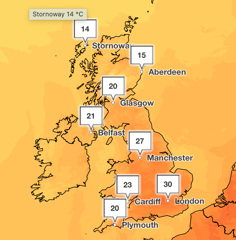
Elsewhere, temperatures in the mid to high 20C are expected more widely with a varied picture being painted across the country.
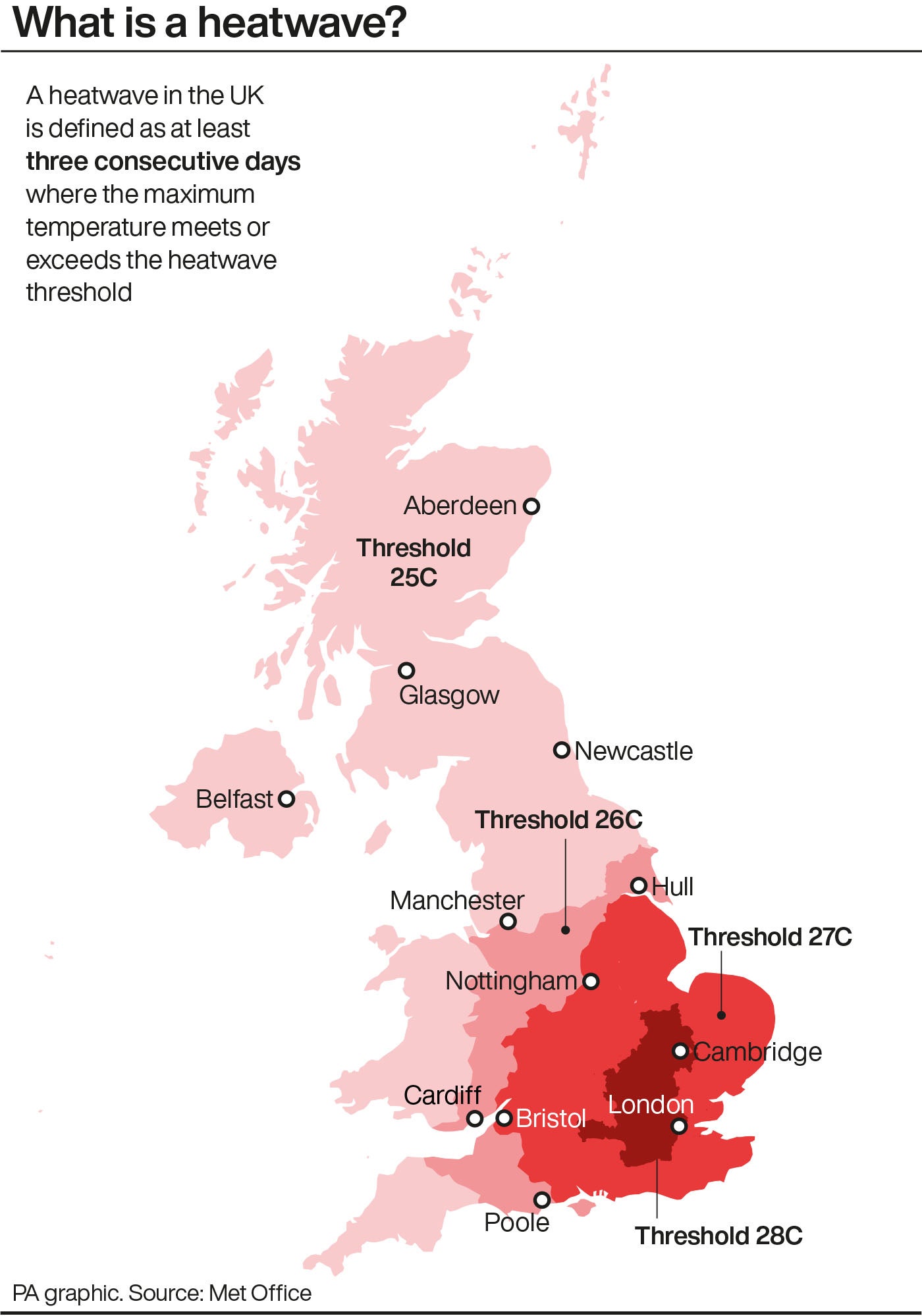
Mark Sidaway is a Deputy Chief Meteorologist at the Met Office and said: “Some areas, mainly central and eastern England, will see temperatures which exceed the heatwave criteria.”
The weather service says a “UK heatwave” is when a location has at least three consecutive days with temperatures hitting the heatwave threshold.
Weather health alerts came into place for most of the country on Monday morning in light of the high temperatures.
The alerts, issued by the UK Health Security Agency and Met Office, warn of the threat of increased deaths among older and vulnerable people.
The only region in the country not impacted by warnings, which will remain in place until Thursday at 5pm, is the North East.
Although some areas are gearing up for further hot weather, other parts of the country are facing more unsettling conditions.
“Although we are expecting to see some very warm temperatures this week, it may not be the wall-to-wall sunshine and blue skies people are expecting as there is likely to be some cloud around in places,” Mr Sidaway said.
He added: “Although we are looking to enjoy some nice warm temperatures, the weather this week does not look particularly exceptional or extreme.”
It will be a cloudier start to Wednesday for many parts of the North and North East with some light rain or drizzle in places subduing temperatures there.
Through the afternoon, some extremely isolated heavy showers are possible across some western areas such as northern Wales and northwestern England.
There will be a change in weather nationwide on Thursday.
A cold front is forecast to bring a band of cloud and showery rain across the east and southeast of the country.
The Met Office added that there is a chance of isolated heavy showers and thunderstorms developing in the afternoon.
Join our commenting forum
Join thought-provoking conversations, follow other Independent readers and see their replies
Comments