Mapped: Where and when will Storm Jocelyn hit the UK after Storm Isha disruption
Storm Isha has killed four motorists and left thousands without power - but another storm has arrived
Your support helps us to tell the story
From reproductive rights to climate change to Big Tech, The Independent is on the ground when the story is developing. Whether it's investigating the financials of Elon Musk's pro-Trump PAC or producing our latest documentary, 'The A Word', which shines a light on the American women fighting for reproductive rights, we know how important it is to parse out the facts from the messaging.
At such a critical moment in US history, we need reporters on the ground. Your donation allows us to keep sending journalists to speak to both sides of the story.
The Independent is trusted by Americans across the entire political spectrum. And unlike many other quality news outlets, we choose not to lock Americans out of our reporting and analysis with paywalls. We believe quality journalism should be available to everyone, paid for by those who can afford it.
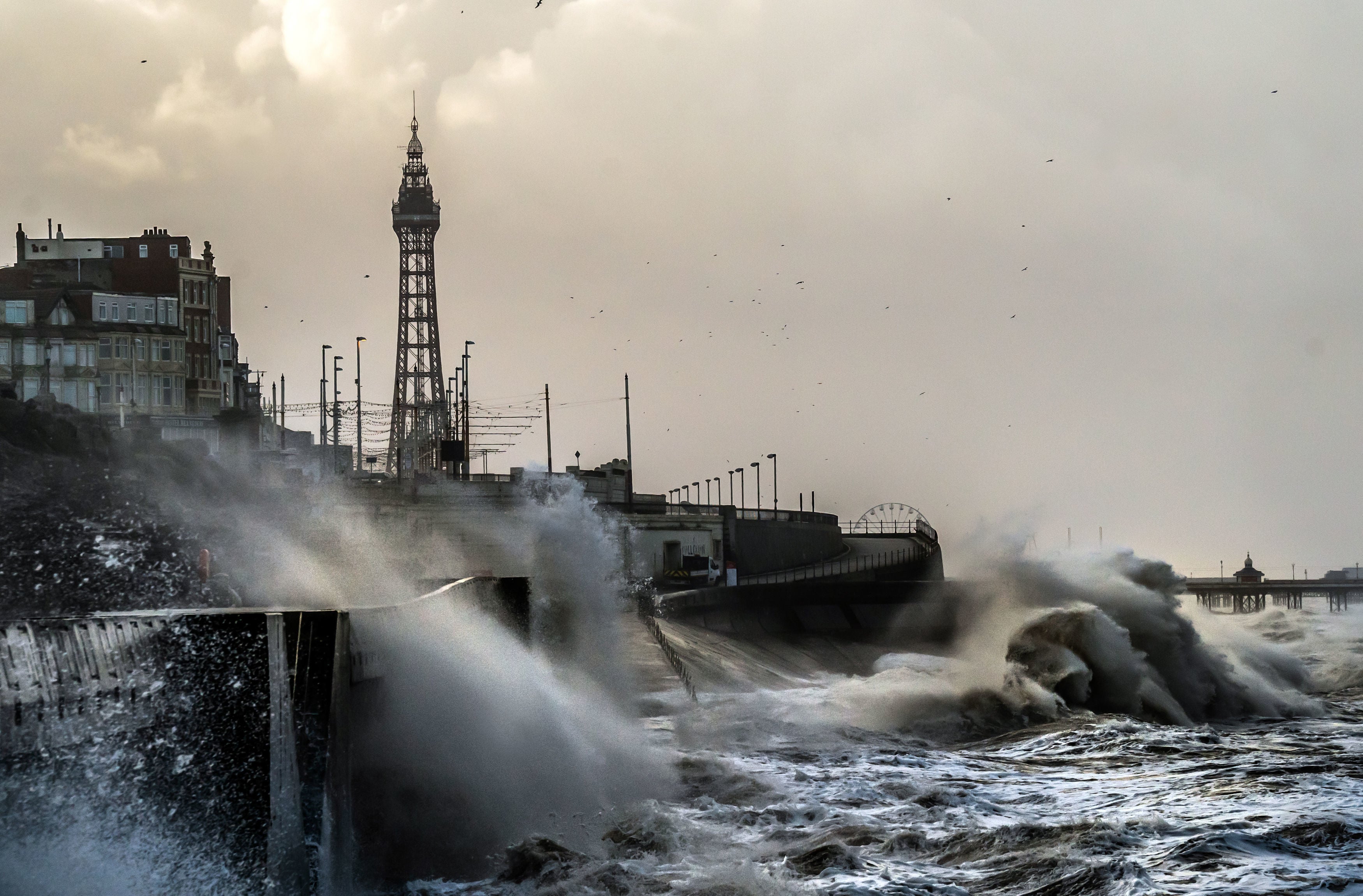
Your support makes all the difference.With the UK reeling from the destruction left in the 107mph winds of Storm Isha, a new storm is here to crash our shores with 80mph winds.
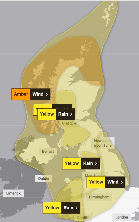
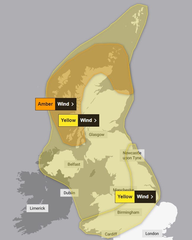
Storm Jocelyn is set to bring blustery winds and heavy rain overnight on Tuesday as amber and yellow weather warnings for wind have been issued covering much of the UK.
Yellow warnings for rain covering parts of western and southern Scotland, and north-west England have also been issued, alongside a yellow warning for ice across northern and eastern parts of Scotland.
Gusts of 80mph could be experienced in exposed areas, with 40-50mm of rain possible over higher ground, the Met Office said.
The forecaster warns of a strong jet stream pushing a large-scale, low-pressure system from the Atlantic across northern Scotland.
Met Office chief meteorologist, Steve Willington, said: “Although this system will be a step down relative to Storm Isha, with the damage and clean up still underway, we could potentially see more impacts from Storm Jocelyn.
“Outbreaks of heavy rain on Tuesday could bring rainfall accumulations of 15 to 20 mm quite widely with 40 to 50 mm over higher ground in southwest Scotland, the Scottish Highlands and parts of northwest England.
“Wind gusts are expected to reach 55 to 65 mph across northwestern Scotland while there is potential for winds to gust to 75 to 80 mph in a few places, in particular exposed parts of the Western Isles and coastal northwest Scotland early on Wednesday morning.”
The winds will gradually ease through Wednesday but the weather continues to look changeable, with the drier and most settled conditions towards the south and east, and the most wettest and windiest conditions expected in the northwest.
Temperatures are expected to remain mild or close to average for the time of year.
A train operator is “strongly urging” passengers to avoid travelling between England and Scotland from 3pm on Tuesday until noon on Wednesday because of Storm Jocelyn.
TransPennine Express (TPE) said: “High winds and heavy rainfall are set to cause major disruption to services in and out of Scotland.”
The affected routes are between Glasgow and Preston, and between Edinburgh and both Newcastle and Preston.
Services across the rest of the operator’s network are also expected to be affected by the severe weather.
TPE customer experience and operations director Kathryn O’Brien said: “Our number one priority is to keep our customers and colleagues safe, and we will be doing all we can to keep people moving in difficult conditions.
“We are urging anyone travelling across the affected routes to plan ahead, allow extra time, check their journey up until the last minute and follow the guidance provided.”
Avanti West Coast has also called on passengers not to travel north of Preston after 3.30pm on Tuesday because of Storm Jocelyn.
The last scheduled service from London to Glasgow departs the capital at 3.30pm, calling at Preston at 5.41pm, and is “expected to be extremely busy”, the operator warned.
Martin Thomson, national operations manager for resilience at Transport Scotland said: “The trunk road network is recovering well from the worst impacts of Storm Isha. Some roads and bridges do remain disrupted and so please continue to check before you travel until conditions improve and the clear-up is complete.
“Focus will soon shift to the next named storm, Jocelyn, for later this week, and preparations are already underway with rail, aviation and ferries colleagues to ensure we are as ready as we can be.
“Staff from our trunk road operating companies will be patrolling the network and undertaking inspections to respond quickly to any further treefall or blocked drains. Their proactive efforts in terms of branch cutting and drain clearing at vulnerable locations has helped minimise disruption in the past.
“Across the wider network, we can expect to see more delays and cancellations with ferries, flights and rail from Tuesday into Wednesday morning. Please check with your public transport operator for the latest information and your local authority and Police Scotland for the latest information on local roads.”
Storm Jocelyn will be the tenth named storm in five months and only the second time in a UK storm season that the letter J has been reached in the alphabet.
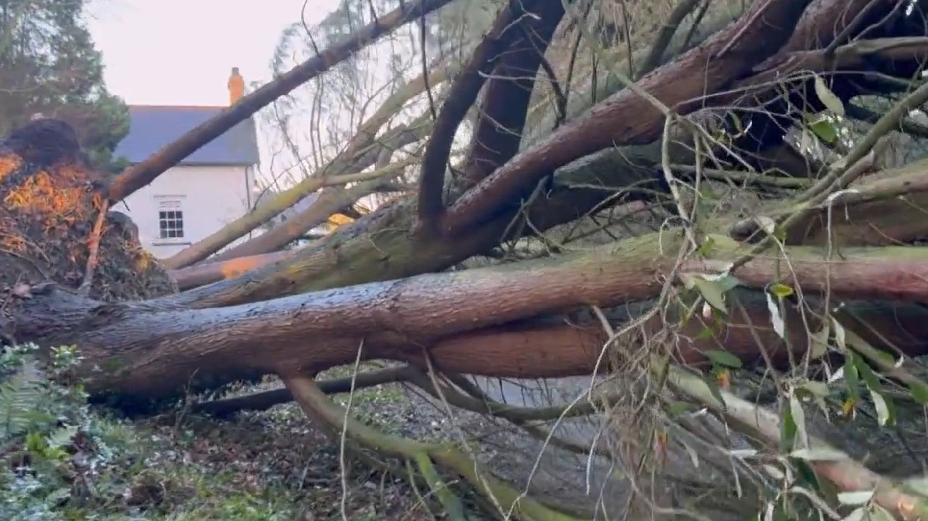
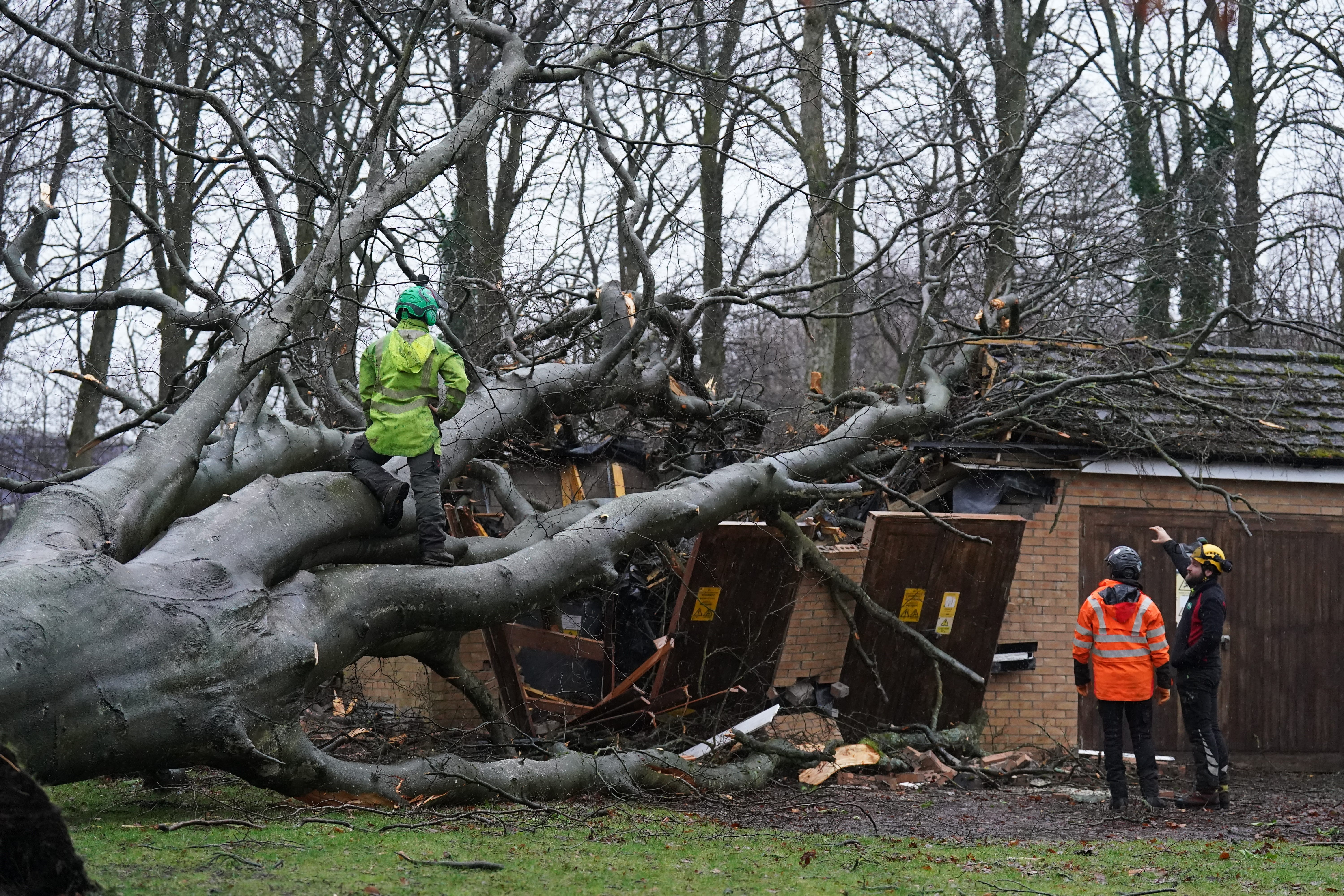
It comes as a pensioner has died and thousands of homes remain without power after Storm Isha battered the UK.
Transport services were also disrupted with roads closed, rail lines blocked and flights diverted, while dozens of schools were shut on Monday.
Transport Scotland said a gust of 107mph was recorded on the Tay Bridge and the Met Office said the highest recorded wind speed during Storm Isha was 99mph at Brizlee Wood in Northumberland.
Join our commenting forum
Join thought-provoking conversations, follow other Independent readers and see their replies
Comments