Storm Ingunn map: Where and what time ‘weather bomb’ will bring 85mph winds to the UK
Temperatures to drop several degrees as ‘bomb cyclone’ named Storm Ingunn surges past Britain
Your support helps us to tell the story
From reproductive rights to climate change to Big Tech, The Independent is on the ground when the story is developing. Whether it's investigating the financials of Elon Musk's pro-Trump PAC or producing our latest documentary, 'The A Word', which shines a light on the American women fighting for reproductive rights, we know how important it is to parse out the facts from the messaging.
At such a critical moment in US history, we need reporters on the ground. Your donation allows us to keep sending journalists to speak to both sides of the story.
The Independent is trusted by Americans across the entire political spectrum. And unlike many other quality news outlets, we choose not to lock Americans out of our reporting and analysis with paywalls. We believe quality journalism should be available to everyone, paid for by those who can afford it.
Your support makes all the difference.The UK is set to be battered by strong winds and rain as Storm Ingunn passes by to the north, bringing hurricane-force gusts as it powers towards Norway.
The Met Office has issued multiple weather alerts on Wednesday as the Atlantic storm clips Britain, and warns of the potential for flying debris and rough coastal conditions to pose a danger to life.
A wind speed of 155mph has already been recorded in the Faroe Islands, the BBC reports – far stronger than any gust seen during the UK’s Great 1987 Storm – and residents in Norway have been told to brace for their worst storm in 30 years.

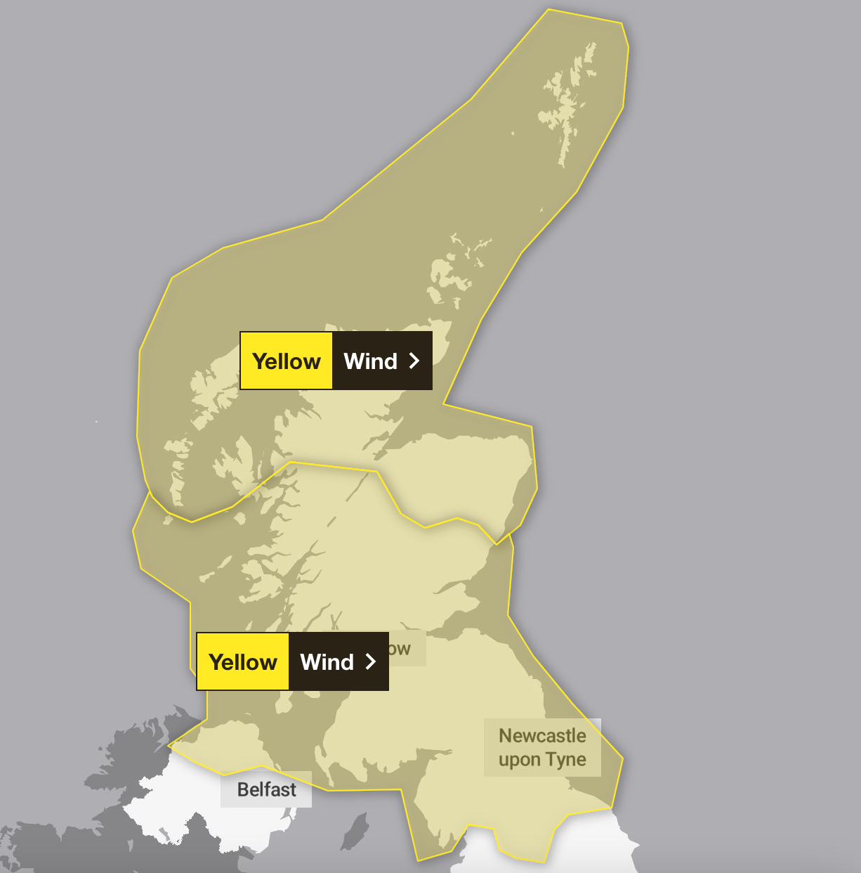
In Britain, gusts are expected to reach 85mph, and two weather warnings have been put in place.
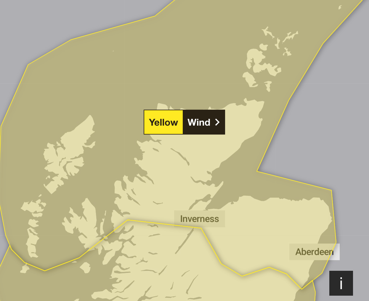
The first – in force in northern Scotland, the Hebrides, and Orkney and Shetland from 5am on Wednesday – warns of potential power cuts, mobile phone blackouts, and damage to buildings, such as tiles being blown from roofs.
Roads and bridges could be closed, with road, air and ferry travel all potentially affected, the Met Office warned, with the “small chance that injuries and danger to life could occur from large waves and beach material being thrown onto sea fronts, coastal roads and properties”.
That warning will remain in force until 7pm, during which time a second warning stretching nearly as far south as Harrogate and impacting Northern Ireland will also come into effect, lasting from 9am until 5pm.
Residents in those areas are warned of travel disruption, power cuts and the potential for damage to trees, with coastal communities affected by large waves.


More than 40 train services have already been cancelled in Scotland out of concern for passenger safety, including those between Dundee and Glasgow, and Aberdeen to Edinburgh. Speed restrictions were put in place across much of the network, with safety inspections to continue throughout the day.
Ferry operator Calmac also cancelled all departures on five of its routes, with many more services under review for the rest of the day. No ferries will sail from Oban to Colonsay, or from Mallaig to Armadale, while scheduled departures from Ardrossan and Ullapool may be cancelled at short notice too.
Storm Ingunn was named by the Norwegian weather service, where police are warning that gusts of up to 112mph are expected. The storm was expected to land in central Norway around midday on Wednesday before moving north the following day.
The storm is what is known as a “bomb cyclone”, an area of low pressure which strengthens quickly and dramatically in what is referred to as “explosive cyclogenesis” – a rapid deepening of pressure within 24 hours.
In Wednesday morning’s forecast, Met Office forecaster Clare Nasir warned of “a very windy day”, with gusts in the far north of Scotland potentially reaching 85mph as a result of the storm moving in from the northwest.
Towards Cumbria and north Yorkshire, there will be “some damaging winds” throughout Wednesday, with heavy rain in western parts of Scotland, and Orkney and Shetland, the meteorologist said.
From Wales to the Midlands, lower temperatures could bring patcy frost, and mist and fog, with a cloudy and windy end to the day across central and southern England and Wales. By rush hour, the rain will slide towards the south of England, where brief thunderstorms “can’t be ruled out” as the band of rain moves southwards, said Ms Nasir.
Additional reporting by agencies

Join our commenting forum
Join thought-provoking conversations, follow other Independent readers and see their replies
Comments