Storm Henk mapped: UK set to be battered by 80mph winds and heavy rain
Storm Henk will bring heavy rain and strong winds to large swathes of the UK
Your support helps us to tell the story
From reproductive rights to climate change to Big Tech, The Independent is on the ground when the story is developing. Whether it's investigating the financials of Elon Musk's pro-Trump PAC or producing our latest documentary, 'The A Word', which shines a light on the American women fighting for reproductive rights, we know how important it is to parse out the facts from the messaging.
At such a critical moment in US history, we need reporters on the ground. Your donation allows us to keep sending journalists to speak to both sides of the story.
The Independent is trusted by Americans across the entire political spectrum. And unlike many other quality news outlets, we choose not to lock Americans out of our reporting and analysis with paywalls. We believe quality journalism should be available to everyone, paid for by those who can afford it.
Your support makes all the difference.Storm Henk is set to batter the UK with strong winds and heavy rain as the Met Office warned of a danger to life in parts of the country.
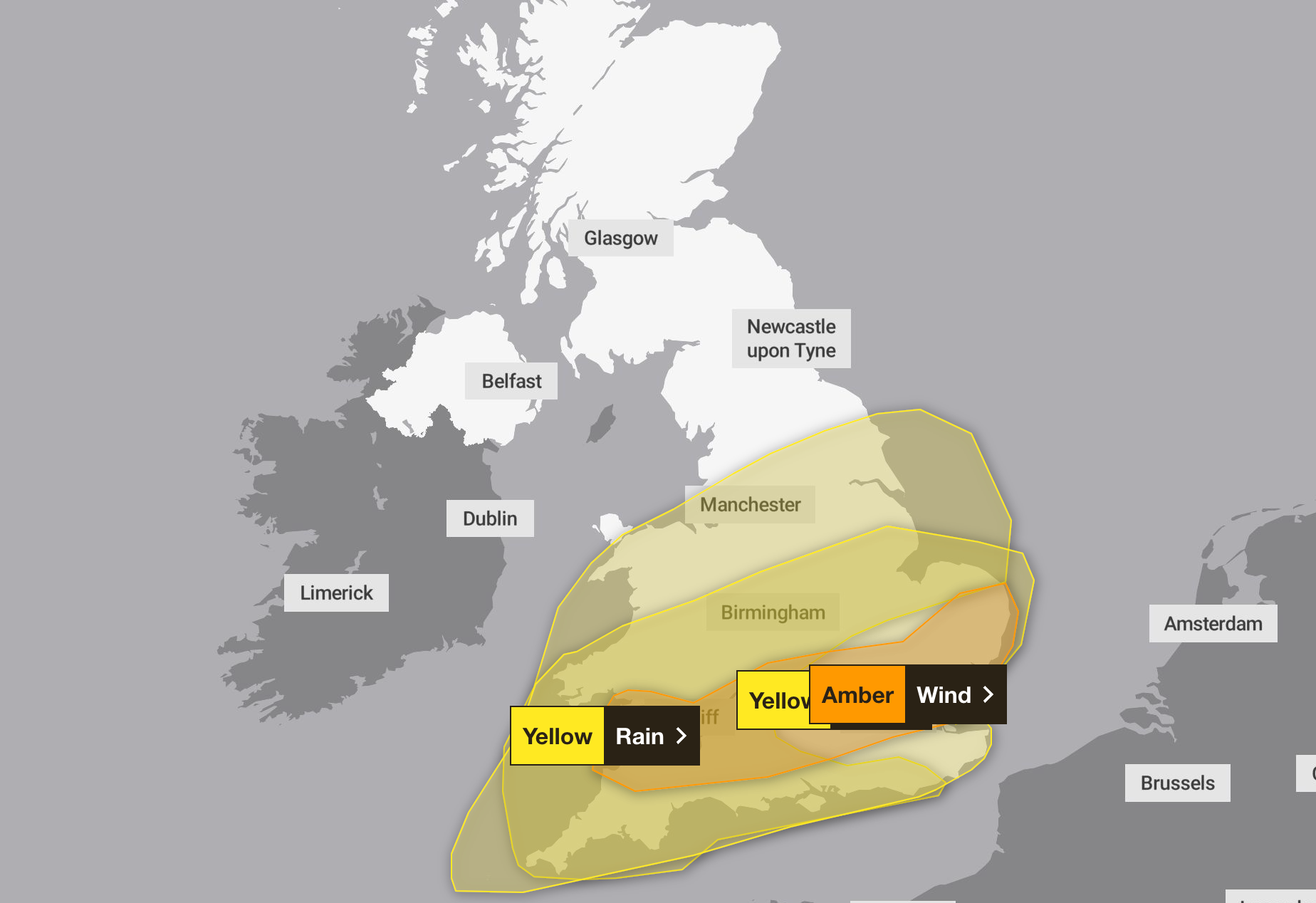
The forecaster warned of gusts of up to 80mph with an amber wind warning issued across much of the south including Cardiff, London and Norwich from 10am to 8pm on Tuesday.
A yellow wind warning was also put in place between 8am to 9pm on Tuesday, stretching from the tip of Cornwall through the Midlands and East Anglia.
Meanwhile, a yellow rain warning was issued between 5pm on Monday and 9pm on Tuesday for large swathes of the country with risks of flooding to homes.

The Met Office added that there was a good chance power cuts could occur, with probable damage to buildings, travel disruption and a chance of injury or loss of life from flying debris.
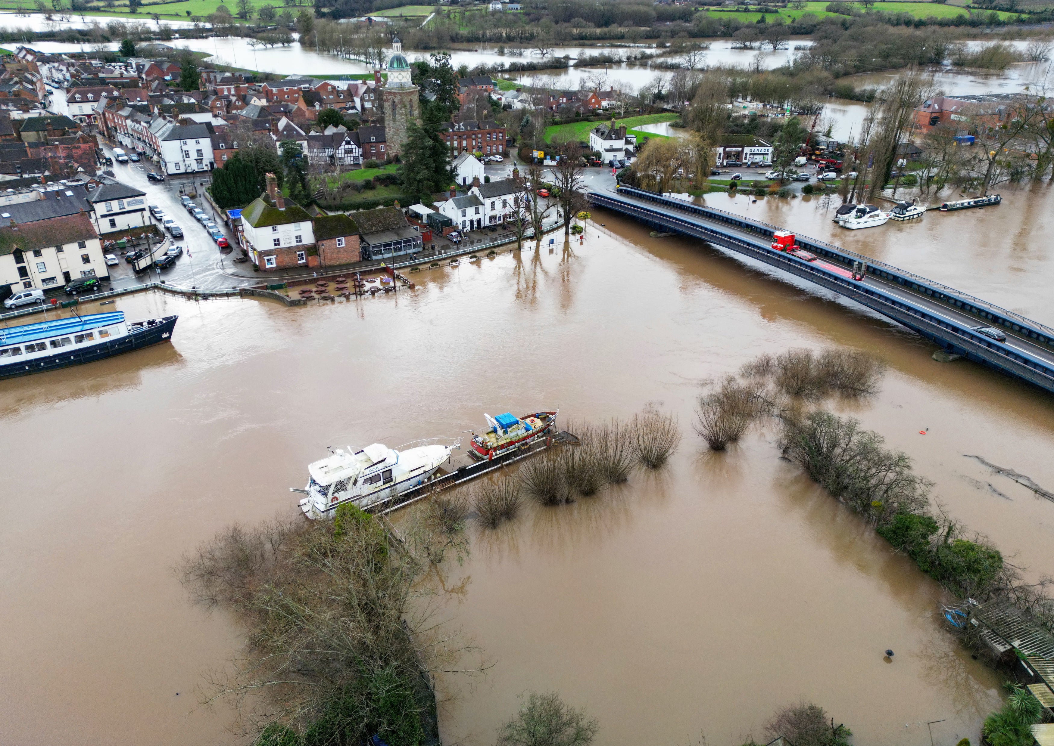
Across the country, there are 130 flood warnings and alerts in place. The Environment Agency urged motorists not to drive through water.
Chief Meteorologist Paul Gundersen said: “Our latest analysis of the forecast shows an increase in the likelihood of very strong wind gusts across parts of southern Wales and England, which is why we have issued this amber warning this morning and named Storm Henk.
“Storm Henk will initially bring very strong winds to the South West of England and southern Wales, with gusts of up to 80mph possible.

“As Storm Henk moves north-eastwards across the south of the UK through Tuesday, the strongest winds will also move eastwards, across the south Midlands, Home Counties and East Anglia through the afternoon and evening.”
It comes after Storm Gerrit ripped through the UK last week, wreaking travel chaos across the country as well as a rare supercell thunderstorm that is believed to have spawned a tornado in Greater Manchester.
A major incident was declared in Tameside after the tornado tore roofs and chimneys from homes, shattered windows and left debris and uprooted trees littered across streets.
It prompted calls for prime minister Rishi Sunak to call an emergency Cobra meeting “to ensure a swift, robust recovery plan”.
Residents said they had suffered an “absolute disaster” unlike anything they had ever experienced, and described the terrifying noise of the powerful winds as like “a plane was coming down on the house”.
Subscribe to Independent Premium to bookmark this article
Want to bookmark your favourite articles and stories to read or reference later? Start your Independent Premium subscription today.

Join our commenting forum
Join thought-provoking conversations, follow other Independent readers and see their replies
Comments