Mapped: Storm Gerrit weather warnings in your area as UK faces snow, rain and strong winds
Gusts of nearly 80mph in coastal areas as suspected tornado hits Greater Manchester
Your support helps us to tell the story
From reproductive rights to climate change to Big Tech, The Independent is on the ground when the story is developing. Whether it's investigating the financials of Elon Musk's pro-Trump PAC or producing our latest documentary, 'The A Word', which shines a light on the American women fighting for reproductive rights, we know how important it is to parse out the facts from the messaging.
At such a critical moment in US history, we need reporters on the ground. Your donation allows us to keep sending journalists to speak to both sides of the story.
The Independent is trusted by Americans across the entire political spectrum. And unlike many other quality news outlets, we choose not to lock Americans out of our reporting and analysis with paywalls. We believe quality journalism should be available to everyone, paid for by those who can afford it.
Your support makes all the difference.Flood warnings are in place across the UK as snow, rain and gale-force winds continue to lash the country in the wake of Storm Gerrit.
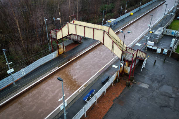
Trains across much of Scotland ground to a halt on Wednesday and a major incident was declared in Greater Manchester after a supercell thunderstorm and localised tornado damaged around 100 properties, tearing roofs and chimneys from homes and smashing windows.
The travel chaos continued on Thursday, with many trains cancelled due to flooding, blocked lines and other faults, while high winds forced flight and ferry cancellations.
Click here for live updates on the storms and travel disruption.
And a second supercell thunderstorm – more typically the preserve of Tornado Valley in the United States – was making its way inland from Lancashire’s Morecambe Bay, with the Met Office warning of hail, widespread lightning and powerful winds.
However it was flooding that led to much of the travel disruption on Wednesday, blocking both major rail routes in and out of Scotland, and more than 30 flood warnings – meaning flooding is expected – remained in force on Thursday.
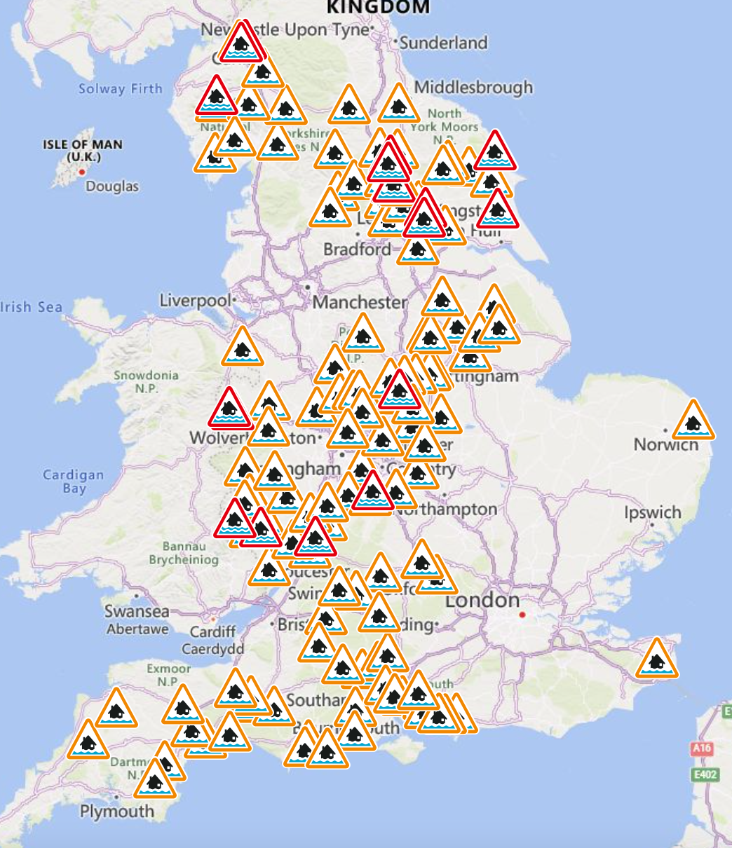
Twenty-one of those warnings were in England, where a further 119 lesser flood alerts were also in force as of 1:30pm. The more severe warnings were in Cumbria, Yorkshire and the Midlands.
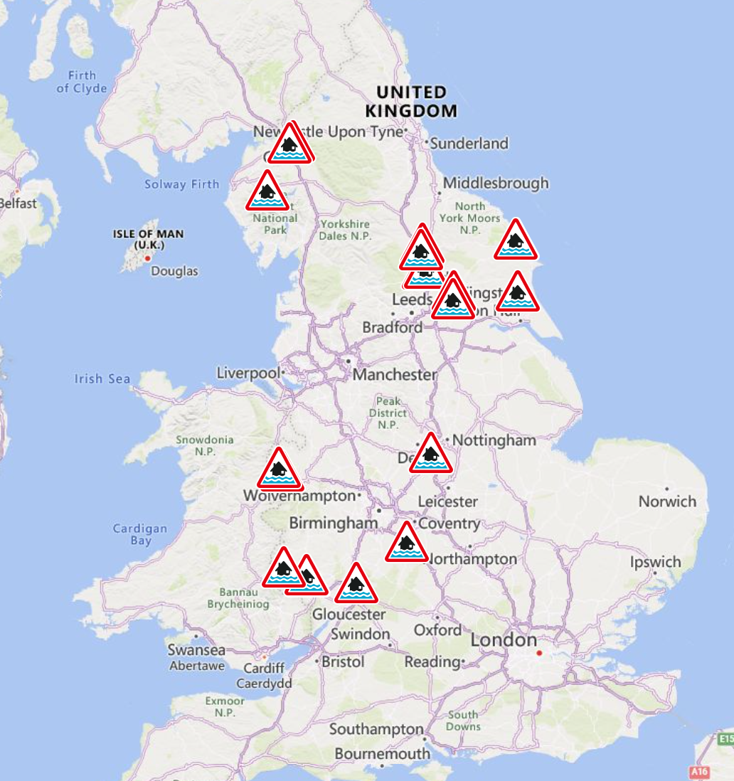
Local flooding is probable from rivers in parts of West Midlands and Yorkshire and the Humber until Monday, and possible more widely across the North of England on Thursday, according to the Environment Agency.
It is also possible – but not expected – across South West England, the Midlands and the North of England on Thursday, while local groundwater flooding is possible in parts of southern England, Yorkshire and the Humber throughout the next five days, the agency said.
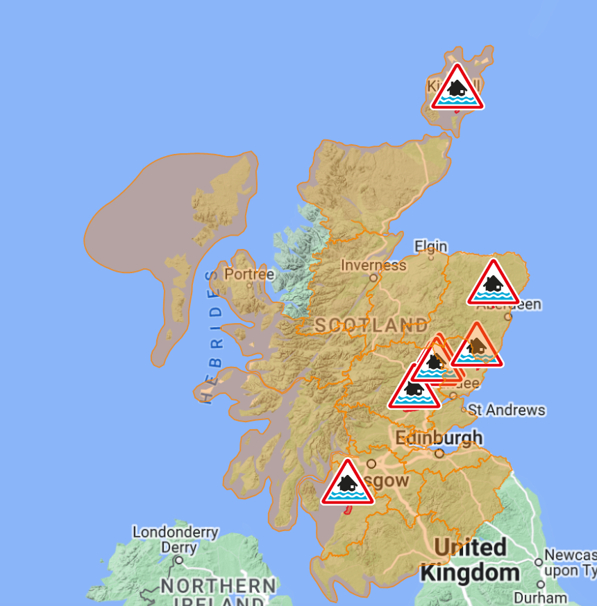
In Scotland, nine flood warnings were in force in Tayside, Aberdeenshire, Ayrshire, Dundee and Orkney, with a further 21 flood alerts were also issued, including in Edinburgh, Fife, Skye, Dumfries and Galloway, and Argyll and Bute.
Another severe warning was issued at the River Towy in Wales, with flooding also possible across much of the rest of the country.
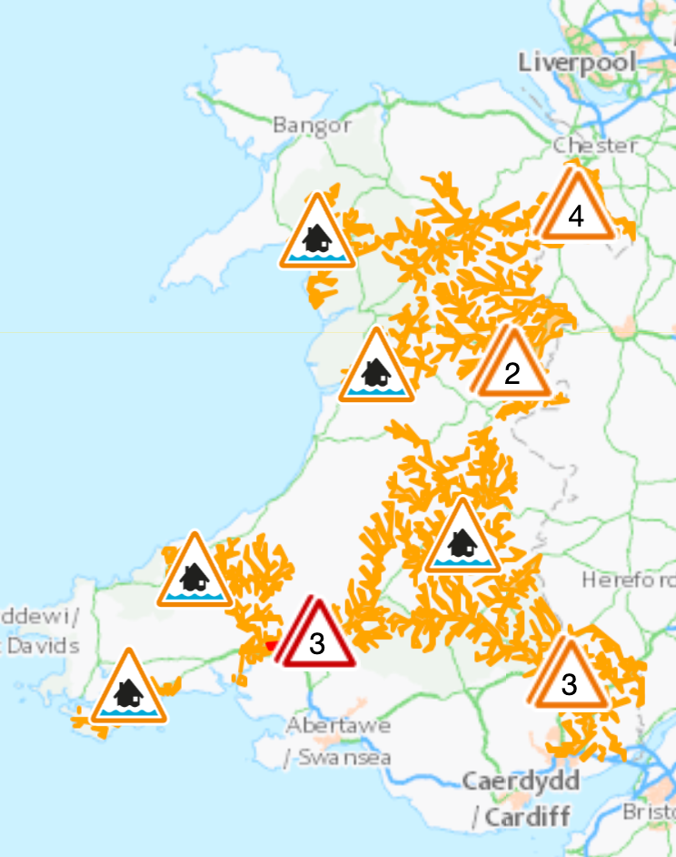
Storm Gerrit was named by the Met Office on Tuesday and brought heavy rain to many parts of the UK on Wednesday, when eight weather alerts were in force.
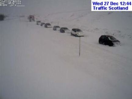
Snow across higher ground in Scotland brought the main artery through the Highlands to a standstill, trapping people in their cars for hours at a remote mountain pass on the A9.
Police Scotland confirmed the A9 had fully reopened in both directions on Thursday and was “passable with care”, after snow blocked the road between Drumochter and Dalwhinnie in the Highlands.

Meanwhile, Scottish and Southern Electricity Networks (SSEN) said that as of 11am on Thursday, supplies had been restored to some 34,000 customers, with around 7,700 left without power.
Director of corporate affairs Graeme Keddie told BBC Radio Scotland many of those properties are in north-east Scotland and Shetland.
“One of the main impacts we’ve seen is around access to faults, so blocked roads, flooding in fields, and issues with snow,” he said.
“We’re very hopeful that that will ease today but that has meant our teams on the ground have been saying that (in) the time it would take to fix two or three faults they have only been able to fix one, but we are hopeful of further progress today as weather conditions have eased.”
Inspector Michelle Burns, from the force’s road policing unit, said: “Conditions for travel in the affected areas may be hazardous and extra caution should be exercised by all road users.”

Join our commenting forum
Join thought-provoking conversations, follow other Independent readers and see their replies
Comments