Storm Darragh map: Where are the weather warnings and when will it end
Storm Darragh caused significant disruption to travel amid fierce gales
Your support helps us to tell the story
From reproductive rights to climate change to Big Tech, The Independent is on the ground when the story is developing. Whether it's investigating the financials of Elon Musk's pro-Trump PAC or producing our latest documentary, 'The A Word', which shines a light on the American women fighting for reproductive rights, we know how important it is to parse out the facts from the messaging.
At such a critical moment in US history, we need reporters on the ground. Your donation allows us to keep sending journalists to speak to both sides of the story.
The Independent is trusted by Americans across the entire political spectrum. And unlike many other quality news outlets, we choose not to lock Americans out of our reporting and analysis with paywalls. We believe quality journalism should be available to everyone, paid for by those who can afford it.
Your support makes all the difference.Winds reaching more than 90mph have left tens of thousands of homes without power across Wales and the west of England as Storm Darragh lashed the UK.
Gusts of 96mph have been recorded in some parts of the country after millions of people were warned to stay indoors amid a government’s “risk to life” alert, that came into effect at 1am on Saturday.
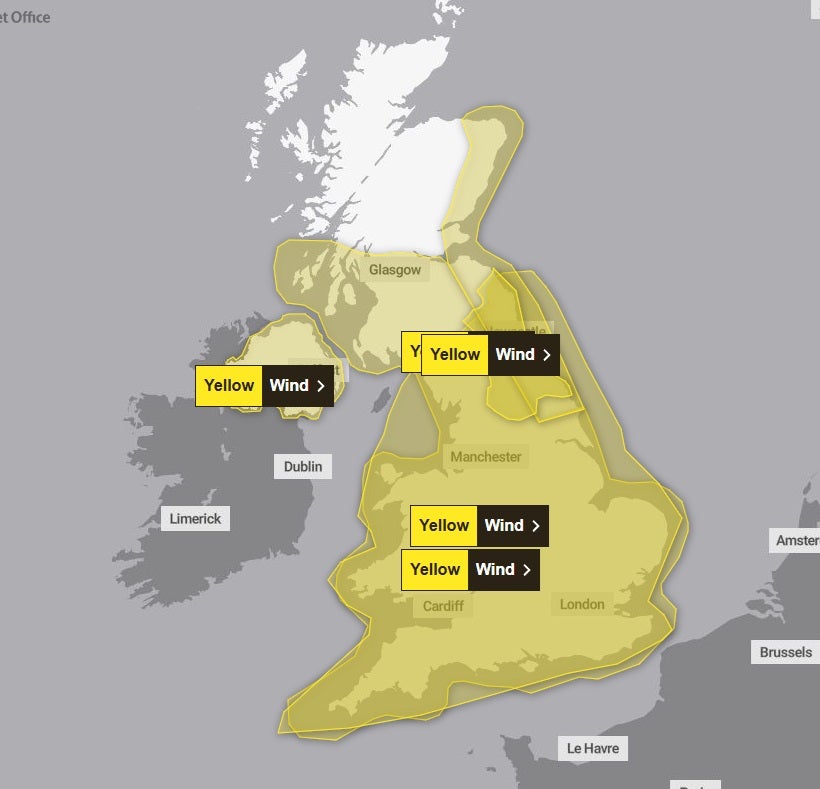
Although the Met Office’s rare red warning came to an end, many parts of the country remain under a yellow weather warning for wind going into Sunday.
Sunday: Weather warnings continue to stay in place
Storm Darragh will be moving away from the UK through Sunday but will continue to leave a legacy of strong north to northeasterly winds across much of England and Wales.

Gusts of up to 80mph could hit Northern Ireland until 6am on Sunday, before a fresh yellow Met Office wind warning comes into force across much of England and Wales.
More widely there are likely to be gusts of 35-45mph inland, even reaching 70mph around coasts during the morning.
It means that further travel disruption and power cuts are likely until 6pm, the Met Office said.
There is a chance of damage to buildings, such as tiles blown from roofs, and it is likely that some roads and bridges could close, with impacts from falling trees.
Public transport will be affected, with delays to road, rail, air and ferry transport expected.
Thousands of homes and businesses could also potentially lose power.
Looking ahead to Monday, the Met Office says the weather will settled, although feeling breezy in the south with further outbreaks of rain.
The agency’s outlook for Tuesday to Thursday forcasts a largely dry and settled week with patch rain and drizzle confined to the north and south coasts.

Join our commenting forum
Join thought-provoking conversations, follow other Independent readers and see their replies
Comments