Snow mapped: Where freezing weather and flooding will hit UK with more snow forecast
Heavy snow and rain causes disruption as cold air returns on Monday
Your support helps us to tell the story
From reproductive rights to climate change to Big Tech, The Independent is on the ground when the story is developing. Whether it's investigating the financials of Elon Musk's pro-Trump PAC or producing our latest documentary, 'The A Word', which shines a light on the American women fighting for reproductive rights, we know how important it is to parse out the facts from the messaging.
At such a critical moment in US history, we need reporters on the ground. Your donation allows us to keep sending journalists to speak to both sides of the story.
The Independent is trusted by Americans across the entire political spectrum. And unlike many other quality news outlets, we choose not to lock Americans out of our reporting and analysis with paywalls. We believe quality journalism should be available to everyone, paid for by those who can afford it.
Your support makes all the difference.A number of weather warnings have remained in place for the majority of the UK on Monday morning, as more snow is predicted to fall across the country and flooding is expected.
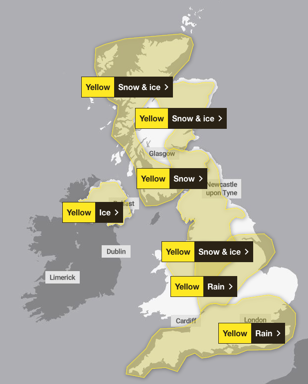
Seven weather warnings for snow, ice and rain have persisted, with most set to remain until at least midday following a weekend of heavy snow for some.
A yellow rain warning for southern England from Cornwall across to Kent will last until 9am on Monday, while a separate rain warning covering much of Wales, the Midlands and parts of Greater Manchester and Yorkshire is in force until 10am.
A yellow warning for snow and ice covering most of northern England and Wales is in place until midday on Monday, while a yellow ice warning covering large parts of Northern Ireland expires at 11am.
The north and west of Scotland are covered by a yellow warning for snow and ice until 11am on Monday, with another for snow and ice in central and eastern parts of the country in place until midday.
A further yellow snow warning covering part of the Scottish Lowlands including Edinburgh is in place until midday.

An amber weather warning for snow – which covered parts of Lancashire, Cumbria and the Lake District – expired at 6am on Monday.
Further weather warnings could be issued with the potential for some snow to fall in southern and central England and Wales around the middle of the week, The Met Office said.
Cold air will return and remain across the whole country from Monday onwards after a brief spell of milder conditions in southern areas.
Deputy chief forecaster Mike Silverstone said: “The low pressure that brought the snow and heavy rain in the south will move out to the east by Monday. This will allow a cold northerly flow to become established again for much of next week.
“This will bring further sleet, snow and hail showers to northern Scotland in particular, but possibly to some other areas, especially near western coasts, with a fair amount of dry and bright weather elsewhere.

“Temperatures will remain below average, with widespread frost and the threat of ice at times. Some areas, especially in the north, may struggle to get above freezing for several days.”
The warnings come as millions of Britons struggled on their commutes on Monday morning due to weather-related travel disruption.
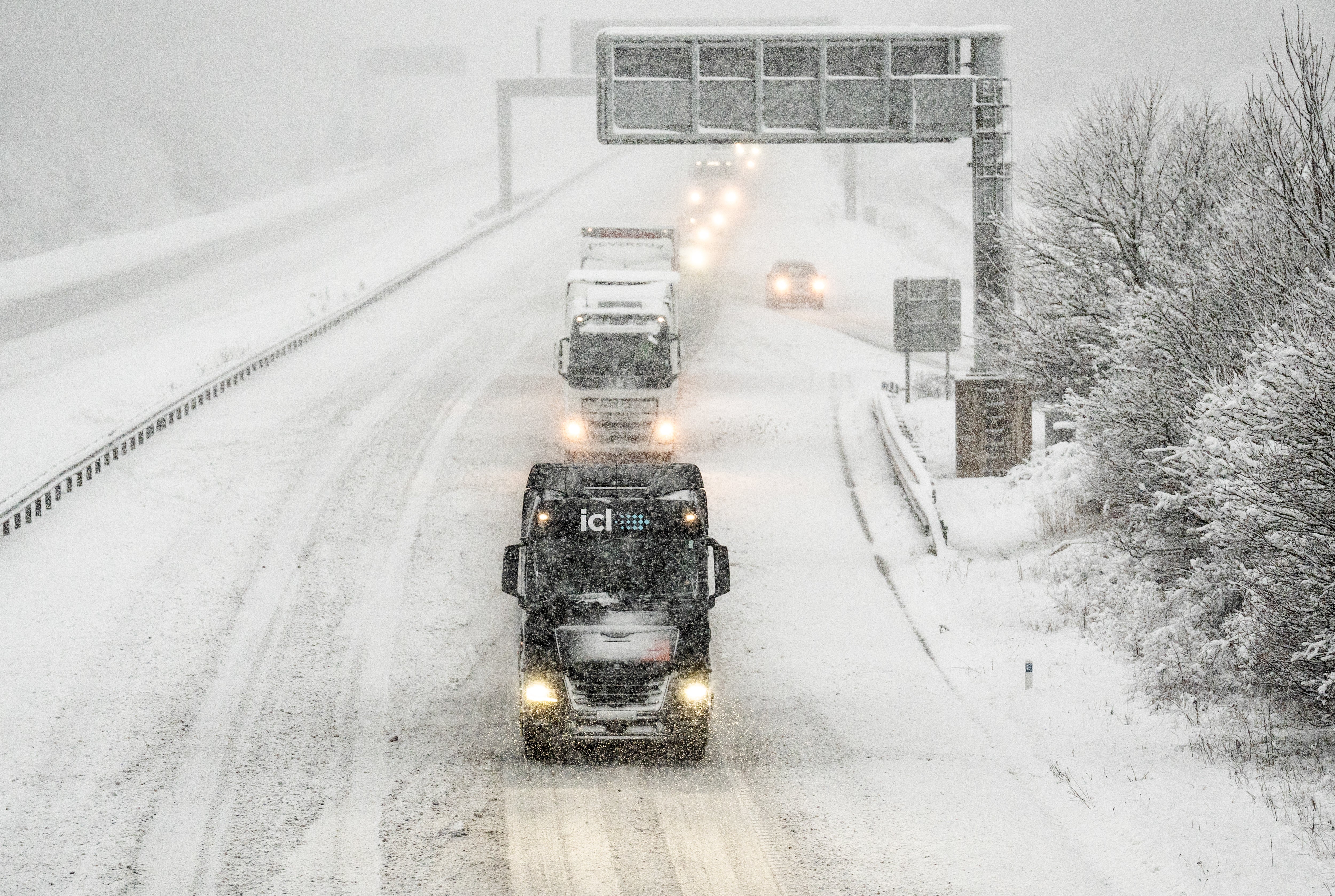
Major airports closed their runways for several hours due to heavy snow, while there were stranded vehicles and collisions which blocked key roads across northern England.
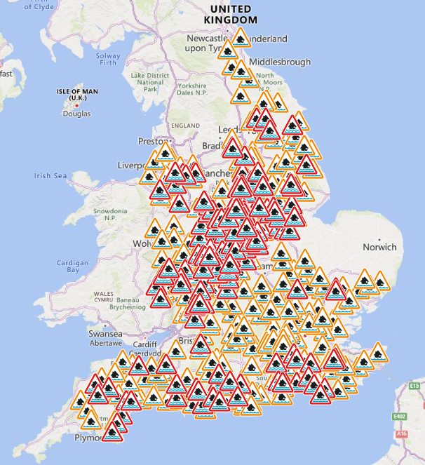
The Environment Agency issued 174 flood warnings, meaning flooding is expected, and 303 flood alerts, meaning flooding is possible, across England as of 9am on Monday. At the same point, National Resources Wales had issued three flood warnings and 34 flood alerts.
Warwickshire Police said early on Monday that a stretch of the A46 was shut in both directions due to flooding.

Surrey Police said the M25 was closed anti-clockwise between Junction 10 (A3) and Junction 8 (Reigate) with a temporary diversion in place following a single-vehicle collision. The force said a lorry had collided with the central reservation just before midnight, with diversions expected to be in place until Monday evening.
South Wales Police warned the A48 was closed from the Llanedeyrn roundabout due to a serious road traffic collision, with eastbound traffic down to one lane.
Flooding forced the closure of all railway lines between Derby and both Nottingham and East Midlands Parkway on Monday morning, affecting CrossCountry and East Midlands Railway services.
Southeastern trains were also unable to run from Ramsgate or Margate towards London via Canterbury West because of a fallen tree. Flooding near Hooton, Cheshire, means Merseyrail’s Chester services were also suspended.

Join our commenting forum
Join thought-provoking conversations, follow other Independent readers and see their replies
Comments