Met Office issues three days of weather warnings for heavy rain as summer officially ends
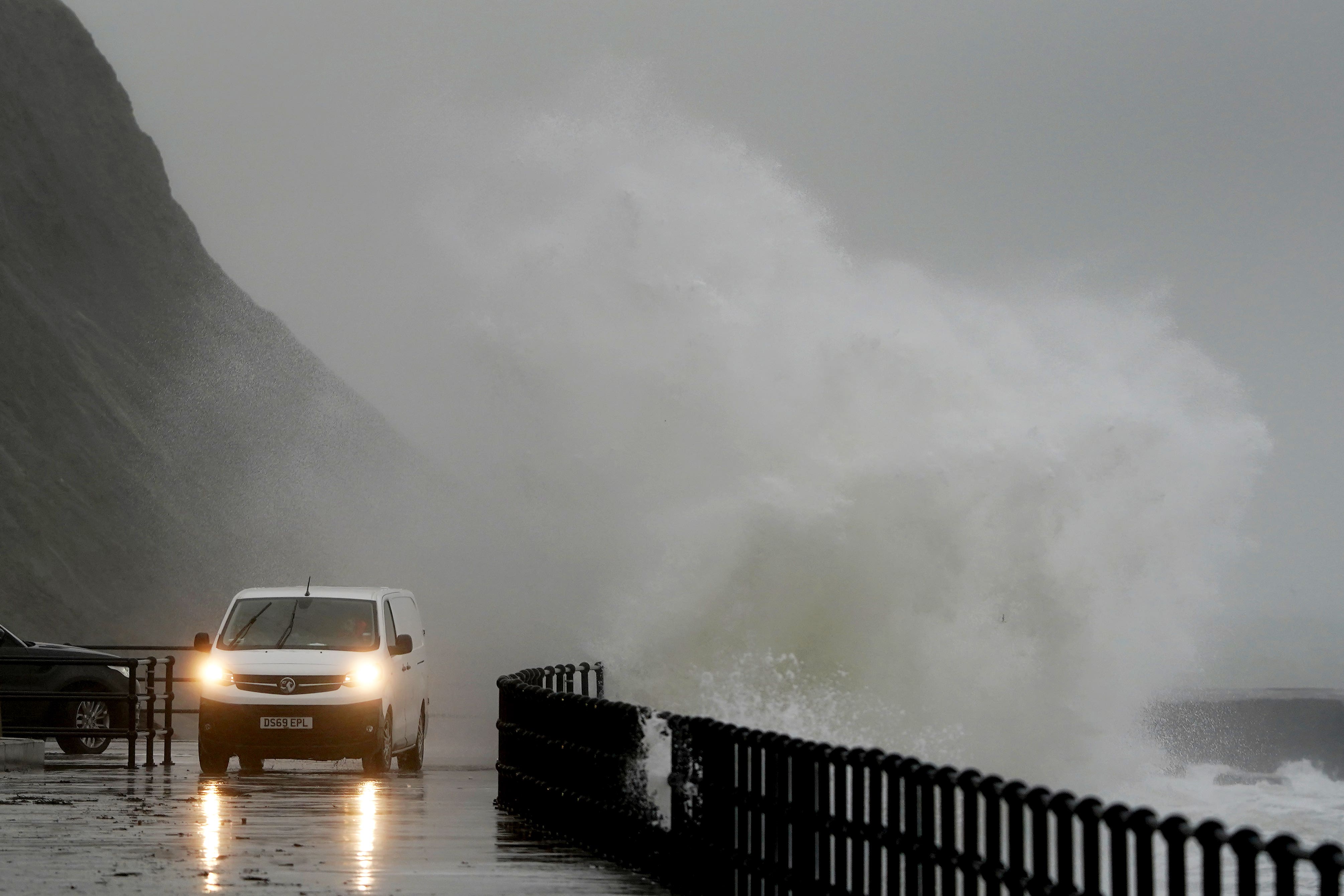
Temperatures are set to stay low as heavy rain hits England and Wales
Your support helps us to tell the story
From reproductive rights to climate change to Big Tech, The Independent is on the ground when the story is developing. Whether it's investigating the financials of Elon Musk's pro-Trump PAC or producing our latest documentary, 'The A Word', which shines a light on the American women fighting for reproductive rights, we know how important it is to parse out the facts from the messaging.
At such a critical moment in US history, we need reporters on the ground. Your donation allows us to keep sending journalists to speak to both sides of the story.
The Independent is trusted by Americans across the entire political spectrum. And unlike many other quality news outlets, we choose not to lock Americans out of our reporting and analysis with paywalls. We believe quality journalism should be available to everyone, paid for by those who can afford it.
Your support makes all the difference.Parts of the UK are set to see heavy storms in the coming days as the Met Office issues a yellow weather warning for rain and warns of possible flooding.
The warning is set to last from Wednesday to Friday, and will primarily affect the south of England and Wales. It brings an abrupt end to the summer sunshine, with temperatures also set to stay below 20C.
Guidance from the Met Office says: “Some parts missing the worst, but heavy rain becomes more extensive Wednesday night and especially Thursday, with some flooding impacts.”
“Spray and sudden flooding could lead to difficult driving conditions and some road closures,” they say, also warning that train travel could be disrupted. They add that there is a small chance that homes and businesses could be flooded.
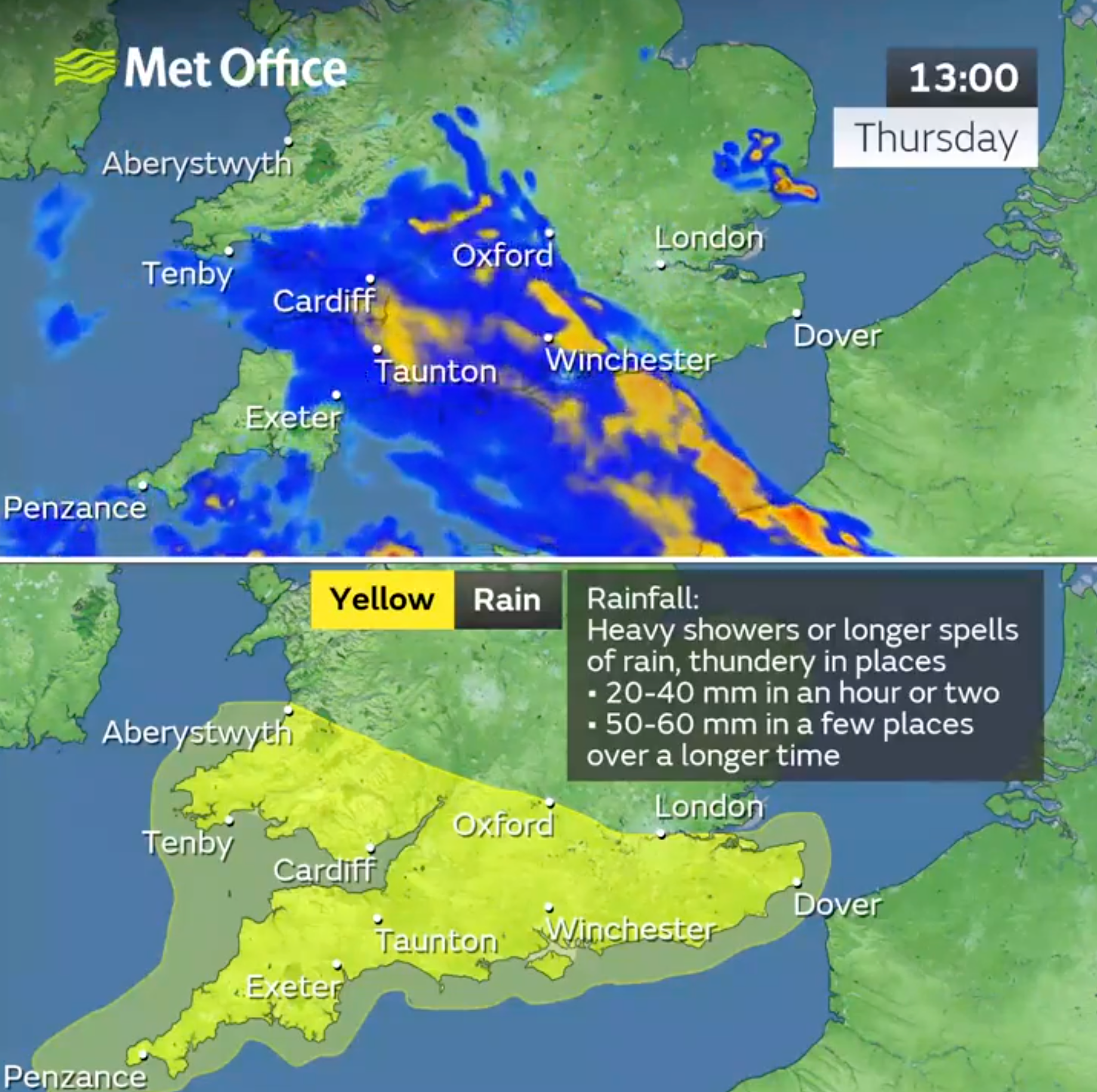
The worst of the wet weather is more likely during the second half of Thursday and throughout Friday, forecasts show. As much as 80 to 100mm could fall.
On Thursday, heavy rain is set to sweep westwards, with the most severe showers falling on the South West throughout the day. The storm will also reach as high as the West Midlands for a few hours before passing over South Wales.
And Friday will see showers make their way along the south coast in the early hours, before hitting parts of the West Midlands and Wales in the evening.
The UK has seen a particularly stormy year, seeing 12 named storms this season – the most since the new naming convention was introduced in 2015.
The most severe of these was Storm Babet, which hit the country in October. Two red warnings were given for rain during the storm, and another two amber warnings for wind. Five people tragically lost their lives during the weather event as parts of Scotland saw 150-200mm of rain.
The Met Office has given advice to anyone who is likely to be affected by the yellow weather warnings, writing: “Consider if your location is at risk of flash flooding. If so, consider preparing a flood plan and an emergency flood kit.
“Give yourself the best chance of avoiding delays by checking road conditions if driving, or bus and train timetables, amending your travel plans if necessary.
“Be prepared for weather warnings to change: the Met Office recommends staying up to date with the weather forecast in your area.”
Join our commenting forum
Join thought-provoking conversations, follow other Independent readers and see their replies
Comments