North of England set for icy conditions after warmest weekend of year
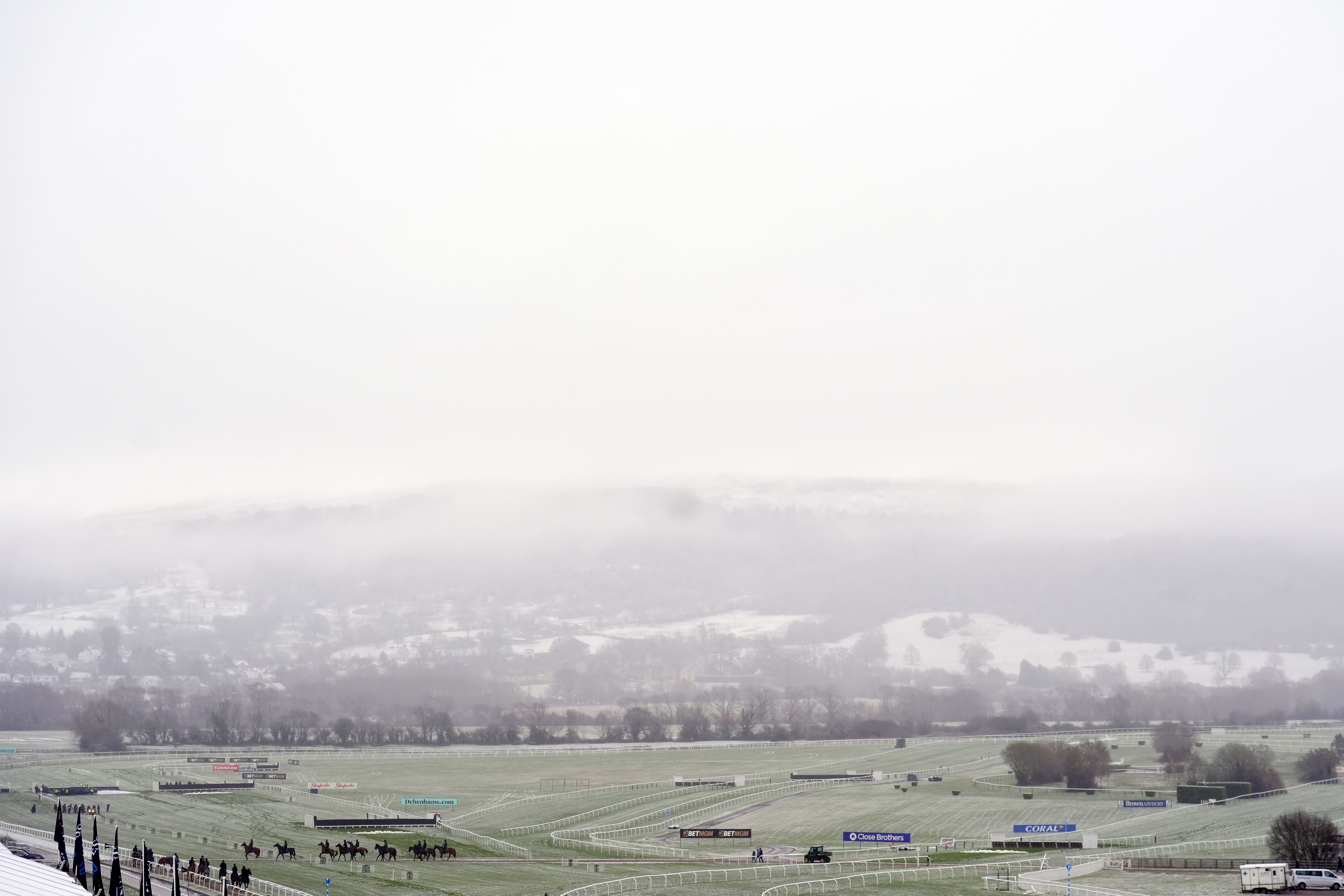
Yellow weather warnings issuedafter snow falls on Cheltenham.
Your support helps us to tell the story
From reproductive rights to climate change to Big Tech, The Independent is on the ground when the story is developing. Whether it's investigating the financials of Elon Musk's pro-Trump PAC or producing our latest documentary, 'The A Word', which shines a light on the American women fighting for reproductive rights, we know how important it is to parse out the facts from the messaging.
At such a critical moment in US history, we need reporters on the ground. Your donation allows us to keep sending journalists to speak to both sides of the story.
The Independent is trusted by Americans across the entire political spectrum. And unlike many other quality news outlets, we choose not to lock Americans out of our reporting and analysis with paywalls. We believe quality journalism should be available to everyone, paid for by those who can afford it.
Your support makes all the difference.The north of England is expected to see icy conditions as yellow weather warnings were issued to 10 areas of the country following snow in Cheltenham on Wednesday morning.
The Met Office issued the warning for between 3am and 9am on Thursday in areas including Yorkshire, Lancashire, Northumberland and Derbyshire.
This comes after the UK recorded its warmest day of the year last weekend, as parts of England saw highs of 19.1C on Saturday and 19.7C on Sunday.
Cheltenham enjoyed temperatures as high as 18C on Sunday, but snow coated the town’s racecourse for what is often called a “fool’s spring” when a period of warm weather is quickly followed by a cold snap, which sometimes happens in March and April.
Regions affected by the icy conditions on Thursday are expected to see temperatures close to zero, with icy roads increasing the chance of accidents especially over the Pennines and the Peak District.
Tom Morgan, a meteorologist at the Met Office, said: “We have an Arctic air mass in place across the UK at the moment, compared to a much milder continental air mass last weekend.
“Last weekend, we had very mild southerly winds coming up from North Africa and Spain bringing those temperatures into the teens.
“On Monday, we saw cold fronts sink southwards across the UK, and that introduced colder, Arctic air.
“Ice won’t necessarily just be in northern England where the ice warning is.
“We could see some patchy frost and ice pretty much anywhere where we see showers today.”
He added: “This is not unusual, we do see snow and frost in March quite often.
“If anything, it was last weekend that was fairly unusual to see temperatures as high as 18 or 19C.
“With climate change, we can expect higher temperatures earlier in the year becoming a bit more likely and shorter winters with less extreme, less cold conditions.”