Storm Brian path: UK braced as 'weather bomb' approaches
Winds could reach 70mph in exposed areas
Your support helps us to tell the story
From reproductive rights to climate change to Big Tech, The Independent is on the ground when the story is developing. Whether it's investigating the financials of Elon Musk's pro-Trump PAC or producing our latest documentary, 'The A Word', which shines a light on the American women fighting for reproductive rights, we know how important it is to parse out the facts from the messaging.
At such a critical moment in US history, we need reporters on the ground. Your donation allows us to keep sending journalists to speak to both sides of the story.
The Independent is trusted by Americans across the entire political spectrum. And unlike many other quality news outlets, we choose not to lock Americans out of our reporting and analysis with paywalls. We believe quality journalism should be available to everyone, paid for by those who can afford it.
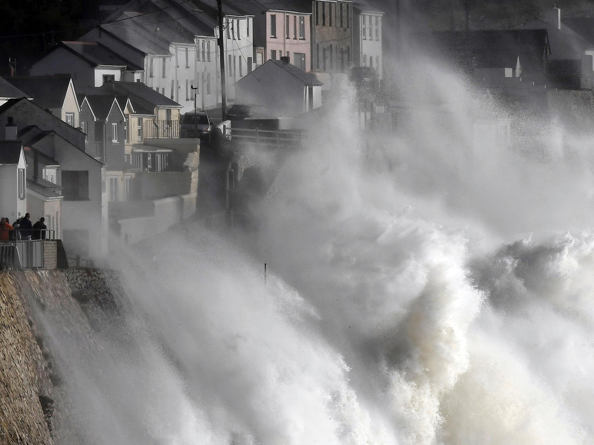
Your support makes all the difference.The UK is bracing itself for Storm Brian, which is expected to batter parts of the coast just days after Ophelia wreaked destruction.
Heavy rain and gusts of 50mph are expected to hammer large swathes of southern England and the west of Wales on Saturday, with a warning that winds could reach 70mph in exposed areas.
The wild conditions, caused by a “weather bomb” over the Atlantic Ocean, may cause coastal flooding and affect transport, the Met Office said.
Spokesman Grahame Madge said: “Dramatic waves could pose a threat to life and there will be quite hazardous conditions along the seafront.”
He warned thrillseekers not to risk their safety by posing for “storm selfies” along the coast.
A yellow weather warning for wind has been issued in affected areas, valid from 4am to midnight on Saturday.
Wide parts of the country could see between 15mm and 25mm of rainfall, with deluges of up to 60mm in isolated areas.
Northern Ireland, one of the areas worst affected by Storm Ophelia, is also braced for further disruption when a band of rain moves in from the west on Thursday.
A yellow weather warning for rain has been issued across the region, valid from 3pm to midnight.
Met Office forecaster Helen Roberts warned that heavy rain would be falling on already saturated ground and could cause flooding and affect properties.
She said: “It will be fairly patchy to begin with but then it looks like through the afternoon and into the evening it becomes heavier and more persistent and more widespread.”
Around 40mm of rain is expected in parts of Northern Ireland and 60mm is possible over the mountains.
Join our commenting forum
Join thought-provoking conversations, follow other Independent readers and see their replies
Comments