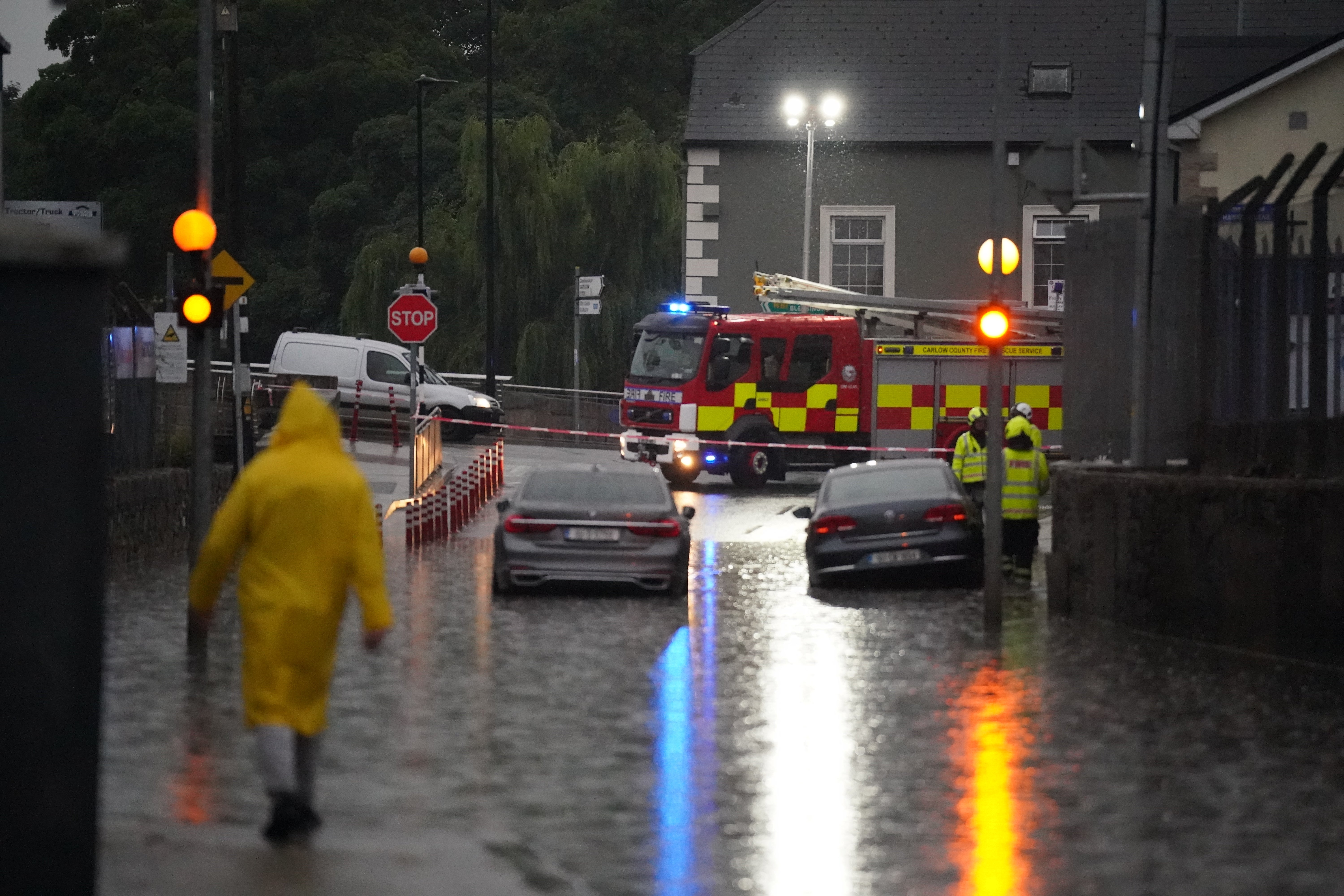
Flash floods and thunderstorms will give way to breezy conditions by end of week
The fresher weather will no doubt come as a relief to many after scorching temperatures over the weekend.

Your support helps us to tell the story
From reproductive rights to climate change to Big Tech, The Independent is on the ground when the story is developing. Whether it's investigating the financials of Elon Musk's pro-Trump PAC or producing our latest documentary, 'The A Word', which shines a light on the American women fighting for reproductive rights, we know how important it is to parse out the facts from the messaging.
At such a critical moment in US history, we need reporters on the ground. Your donation allows us to keep sending journalists to speak to both sides of the story.
The Independent is trusted by Americans across the entire political spectrum. And unlike many other quality news outlets, we choose not to lock Americans out of our reporting and analysis with paywalls. We believe quality journalism should be available to everyone, paid for by those who can afford it.
Your support makes all the difference.Flash floods and thunderstorms hitting parts of the UK over the coming days will give way to breezier weather by the end of the week, forecasters have said.
The fresher conditions, expected from late Wednesday onwards, will no doubt come as a relief to many after scorching temperatures over the weekend were quickly followed by heavy downpours and ongoing humidity.
The Met Office has issued an amber thunderstorm warning for areas of Cornwall, Devon and Somerset – with the likely chance of homes and businesses flooding, power cuts, and transport chaos.
Yellow warnings are also in place for most of the UK on Tuesday and for southern England on Wednesday.
It comes after weeks of little rain and warm conditions have caused droughts across parts of the UK, leaving land parched.
The National Drought Group on Friday moved parts of the South West, southern and central England, and the east of England into official drought status – while six water companies have already or are planning to impose hosepipe bans.
Heavy showers caused flooding in areas of Cornwall and Devon on Monday afternoon while thunderstorms developed in east-coast counties like Essex, Suffolk and Lincolnshire.
Hail, frequent lightning and flash flooding is possible in areas further south, with heavy rain predicted across England and Wales on Tuesday.
The rain will likely later become more concentrated in southern parts of England.
Downpours are expected across Scotland on Tuesday but will gradually clear as the day goes on, while Northern Ireland will be the driest.
Met Office meteorologist Greg Dewhurst said: “Temperatures will be lower, looking at highs of around 27C as a maximum temperature, but it will still be on the humid side tomorrow (on Tuesday).
“Thundery showers across central and southern parts of England on Wednesday and temperatures will be around 26C as a maximum.”
Mr Dewhurst warned that the bad weather conditions could pose difficulties for those hoping to travel and urged people to stay up to date with developments in their local area.
“We’ll see some very heavy showers develop over the coming days, hail, frequent lightning, some flash flooding is possible like we’ve seen in places today so our advice is to stay tuned to latest forecasts and local radio stations as well, to get the latest information,” he said.
“It is worth being aware that there could be disruptions or delays to travel.”
He added: “It will be in turns fairly breezy as we end the week, with some showery rain, particularly across the north of the UK, so temperatures generally around average for many but could possibly be a bit above for the far south, which is the mid-20s.
“It looks probably most likely from late Wednesday to Thursday onwards it will become fresher for everyone.”
Footage shared to social media showed a roundabout near the river in Truro, Cornwall quickly flooding with water on Monday afternoon as showers moved in.
Earlier, Professor Hannah Cloke, an expert in hydrology at the University of Reading, explained why there is the potential for floods in drought-hit areas.
It looks probably most likely from late Wednesday to Thursday onwards it will become fresher for everyone
She said: “The ground is really dry and when it is so dry it acts a little bit like concrete and that water can’t get in so it drains straight off.
“There is the damage to homes and businesses these floods can cause, and inconvenience with transport disruptions, but if it is very heavy in one place it can also be very dangerous.”
Explaining why this heavy rain will not alleviate drought-hit areas, she said: “It’s a drop in the ocean really. It is not soaking into the soil which is how we really need it. We need it back into the system where it can be stored.
“We really need a long winter of rain to replenish this.”