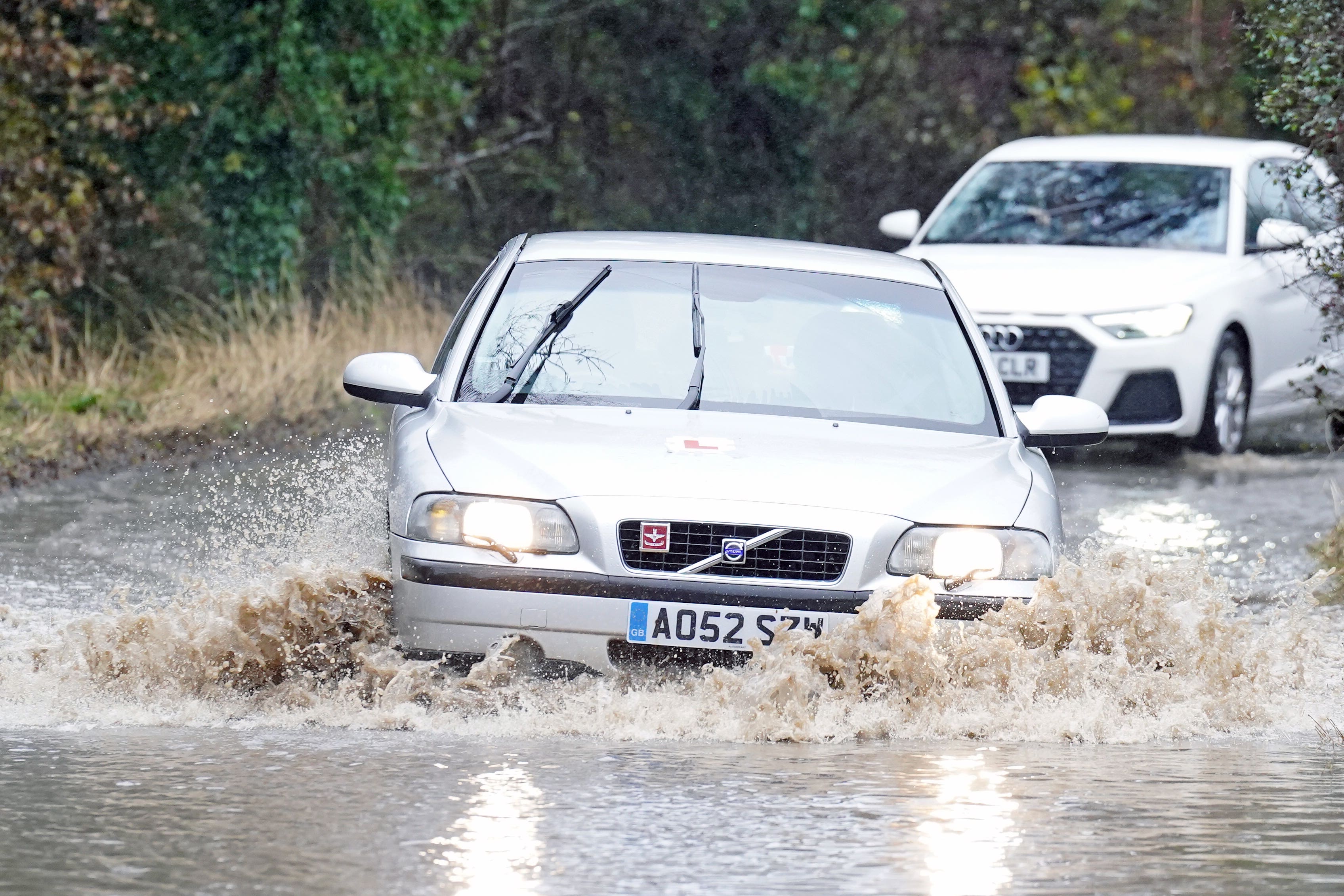
Storm Ciaran on way to UK with ‘danger to life’ amber weather warnings
Amber warnings are in place for parts of the south coast of England on Thursday as Storm Ciaran is due to hit.

Your support helps us to tell the story
From reproductive rights to climate change to Big Tech, The Independent is on the ground when the story is developing. Whether it's investigating the financials of Elon Musk's pro-Trump PAC or producing our latest documentary, 'The A Word', which shines a light on the American women fighting for reproductive rights, we know how important it is to parse out the facts from the messaging.
At such a critical moment in US history, we need reporters on the ground. Your donation allows us to keep sending journalists to speak to both sides of the story.
The Independent is trusted by Americans across the entire political spectrum. And unlike many other quality news outlets, we choose not to lock Americans out of our reporting and analysis with paywalls. We believe quality journalism should be available to everyone, paid for by those who can afford it.
Your support makes all the difference.Storm Ciaran is set to bring a fresh bout of wind and rain to the UK – with “danger to life” amber weather warnings issued for Thursday.
Two amber warnings, the second highest level of alert, are in place for parts of the south coast of England on Thursday, together with further yellow rain warnings, the lowest level, meaning some disruption could be on the way.
Met Office spokesman Oli Claydon said the storm is “forming as we speak” and will hit on Wednesday evening, with coastal gusts of 70mph to 80mph and the potential for 85mph.
And people are being urged not to go near the water’s edge due to “very dangerous conditions”.
A red wind warning, the highest level, has been issued by Jersey Met for Wednesday evening into Thursday, with residents warned to avoid outside activity due to predicted gusts of almost 100mph.
Northern Ireland has already seen flooding, where a yellow rain warning from the Met Office is in place until 9am on Wednesday.
A similar notice has been issued for parts of south-west, central and eastern Scotland from 3am to 3pm and in southern parts of England and Wales from 6pm on Wednesday until the end of Thursday.
A further yellow warning for rain and wind had been issued across the south-east coast from 5am to 9am on Wednesday, with a yellow warning for wind across southern England and parts of South Wales from 9pm on Wednesday and throughout Thursday.
Mr Claydon said: “There will be very dangerous conditions on the coastline, large waves. We’d urge people not to go near the water’s edge.
“Rain warnings are in place, there will be some very saturated grounds bringing an additional hazard.”
Northern Wales will see the most rain, with the potential for 100mm (nearly 4in) over 36 hours.
Thursday’s amber warning is in place from 3am to 11am in Cornwall and Devon, with the Met Office predicting Storm Ciaran will bring winds of 75mph to 85mph with 65mph to 75mph gusts inland.
Across the south coast, the amber warning runs from 6am to 5pm, with winds expected to reach 70mph to 80mph with the potential for 85mph and large waves.
The warning says wind could disrupt travel, down power lines and cause structural damage, with flying debris providing a threat to life.
Elsewhere in southern England and south-west Wales, gusts could reach 50mph to 60mph with 60mph to 70mph on the coasts.
Yellow warnings for rain are in place for southern England and Wales, north-east Wales, north-east England and Scotland stretching up to Inverness, and the south-east of Northern Ireland.
The warning across north-east England and Scotland will be in place until 6am on Friday.
People are being urged by the Environment Agency to prepare for “possible significant flooding” across parts of England from Wednesday to Friday, with some significant coastal impacts also possible but not expected on Thursday.
The mobile barriers at Exeter, which are part of the flood defence scheme, are being deployed and demountable and temporary barriers are already in place or ready to be installed along the River Severn.
Ben Lukey, flood duty manager at the Environment Agency, said: “Large waves and onshore gales brought by Storm Ciaran could see significant flooding along parts of the south coast tomorrow, while minor impacts are possible along the coast from Dorset to Sussex this evening and along parts of the Yorkshire and North East coasts on Thursday.
“Rain from the storm could also see significant surface water and river flooding across parts of the West, South and North East of England from later today until Friday, with minor impacts possible more widely on Saturday due to further showers.
“Environment Agency teams are out on the ground clearing any blocking debris from screens and watercourses, operating flood defence assets where required, working with partners and present in those communities that have experienced flooding, looking to minimise the impact on residents.
“We urge people to stay safe on the coast and to remember to take extreme care on coastal paths and promenades. Flooding of low-lying coastal roads is also possible and people must avoid driving through flood water, as just 30cm of flowing water is enough to move your car.”
The Environment Agency had issued 24 flood warnings for England by 11am on Wednesday morning, with 116 flood alerts.
The weather is not showing much sign of a rapid improvement once Storm Ciaran does pass.
Met Office deputy chief meteorologist Steven Keates said: “Once Storm Ciaran has passed, the weather over the weekend continues to look unsettled for many, with more showers and rain at times.
“Warnings will continue to be updated over the coming days, so it is important to stay up to date with the Met Office forecast and warnings in your area.”