River Ganges abruptly changed course after major earthquake 2,500 years ago
River’s main channel previously ran about 100km south of Dhaka in Bangladesh
Your support helps us to tell the story
From reproductive rights to climate change to Big Tech, The Independent is on the ground when the story is developing. Whether it's investigating the financials of Elon Musk's pro-Trump PAC or producing our latest documentary, 'The A Word', which shines a light on the American women fighting for reproductive rights, we know how important it is to parse out the facts from the messaging.
At such a critical moment in US history, we need reporters on the ground. Your donation allows us to keep sending journalists to speak to both sides of the story.
The Independent is trusted by Americans across the entire political spectrum. And unlike many other quality news outlets, we choose not to lock Americans out of our reporting and analysis with paywalls. We believe quality journalism should be available to everyone, paid for by those who can afford it.
Your support makes all the difference.The Ganges river abruptly changed course 2,500 years ago following a devastating earthquake, according to a new study that raises concerns about the prevailing risk of megaquakes in South Asia.
Researchers, including from the Columbia Climate School, discovered a previously undocumented quake that struck what is now Bangladesh.
“I don’t think we have ever seen such a big one anywhere,” said geophysicist Michael Steckler, a co-author of the study published in the journal Nature.
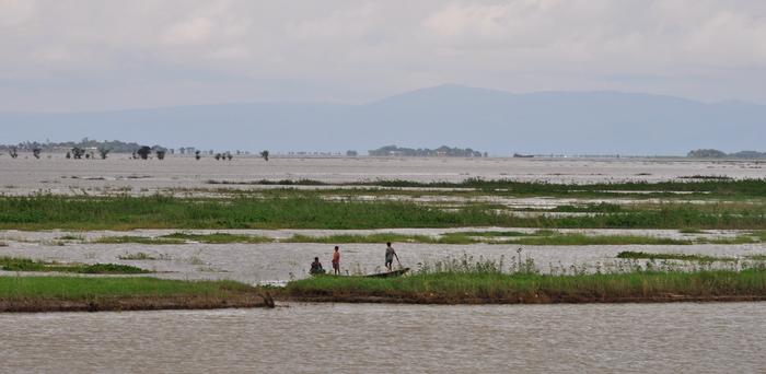
The Ganges forms the world’s second-largest river system after the Amazon in South America, flowing for over 2,500 km through northern India and Bangladesh before joining the Brahmaputra and emptying into the Bay of Bengal. It forms a vast labyrinth of waterways that feeds the most densely populated region on the planet.
While earthquakes are known as one of the key drivers of landscape change, their impact on river courses isn’t fully understood.
Rivers are known to periodically change course without the help of earthquakes but this process generally takes successive floods over years or decades.
When a river changes course, sediments wash from upstream, settle and build up and eventually cause the river bed to rise higher than the surrounding floodplain.
But when the change of course is caused by a quake, the sediment flow can occur almost instantaneously.
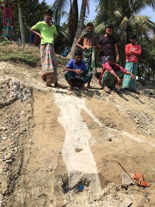
In the new study, scientists assessed a unique sediment feature that was first discovered in a freshly dug pond near Dhaka that had not yet been filled with water.
On one flank of the pond, they spotted vertical dikes of sand that are well-known as a feature created by earthquakes. The dikes are caused when quakes pressurise buried sand and inject it up out of the soil like “literal sand volcanoes”, researchers said.

On further analysis, scientists found the sand dikes in the pond were all created at the same time about 2,500 years ago.
A similar change was discovered at a site about 85km downstream.
Researchers said these changes are proof of the former main channel of the river that ran about 100km south of Dhaka.
This fossil channel of the Ganges is a low-lying area about 1.5 km wide and stretches intermittently for some 100km parallel to the current river course.
The extinct channel frequently floods and is used mainly for rice cultivation, scientists said.

Researchers concluded from their findings that there was a “big, sudden avulsion triggered by an earthquake, estimated to be magnitude 7 or 8” which struck the region two and a half millennia ago.
The quake was likely caused by a huge under-ocean tectonic plate shoving itself under Bangladesh, Myanmar and northeastern India, they said.
Scientists noted that these zones are still building stress and could produce quakes of comparable magnitude again in this densely populated region.
“Large earthquakes impact large areas and can have long-lasting economic, social and political effects,” Syed Humayun Akhter, vice-chancellor of Bangladesh Open University and an author of the study, said.
Join our commenting forum
Join thought-provoking conversations, follow other Independent readers and see their replies
Comments