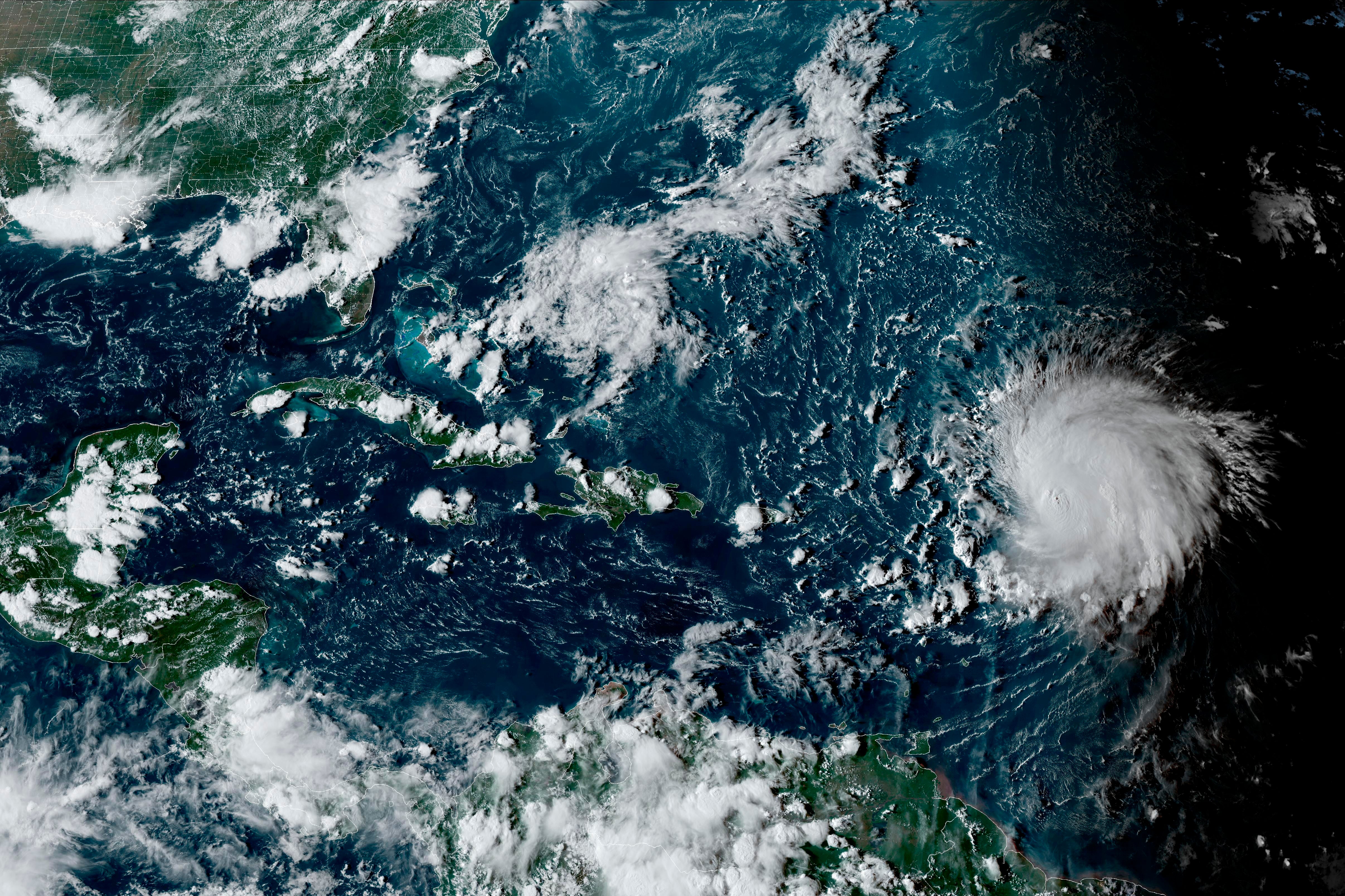
Hurricane Lee generates big swells along northern Caribbean while it churns through open waters
Hurricane Lee is whipping up waves of more than 15 feet as the Category 3 storm cranked through open waters just north of the Caribbean region

Your support helps us to tell the story
From reproductive rights to climate change to Big Tech, The Independent is on the ground when the story is developing. Whether it's investigating the financials of Elon Musk's pro-Trump PAC or producing our latest documentary, 'The A Word', which shines a light on the American women fighting for reproductive rights, we know how important it is to parse out the facts from the messaging.
At such a critical moment in US history, we need reporters on the ground. Your donation allows us to keep sending journalists to speak to both sides of the story.
The Independent is trusted by Americans across the entire political spectrum. And unlike many other quality news outlets, we choose not to lock Americans out of our reporting and analysis with paywalls. We believe quality journalism should be available to everyone, paid for by those who can afford it.
Your support makes all the difference.Hurricane Lee whipped up waves of more than 15 feet (5 meters) on Monday as the Category 3 storm cranked through open waters just north of the Caribbean region.
The storm is not expected to make landfall. It was located some 340 miles (545 kilometers) north of the northern Leeward Islands. It had winds of up to 120 mph (195 kph) and was moving northwest at 7 mph (11 kph).
A high surf advisory was in effect for Puerto Rico and the U.S. Virgin Islands, with the National Weather Service warning of breaking waves of up to 15 feet (5 meters) for north and east-facing beaches.
The National Hurricane Center also warned of dangerous surf and rip currents for most of the U.S. East Coast this week, but what the hurricane might do beyond that is unclear.
"It remains too soon to know what level of impacts, if any, Lee might have along the U.S. East Coast and Atlantic Canada late this week, especially since the hurricane is expected to slow down considerably over the southwestern Atlantic," the center said.
Lee strengthened from a Category 1 storm to a Category 5 storm last week in the span of 24 hours before weakening slightly.
The storm is expected to strengthen slightly in upcoming days before weakening again.
Lee was forecast to turn north on Wednesday, prompting the National Hurricane Center to warn that Bermuda could see wind, rain and high surf, adding that “it is too soon to determine the specific timing and level of those impacts.”
Lee is the 12th named storm of the Atlantic hurricane season, which runs from June 1 to Nov. 30 and peaked on Sunday.
In August, the National Ocean and Atmospheric Administration updated its forecast and doubled the chance to 60% for an above normal hurricane system. Between 14 to 21 named storms are forecast, with six to 11 predicted to strengthen into hurricanes. Of those, two to five are forecast to become major hurricanes.
Also swirling in the open Atlantic was Tropical Storm Margot, which was expected to become a hurricane on Monday night. The storm was located 1,215 miles (1,955 kilometers) northwest of the Cabo Verde islands. It had maximum sustained winds of 65 mph (100 kph) and was moving north at 8mph (13 kph). It is not expected to remain over open waters.