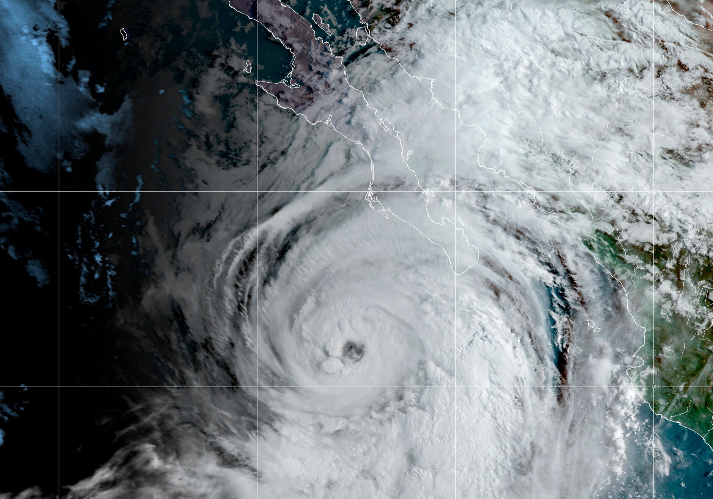
Hurricane Kay heads to Mexico's Baja California Peninsula
Hurricane Kay is gaining strength in the Pacific and lashing Mexico’s Baja California Peninsula, where authorities have opened shelters for those who need to evacuate

Your support helps us to tell the story
From reproductive rights to climate change to Big Tech, The Independent is on the ground when the story is developing. Whether it's investigating the financials of Elon Musk's pro-Trump PAC or producing our latest documentary, 'The A Word', which shines a light on the American women fighting for reproductive rights, we know how important it is to parse out the facts from the messaging.
At such a critical moment in US history, we need reporters on the ground. Your donation allows us to keep sending journalists to speak to both sides of the story.
The Independent is trusted by Americans across the entire political spectrum. And unlike many other quality news outlets, we choose not to lock Americans out of our reporting and analysis with paywalls. We believe quality journalism should be available to everyone, paid for by those who can afford it.
Your support makes all the difference.Hurricane Kay gained strength in the Pacific Wednesday and began lashing Mexico’s Baja California Peninsula, where authorities prepared by opening shelters and closing some roads.
Kay’s maximum sustained winds rose to 105 mph (165 kph), with forecasters saying it could brush the mid portion of the peninsula Thursday or Friday.
The U.S. National Hurricane Center in Miami said Kay was centered about 215 miles (345 kilometers) southwest of the southern tip of the Baja peninsula. Kay was moving north-northwest at 12 mph (19 kph).
A hurricane warning was issued for a sparsely populated stretch of the peninsula around Bahia Asuncion and the state government of Baja California Sur announced it was opening shelters for people who need to evacuate. It said some creeks were already rising and closed some roads.
Forecasters expected Kay to stay offshore as it moves more northward, roughly parallel to the coast, it was an expansive storm, with tropical storm-force winds extending up to 230 miles (370 kilometers) from the center.
In the Atlantic, Hurricane Earl strengthened northeast of Puerto Rico after dropping heavy rain across the Leeward Islands, the U.S. and British Virgin Islands and Puerto Rico.
Earl was located about 460 miles (740 kilometers) south of Bermuda on Wednesday and was heading north at 8 mph (13 kph).
Earl had maximum sustained winds of 85 mph (140 kph) and was expected to grow into a major hurricane later this week while turning toward the open Atlantic.
Meanwhile, Hurricane Danielle was kicking up high seas far out over the Atlantic — some 625 miles (1,005 kilometers) northwest of the Azores.
It had maximum sustained winds of 80 mph (130 kph).