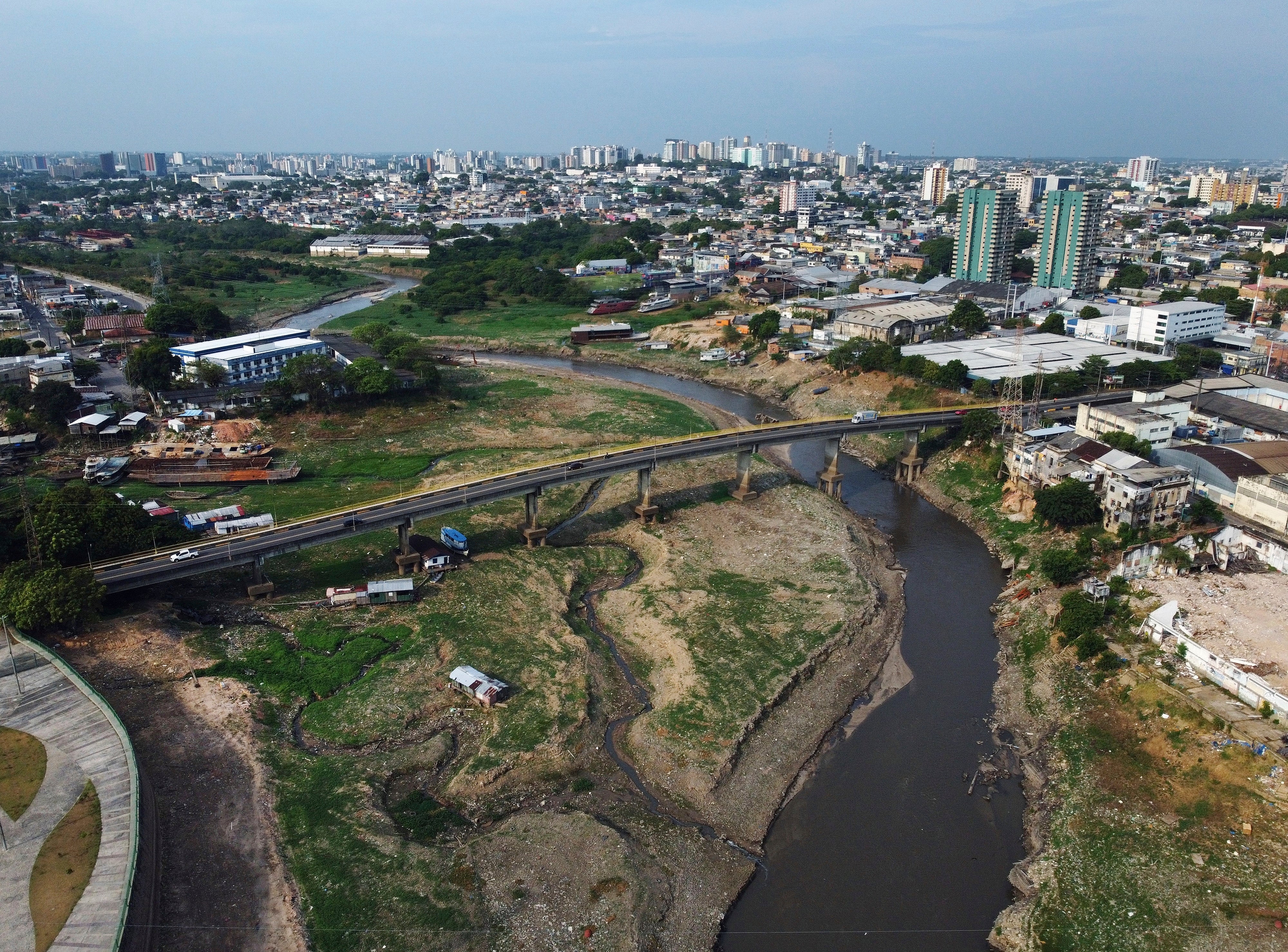
Aerial photos capture devastating before-and-after impacts of drought on Amazon

Your support helps us to tell the story
From reproductive rights to climate change to Big Tech, The Independent is on the ground when the story is developing. Whether it's investigating the financials of Elon Musk's pro-Trump PAC or producing our latest documentary, 'The A Word', which shines a light on the American women fighting for reproductive rights, we know how important it is to parse out the facts from the messaging.
At such a critical moment in US history, we need reporters on the ground. Your donation allows us to keep sending journalists to speak to both sides of the story.
The Independent is trusted by Americans across the entire political spectrum. And unlike many other quality news outlets, we choose not to lock Americans out of our reporting and analysis with paywalls. We believe quality journalism should be available to everyone, paid for by those who can afford it.
Your support makes all the difference.Drought is devastating Brazil’s Amazon rainforest, and some rivers are falling to historic lows. Images of one of the Amazon River’s main tributaries, the Negro River, show just how dramatically water is dwindling.
When The Associated Press photographed the Negro River and surrounding areas in late June and early July, it was nearly 27 meters (88.5 feet) deep at the port in Manaus. In just three months, it fell by nearly half, to 13.9 meters (45.6 feet) as of Thursday.
If the pace at which the Negro has been dropping continues, within a week it will break the record for the lowest level in 122 years of monitoring. The record was set last year, but toward the end of October.
The Negro River drains about 10 percent of the Amazon basin and is the world’s sixth-largest by water volume. Manaus, the biggest city in the rainforest, is where the Negro joins the Amazon River, which in Brazil is called the Solimoes River upstream.
Riverine communities around Manaus and elsewhere in the Amazon have been left stranded. Authorities have been distributing potable water and water purification systems. Passenger boats and supply ships are struggling to navigate the shallows.
Amazonas state’s fishing federation has warned that limited access to nearby, traditional fishing areas is imperiling their livelihoods, diminishing supply of the region’s mainstay food and boosting prices. The cost of bottled water and other goods in far-flung areas has surged, too.
Water levels in Brazil’s Amazon always rise and fall with its rainy and dry seasons — but not like this. At this time of year, the Negro River should still be around 21 meters deep at the Manaus port, according to the nation’s geologic service. And all of the major rivers are at critical levels, with the most dramatic decline at the Madeira River, the Amazon River’s longest tributary.
On Monday at the measuring site in the city of Porto Velho, the Madeira’s level fell to just 25 centimeters (about 10 inches), a record since measurement began in 1967, and more than 3 meters below the historic average for the day. It increased the next day, but only slightly, and rivers were expected to stay low well into October.