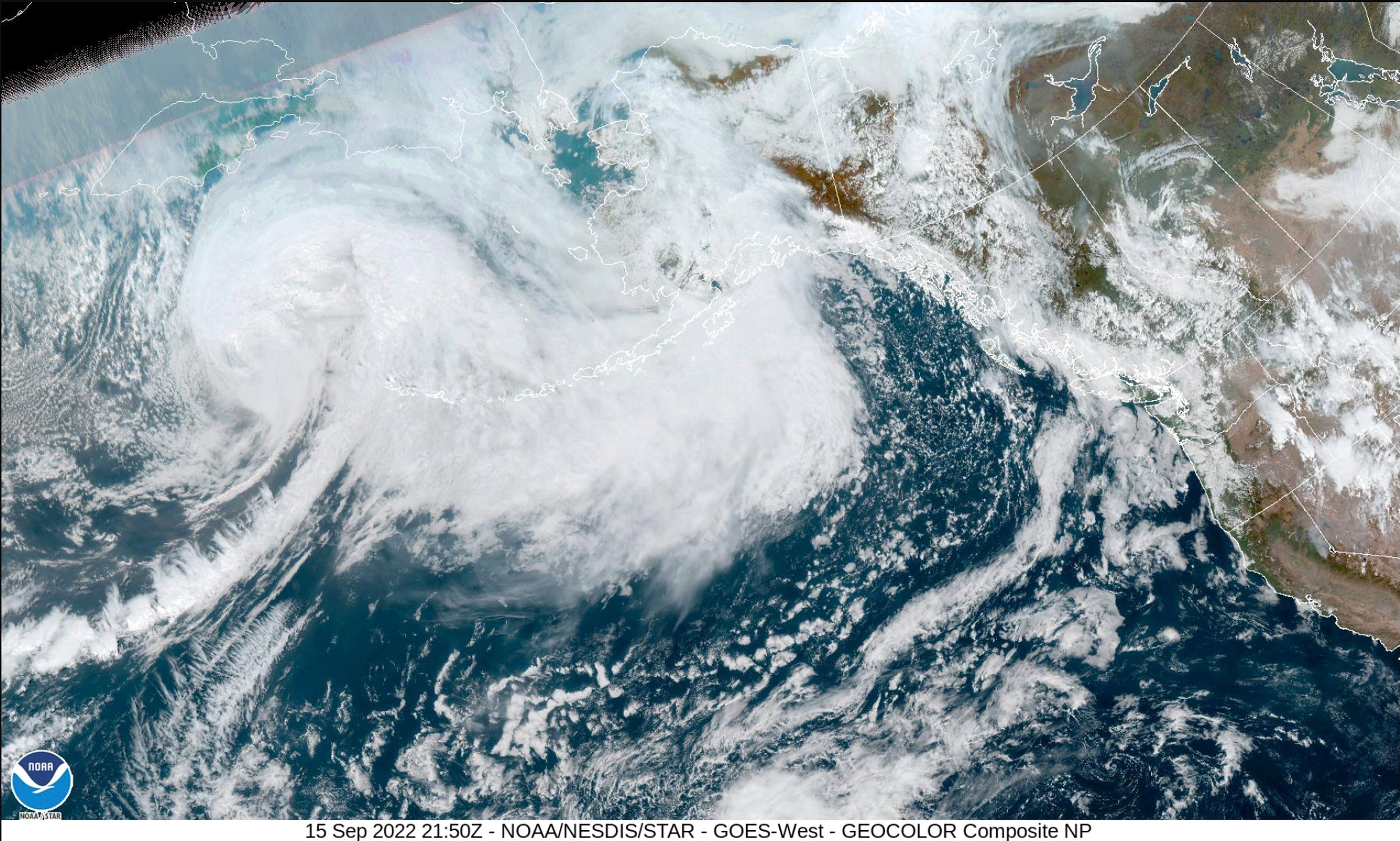
Western Alaska braces for strong storm, possible floods
A vast swath of western Alaska could see flooding and high winds as the remnants of Typhoon Merbok move toward the Bering Sea region

Your support helps us to tell the story
From reproductive rights to climate change to Big Tech, The Independent is on the ground when the story is developing. Whether it's investigating the financials of Elon Musk's pro-Trump PAC or producing our latest documentary, 'The A Word', which shines a light on the American women fighting for reproductive rights, we know how important it is to parse out the facts from the messaging.
At such a critical moment in US history, we need reporters on the ground. Your donation allows us to keep sending journalists to speak to both sides of the story.
The Independent is trusted by Americans across the entire political spectrum. And unlike many other quality news outlets, we choose not to lock Americans out of our reporting and analysis with paywalls. We believe quality journalism should be available to everyone, paid for by those who can afford it.
Your support makes all the difference.A vast swath of western Alaska could see flooding and high winds as the remnants of Typhoon Merbok move toward the Bering Sea region.
The National Weather Service has coastal flood warnings in place, beginning Friday, spanning from parts of southwest Alaska all the way up to the Chukchi Sea coast in northwest Alaska. The agency warned Thursday that water levels in Nome could be up to 11 feet (3.3 meters) above the normal high tide line, and in Golovin up to 13 feet (4 meters).
The weather service's Fairbanks office on social media said some locations “may experience their worst coastal flooding in nearly 50 years. Peak water levels will persist for 10 to 14 hours before water recedes."
The coastal flood warning for the southern Seward Peninsula coast, including Nome, was in effect from Friday evening until Sunday morning.
Damaging winds were possible, with widespread power outages expected on St. Lawrence Island and communities including Wales, Nome, Golovin and Kotzebue, the weather service said.
Meteorologist Ed Plumb said the storm is strong and on a “perfect track to bring significant severe coastal flooding to parts of western Alaska ... for the Yukon Delta up to the southern Seward Peninsula and Norton Sound.”
“Interestingly with this storm, it looks like for the northern Bering Sea, this will be the deepest or strongest storm we've ever seen in September, so this is quite an unusual storm,” Plumb said Thursday morning.
Beach and shoreline erosion is possible in areas, with wind-driven waves and storm surge, he said.
Warnings from the weather service said roads could be closed and low-lying property could be “inundated” for areas such as the southern Seward Peninsula coast, St. Lawrence Island and the Bering Strait coast.
John Handeland, Nome's mayor, said Thursday that officials were getting weather updates and have been preparing. He said a recreation center has been set up for use as an emergency shelter, if needed.
“We do know the drill and where things normally are impacted” from past storms, he said. Residents were being asked to secure their boats and items around their homes, yards and fish camps.
Jeremy Zidek, a spokesperson with Alaska's emergency management office, said officials planned Thursday to speak with community leaders and others about the forecast, resources and preparations.
There is a large area under warnings, and "it's a powerful storm,” he said.
“We have seen storms like this, like in 2011, that did serious damage across the western coast of Alaska and we've seen similar storms that have not done a lot of damage. So we really have to see what's going to happen and then we'll respond appropriately,” he said.
Plumb, the meteorologist, said the storm is expected to weaken as it moves further north into the Chukchi Sea on Sunday.