A guide to A-road Britian: A44
In his Home Counties youth, John Simister eschewed the epic challenge of venturing through 'Archers' country to Wales and the sea. Regretting that caution, he details here just what he missed

Your support helps us to tell the story
From reproductive rights to climate change to Big Tech, The Independent is on the ground when the story is developing. Whether it's investigating the financials of Elon Musk's pro-Trump PAC or producing our latest documentary, 'The A Word', which shines a light on the American women fighting for reproductive rights, we know how important it is to parse out the facts from the messaging.
At such a critical moment in US history, we need reporters on the ground. Your donation allows us to keep sending journalists to speak to both sides of the story.
The Independent is trusted by Americans across the entire political spectrum. And unlike many other quality news outlets, we choose not to lock Americans out of our reporting and analysis with paywalls. We believe quality journalism should be available to everyone, paid for by those who can afford it.
Your support makes all the difference.The authorities will insist on messing around with road numbers. These digits are intended to be a route guide to help us join Place A to Place B, but to us they become linked to the physical tarmacadam itself, just as a street name is near-sacrosanct. So it's unfortunate that this journey along the sinuous, scenic A44 has a few temporal gaps and glitches nowadays .
Since the M40 was completed, it starts in Oxford. Here it used to be the A34, the Stratford Road, until the A34 was radically diverted to meet the new M40 on the route formerly called A43. Still with me? So we're driving through Cotswold country towards Stratford, and suddenly the A44 forks left to Chipping Norton and the straight road ahead becomes the A3400, in a historic nod to its former identity. This is where the A44 used to begin.
The A44 now takes us on a route of bucolic idyll, postcard villages and sturdy stone towns: Moreton-in-Marsh where it crosses the Fosse Way, Broadway and Evesham. It's a busy road, but choose your time and your car well and you can have a rousingly enjoyable drive. The steep, serpentine descent into twee, tourist-trap Broadway was notably entertaining for me a couple of winters ago as I gently drifted a Lotus Elise on the slush. Going up the other way, where there are two traffic lanes, is even better. Another note for students of ghost roads: that great trans-England route, the A46, used to cross the A44 at Broadway but has now been emasculated into the B4632 with the new A46 now skirting Evesham.
After Evesham, the A44 has been shifted north, by-passing the intriguingly-named Wyre Piddle and then Pershore, whose High Street was formerly part of our route (follow the B4084 for the old road). We're deep in The Archers country now, until we pass through Worcester (or Felpersham as the soap would have it) and cross into Herefordshire. The A44 skirts Bromyard, but it's worth leaving it to take in the town centre.
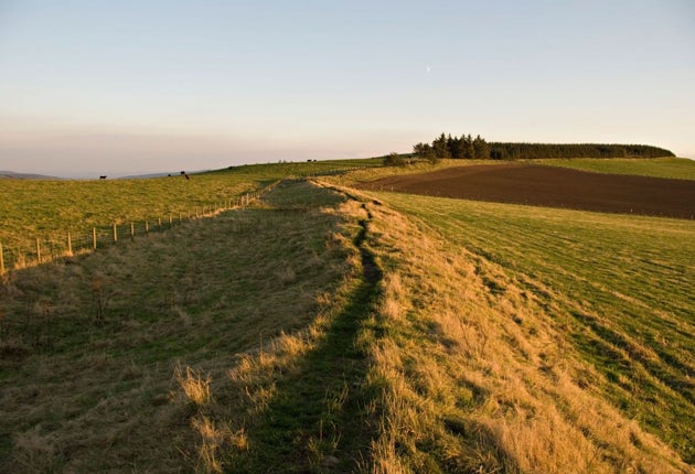
Wales, however, is where the A44 really asserts its line through the topography. We've left Leominster behind, heading amid myriad orchards and black-and-white villages towards Kington, over Offa's Dyke and onward to Hergest Ridge, after which Mike Oldfield's second album was named, on the Welsh border. On the far side, the place names have turned Celtic, the terrain is climbing and we're reaching the start of the best part. Shortly after Llanfihangel-nant-Melan the road performs a fantastic sequence of tight-but-fast twists as it crests another ridge, twists etched in my mind from past great drives of which the most recent involved a bright yellow Mini Cooper S in John Cooper Works guise. I had been ambivalent about that car, finding its suspension tiresomely firm, but just here it all came together in a rush of G forces, traction and torque.
There's a long, fast descent into Crossgates, then an open run along a shallow, big-sky valley past Nantmel, where lives Bill Boddy who edited Motor Sport magazine from 1936 to 1991 and who is still writing for it at 97 years of age. At Rhayader, the A44 goes into hiding as it splices into the A470, the road that clings to the River Wye.
We follow the A470 north-westwards, fast bends bounded by ever-wilder mountains as we climb and dip toward Llangurig. If we continued on the A470 to the right we would soon reach Llanidloes, but instead we'll head straight on because the A44 has reappeared. It has taken over the guarding of the Wye, and after more bleak, empty, majestic sweeps of the road we cross the river whose source is further up the mountains to our right.
Soon we reach the highest point (408 metres) of the whole road, where a large rock by the wayside improbably bears an "Elvis" graffito. Wikipedia tells us this was originally painted in support of Islwyn Ffowc Elis who was a Plaid Cymru candidate in 1962, but the lettering has mutated over the years.
From now it's a snaking descent to the coast, the A44 clings to the sides of the mountains as it passes abandoned lead mines. The density of human habitation gradually rises from near zero as we come closer to Aberystwyth on the coast, where I went for a university entrance interview back in 1973. I didn't take up the university's kind offer of a place, not least because getting there from my south-eastern comfort zone would have been such an epic undertaking. Now I realise how much fun I'd have had along the way.
Join our commenting forum
Join thought-provoking conversations, follow other Independent readers and see their replies
Comments