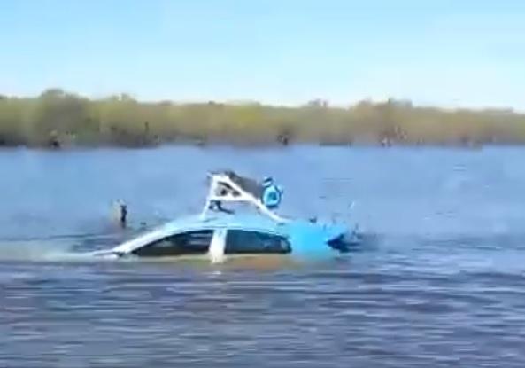
Google Maps Street View car swept away in US floods
Video and pictures of the vehicle showed it submerged up to its roof
Your support helps us to tell the story
From reproductive rights to climate change to Big Tech, The Independent is on the ground when the story is developing. Whether it's investigating the financials of Elon Musk's pro-Trump PAC or producing our latest documentary, 'The A Word', which shines a light on the American women fighting for reproductive rights, we know how important it is to parse out the facts from the messaging.
At such a critical moment in US history, we need reporters on the ground. Your donation allows us to keep sending journalists to speak to both sides of the story.
The Independent is trusted by Americans across the entire political spectrum. And unlike many other quality news outlets, we choose not to lock Americans out of our reporting and analysis with paywalls. We believe quality journalism should be available to everyone, paid for by those who can afford it.
Your support makes all the difference.A car used to map roads for Google Street View has been swept away by floods in West Texas, local police have revealed.
Images and video of the stricken vehicle have been shared across social media, showing the car submerged almost to its roof.
Schleicher County Sheriff's Department said that a Google-owned car with a mapping system attached had become submerged on US Highway 190, about 45 miles south of San Angelo.
Local media reported that the driver had made it to safety with the help of passers by.
"[The driver went around a barricade marked road closed and subsequently drifted off the roadway into the bar ditch where water levels were much deeper," Schleicher County Sheriff David Doran told Dallas News.

Google did not immediately respond to a request for comment from The Independent but the firm's website dedicated to Street View reveals that its cars have been operating in that area of Texas since January 2018.
The website states: "Because of factors outside our control (weather, road closures, etc), it is always possible that our cars may not be operating, or that slight changes may occur."
Floods in the area appear to have come as a result of heavy rainfall in the region between 15 October and 17 October.
It is not the first time that a Google Street View vehicle has been caught up in trouble, with several cars involved in accidents since the mapping project was launched in 2017.
In September 2013, a Google-operated car in Bogor, Indonesia, collided with two public transport buses and reportedly tried to drive off.
In November 2012, Google was forced to deny claims that one of its Street View cars ran over a donkey in Botswana.

Join our commenting forum
Join thought-provoking conversations, follow other Independent readers and see their replies
Comments