Tales from the edge: The Norfolk village disappearing into the sea
Happisburgh has a problem: its coastline is in retreat. And while experts speculate on whether local factors, the climate crisis or both are at fault, all residents can do is wait. Sean Smith reports

Ever since we became a proud island nation, we’ve been fighting a losing battle with the sea. Perhaps the humiliation would be too much to bear if it wasn’t for the convenient fact that much of the vanquished territory lies hidden on the seabed just off the east coast of England.
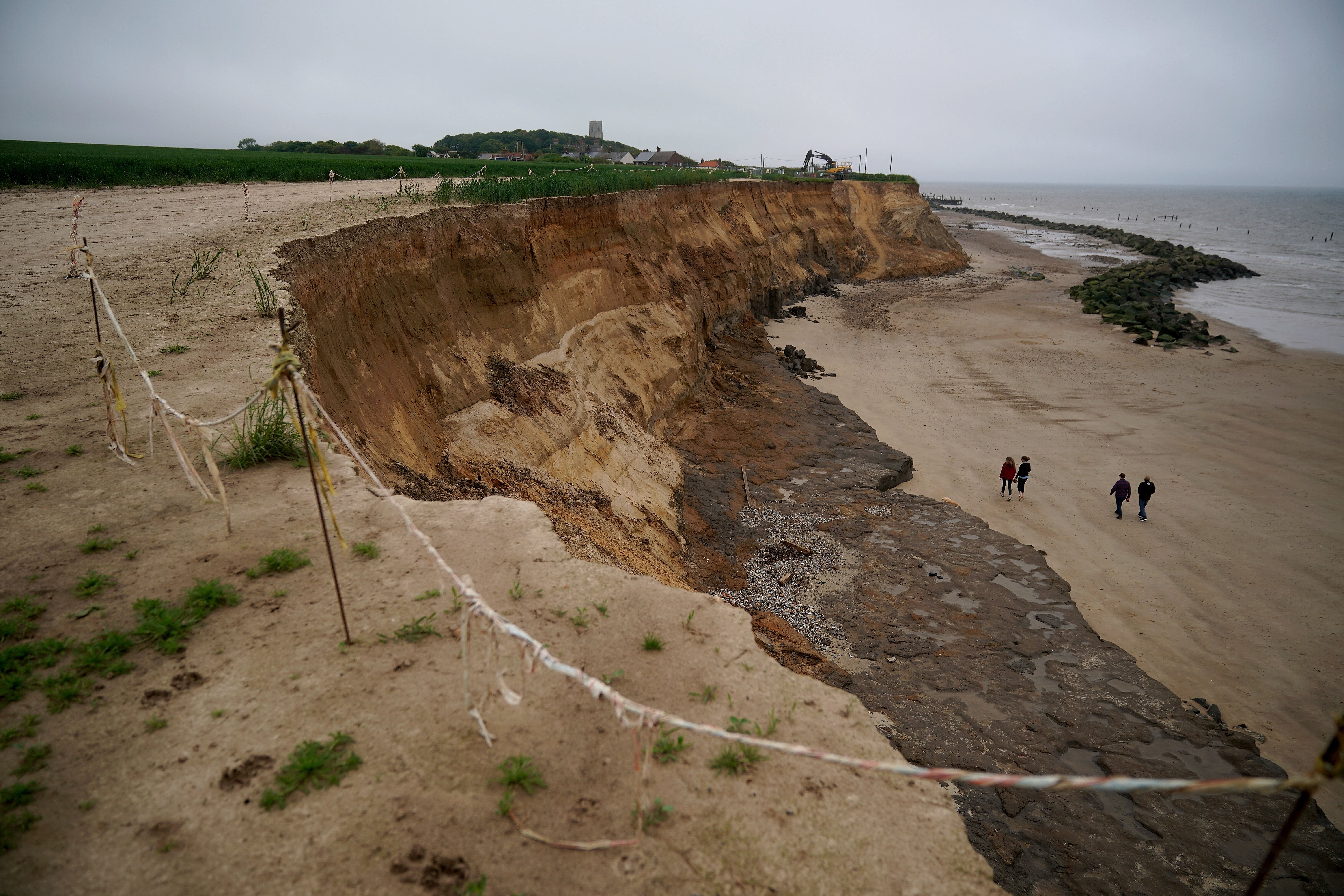
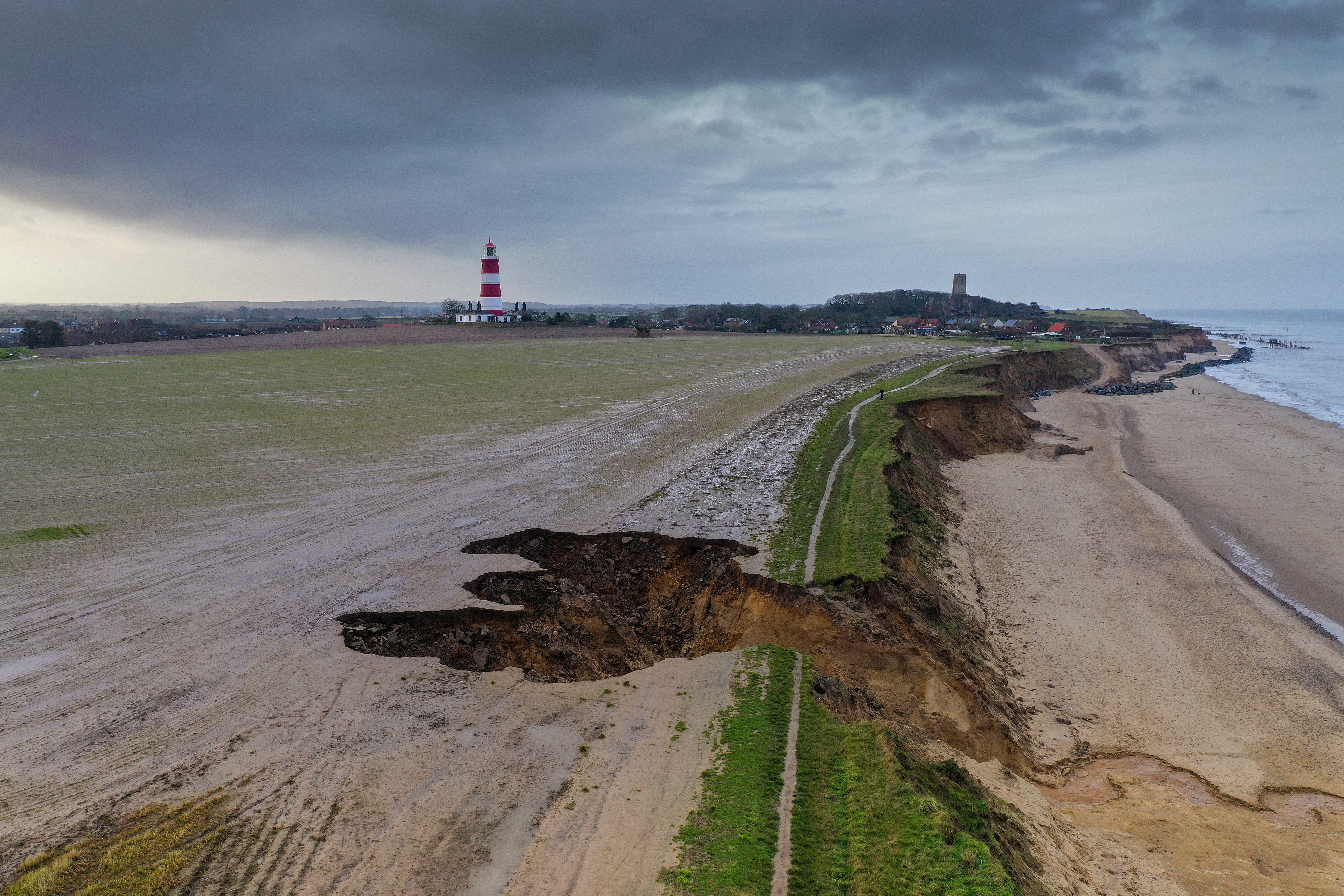
Happisburgh in Norfolk used to be securely landlocked but is now very much on the frontline in the struggle against coastal erosion. Formerly famous for its red and white lighthouse, Happisburgh is today better known as the pretty clifftop village that is crumbling into the sea.
Hayes-buh-ruh, as it’s properly pronounced, is even taught in schools as a coastal erosion case study; each summer, coachloads of clipboard-toting children flock here to analyse its predicament.
Geologists from all over the world have also been drawn here because the rate of erosion makes it possible to observe processes that would normally occur over thousands of years. In fact, the reasons behind the village’s precarious future lie in Norfolk’s recent geological past.
Happisburgh hasn’t always enjoyed such bracing sea views. Just over 8,000 years ago, when the sea was 15 metres below today’s levels, you could have walked all the way to Germany from the spot where the village now stands. At that point Britain was still attached to northern Europe through a land bridge of lagoons, marshes and mudflats called Doggerland.
But as ocean levels rose over the following millennia, Britain became an island separated from continental Europe by the North Sea.
Five-thousand years ago, when sea levels had stabilised to within a metre of current levels, Britain’s eastern shore had taken on a very different shape and was located 10 kilometres further east than its current location. Ever since, Norfolk’s coastline has been rapidly eroding at a rate of around one to two metres per year.
Geologically speaking, 5,000 years is a mere heartbeat. Gerd Masselink, professor of geomorphology at Plymouth University, explains that the erosion rates along the east coast of England are amongst the fastest in the UK because Norfolk’s coastline is still in its infancy and hasn’t yet adjusted to modern sea levels and the boisterous behaviour of the North Sea: “Norfolk is out of whack. Geologically speaking it’s a very young coastline in disequilibrium with the North Sea because there hasn’t been enough time for the coastline to shape itself in tune with the prevailing direction of the waves.”
Masselink urges me to look at a map of the British Isles in order to better visualise Norfolk’s problem: waves and winds from the north are hitting Norfolk’s coastline at an angle. In an erosion process that’s set to continue for thousands of years the sea will keep bending the coastline to its will until it eventually settles at a point of “equilibrium”.
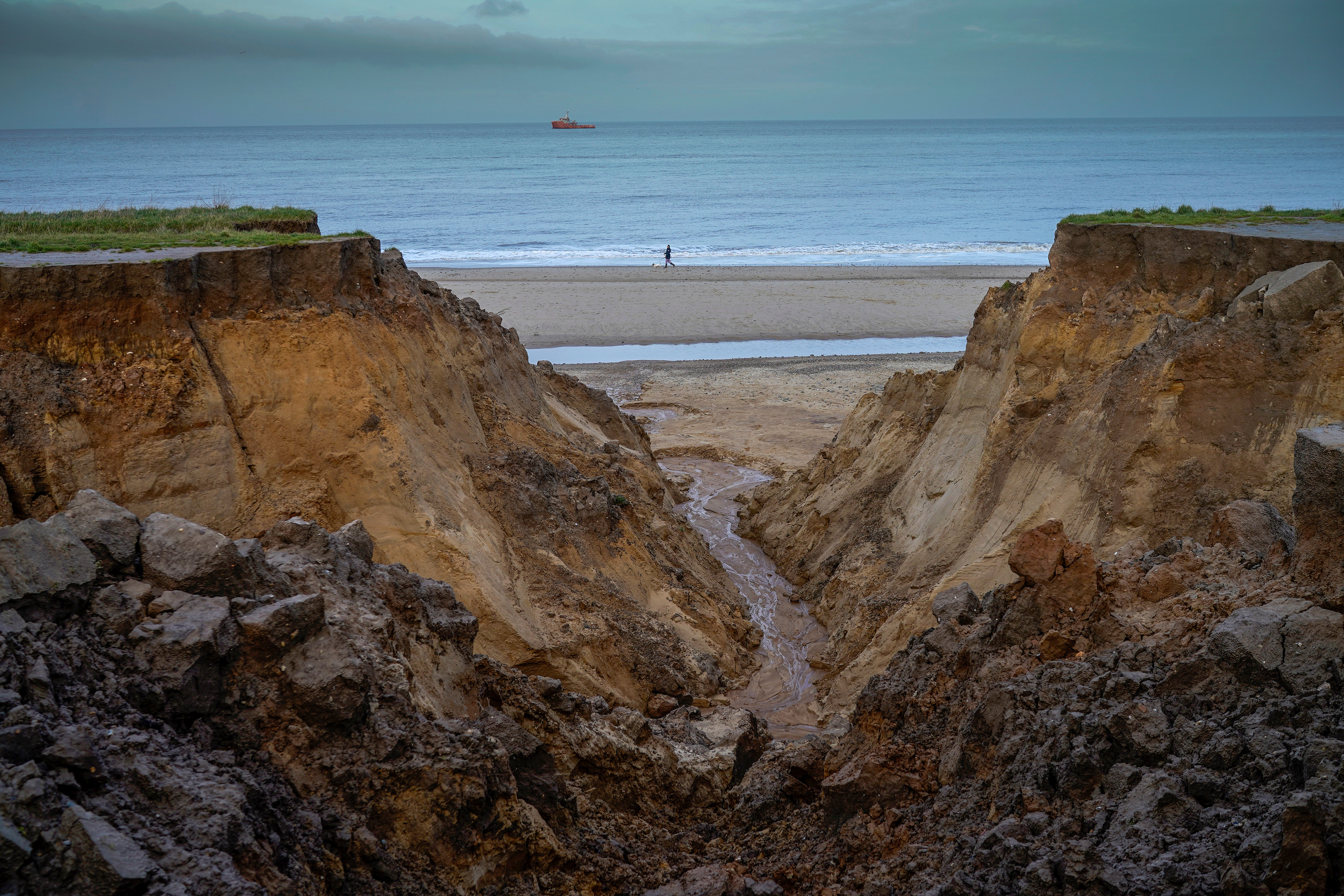
To compound the problem, the cliffs on which Happisburgh stands are so soft that you can dig into their upper sand layers with your hands, which makes them especially exposed whenever the north wind blows and the sea storms in.
Masselink’s explanation makes it easier to understand why England’s youthful east coast has always been fighting a rearguard battle with inclement weather systems from the north.
In 1953, the eastern coast was devastated by a huge northwesterly tidal surge that left 307 people dead and 40,000 homeless.
At Happisburgh, the storm battered the cliff face to such an extent that a bungalow that had stood 15 feet from the edge on Saturday evening was hanging over the cliff by Sunday morning.
After the disaster, Happisburgh was one of the many east coast communities which benefitted from a coordinated coastal defence programme which was designed to hold the North Sea at bay.
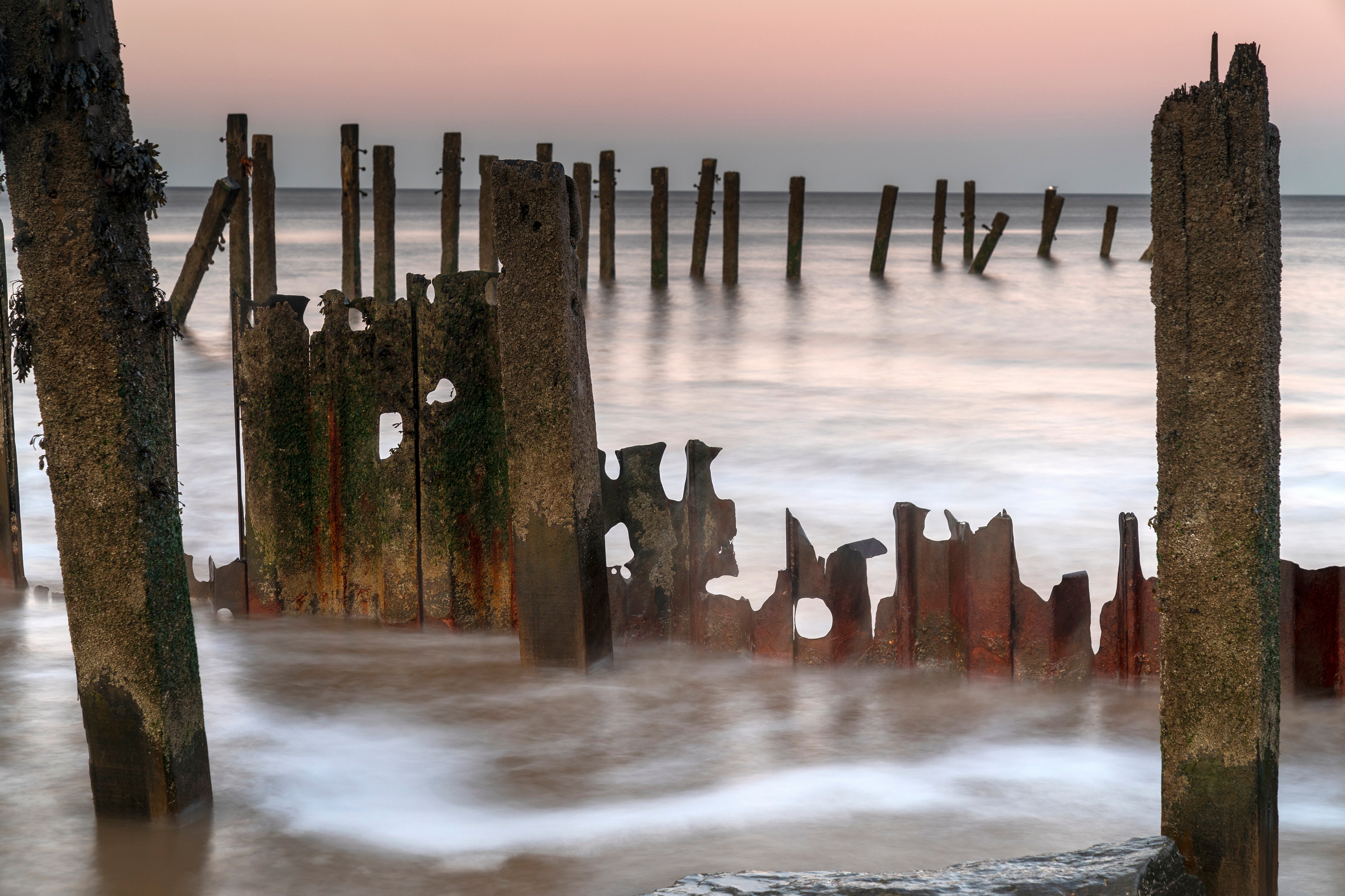
But since the 1990s, when its timber flood defences started to fail and were deemed too expensive to fully replace, the rate of erosion at Happisburgh has accelerated alarmingly.
In February 1993, swathes of farmland were lost when an enormous section of the cliff face collapsed during a violent storm. As a result, Happisburgh woke to discover a new bay had been formed overnight.
Happisburgh received national media attention again in March 1996 when a clifftop home went over the edge. Ever since then, after major storms the national media have beaten a well-worn path to Happisburgh, to capture images of bungalows teetering on clifftops and to marvel at nature’s power.
Since the 1990s, Happisburgh has receded and lost most of its beach access, public toilets, car park and RNLI station. When retiree Malcolm Kerby moved to the village in the late 1990s he co-founded the village's Coastal Concern Action Group (CCAG).
“Happisburgh is absolutely on the frontline of climate change and rising sea levels,” says Kerby.
To illustrate the point, Kerby describes one of the Second World War pillboxes that’s become the symbolic yardstick by which to measure the North Sea’s relentless advance.
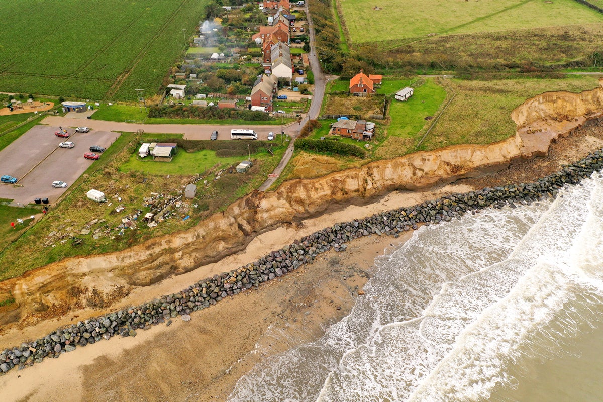
“Back in the 1990s when I moved here the pillbox was in the middle of a huge field but now it’s on the very brink.”
In 2012 the CCAG lobbied for access to Pathfinder funds provided by central government which allowed the local council to buy and demolish nine at-risk homes on Beach Road while setting land aside for replacement housing further inland.
Other redundant clifftop structures were demolished, the car park was rolled back and the lost public toilets were rebuilt.
Ordinarily, compensation is not an option in cases of coastal erosion and Kerby is careful not to use the loaded term but homeowners were able to recover 50 per cent of the value of their homes during that realignment.
But Kerby has been shocked by the rate of erosion since then.
“Pathfinder create a buffer zone that was supposed to last 25 years but erosion has gone ahead of all predictions.”
After a decade of austerity, Kerby doesn’t expect any future financial help from central government anytime soon and believes that the Environment Agency’s budget for is too small and unfairly weighted towards inland flood defences at the expense of coastal management.
“Spending is woefully inadequate. The government don’t like spending money on the coast at all. Flooding is terrible but you can get insurance against it. But no one will insure you against coastal erosion because it’s a case of when, not if, it happens. You’re absolutely buggered.”
Despite Kerby’s conviction that the alarming rate of recent erosion is attributable to climate change and rising sea levels, Professor Masselink is not so sure. Although the more frequent occurrence of violent storms and more powerful waves certainly won’t help, he believes the most important elements stem from site-specific factors nearer home.
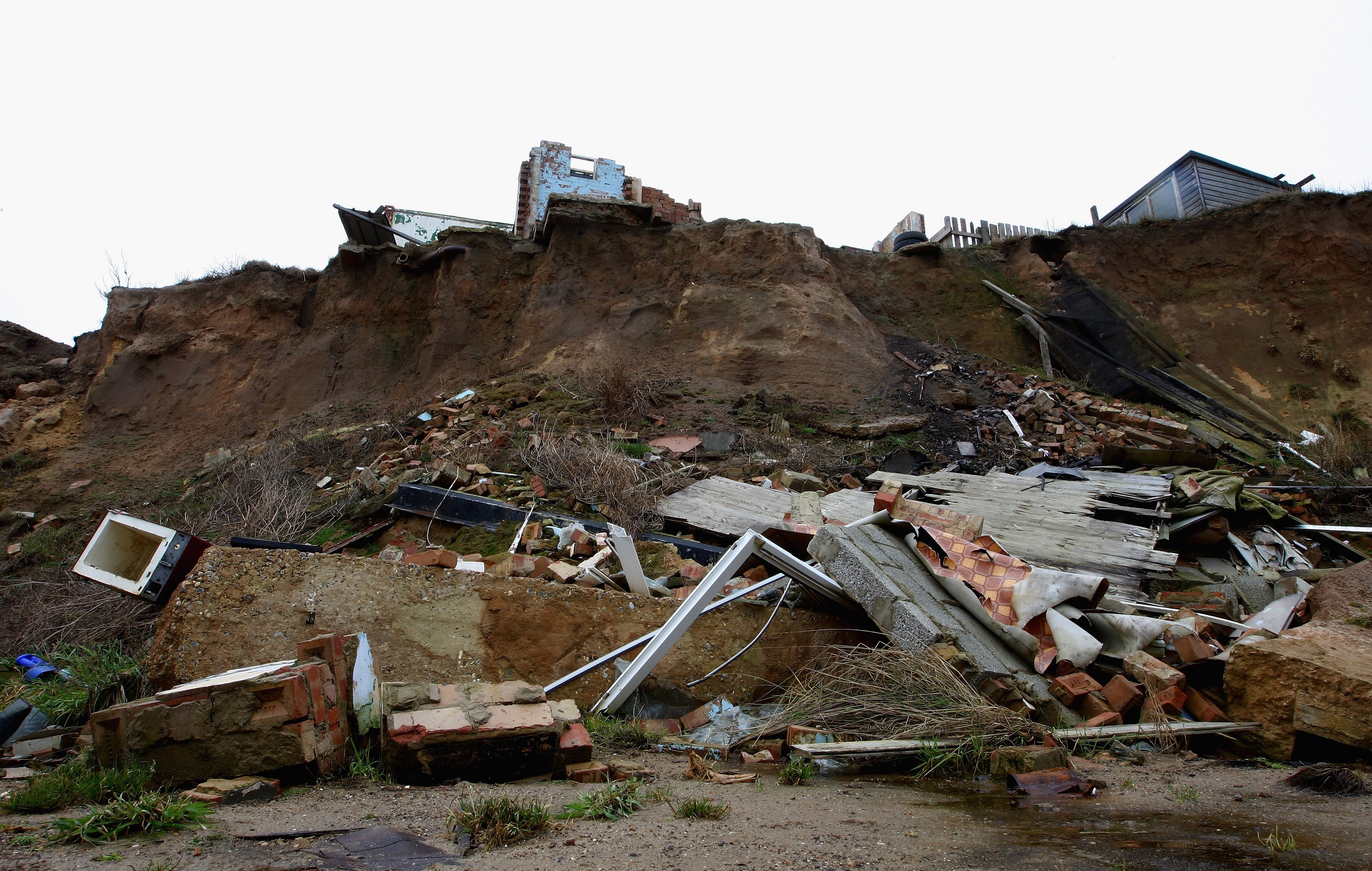
“Coastal erosion is a complex local process that has a variety of causes, with rising sea level being only one of them.”
Clive Stockton doesn’t necessarily regard climate change as a major contributory factor either but nevertheless, he believes Happisburgh’s future has definitely been blighted by “manmade” decisions.
Stockton is the landlord at the grade-II listed Hill House Inn which serves as a community hub at the heart of Happisburgh. When he moved there in 1991, Happisburgh still had a long-term future. At that time, the North Norfolk District council was still minded to maintain coastal defences in pursuit of a “holding the line” strategy.
However, in line with the next generation of shoreline management plans), the council subsequently shifted to the preferred strategy of “managed realignment”.
For small nucleated rural villages like Happisburgh that policy shift has had devastating consequences. Stockton regards “managed realignment” as a euphemism for “see you later” because, in effect, it means abandoning less economically valuable areas to the sea and letting the coast retreat to more defendable positions inland rather than spending millions maintaining unsustainable coastal defences.
Stockton explains that small rural communities like Happisburgh will never pass the cost-benefit analysis formula used to calculate which stretches of coastline merit the expense of hard flood defences
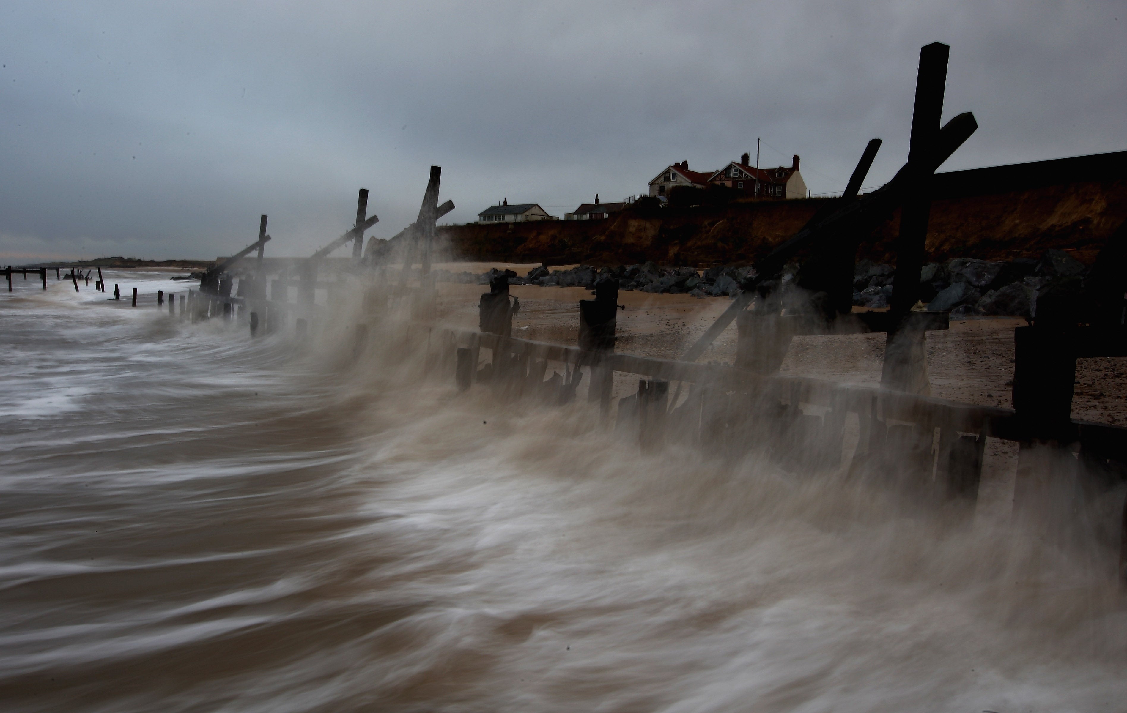
As a local councillor himself, Stockton has become well versed in the challenges of coastal erosion. He believes that Happisburgh has lost so much land at such an alarming rate because of an incoherent strategy to protect some stretches of coastline at the expense of others.
Stockton believes that tidal pressures that are successfully repelled along some stretches of the coast will inevitably bring their force to bear on undefended areas elsewhere along the shoreline, and Happisburgh is stranded between two sea defences.
“We’re being torn to pieces with rates of erosion 20 times the historic rate. We’re left totally undefended with two defended areas on either side. Any coastal engineer would tell you that’s exactly the position you should never find yourself in. There’s a total lack of a coherent overall strategy. When the cliff defence is gone the sea will advance inland unchecked. When Happisburgh goes the flood defences on either side of the village will be irrelevant anyway”.
Stockton explains how the shift in strategy has placed an enormous strain on the village community.
“Locals have been living with the sword of Damocles hanging over their heads. A major slice of Norfolk’s history and heritage is at risk. Happisburgh is a 1,000-year-old Saxon village with 18 listed buildings, four of which are next in line.”
He laments the way in which history and heritage don’t have any economic value and aren’t deemed worthy of protection: “We have families who’ve been living in Happisburgh for seven or eight generations with their relatives buried in the local churchyard. We’re still burying local people in a graveyard that may only have 20 years left.”
A caravan park used to occupy the field to the rear of the inn but that was moved to safety in 2018. If the sea continues to advance at current rates, the Hill House Inn has a life expectancy of about 25 years and is likely to be abandoned at the same time as the village’s three other well-known landmarks: the medieval church, manor house and the famous red and white lighthouse. Stockton can’t understand why less expensive approaches like beach nourishment and sand scaping haven’t been used to buy the village more time.

Historically speaking, when it comes to scattering thriving coastal communities, the North Sea already has plenty of form. The Holderness coast has retreated by around four kilometres over the last 2,000 years and many villages, including Roman settlements, have been lost.
But there is a precedent even closer to home. Happisburgh used to be safely landlocked by the adjacent coastal parish of Whimpwell which bore the brunt of the North Sea’s attacks until it finally succumbed in the 12th century. Nowadays, scuba divers occasionally catch glimpses of its harbour walls on the seabed.
Our ancestors didn’t have the wherewithal to hold back the tides, and perhaps our descendants will wonder why our generation was so quick to surrender land for economic reasons. As Clive Stockton points out, “Once it’s gone, it’s gone forever.”
One of the most controversial aspects of “managed realignment” is the absence of any form of compensation for the displaced communities which have to relocate.
For a utilitarian strategy that requires coastal communities to see the “big” picture and make difficult decisions for the greater good, managed realignment seems to have an inbuilt inconsistency.
Critics argue that if you’re going to pursue a collective outcome of delivering the greatest socioeconomic benefits to the greatest number of people, you are duty-bound to compensate the local residents who have to sacrifice their homes to make that policy possible.
As the cliffs advance to the back door of his business, bringing the sea view ever closer, Clive Stockton finds himself in the unusual position of owning a “thriving business with no residual asset value. It’s the 21st century in the mother of democracy. How can we lose everything we own without being entitled to help from anybody?”


Join our commenting forum
Join thought-provoking conversations, follow other Independent readers and see their replies
Comments