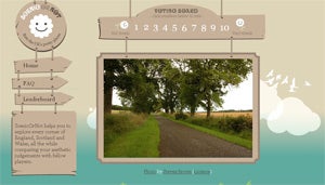
Your chance to rate Britain's scenery – at the click of a button

Your support helps us to tell the story
From reproductive rights to climate change to Big Tech, The Independent is on the ground when the story is developing. Whether it's investigating the financials of Elon Musk's pro-Trump PAC or producing our latest documentary, 'The A Word', which shines a light on the American women fighting for reproductive rights, we know how important it is to parse out the facts from the messaging.
At such a critical moment in US history, we need reporters on the ground. Your donation allows us to keep sending journalists to speak to both sides of the story.
The Independent is trusted by Americans across the entire political spectrum. And unlike many other quality news outlets, we choose not to lock Americans out of our reporting and analysis with paywalls. We believe quality journalism should be available to everyone, paid for by those who can afford it.
Your support makes all the difference.Thousands of people are joining in an internet game to map the most scenic parts of Britain with the click of a mouse.
ScenicOrNot takes the idea of a ratings website, where people give their views on the value of anything from health care to a person's attractiveness, and applies it to the scenery of England, Scotland and Wales.
More than 200,000 photographs of everything from coastal cliffs to village halls, covering 95 per cent of the 1km grid squares on the map of Britain, are posted on the ScenicOrNot site, and appear in a random order to anyone logging on.
Visitors to the site are invited to rate the photos on an "attractiveness scale" of 1 to 10, and their judgements will be averaged out and used to create a Britain-wide "scenic map".
Modelled on the HotOrNot website, which invites users to rate people's looks, ScenicOrNot is a project by Mysociety, an internet charity which builds websites to aid democracy. Its plan with its latest site is "to gather a freely available nationwide dataset of scenicness".
The founder and director of Mysociety, Tom Steinberg, said that the map, likely to be available next month, could have all sorts of different uses. "It could help you work out where you want to go on holiday, or buy a house," he said. "And it may have political interest. For example, it could help you compare protected areas, or help with battles about planning permission."
The ScenicOrNot website also says the data will be used in a "secret project", the details of which Mr Steinberg said he was not yet ready to reveal.
The aim of the site is to try to get at least three votes for each image. Last night it was running a "leader board" showing several photos which had scored a top score of 10 for "scenicness", including Loch Ossian, and Loch Ness with a rainbow over it.
It was also showing photos with a bottom score of one: these included a petrol station in Enfield, the Cardiff ring road and the Leigh Delamere motorway service area on the M4.
Join our commenting forum
Join thought-provoking conversations, follow other Independent readers and see their replies
0Comments