Heavy rain and thunderstorms to batter Britons until end of week
Some parts of the country saw flooding on Wednesday
Your support helps us to tell the story
From reproductive rights to climate change to Big Tech, The Independent is on the ground when the story is developing. Whether it's investigating the financials of Elon Musk's pro-Trump PAC or producing our latest documentary, 'The A Word', which shines a light on the American women fighting for reproductive rights, we know how important it is to parse out the facts from the messaging.
At such a critical moment in US history, we need reporters on the ground. Your donation allows us to keep sending journalists to speak to both sides of the story.
The Independent is trusted by Americans across the entire political spectrum. And unlike many other quality news outlets, we choose not to lock Americans out of our reporting and analysis with paywalls. We believe quality journalism should be available to everyone, paid for by those who can afford it.
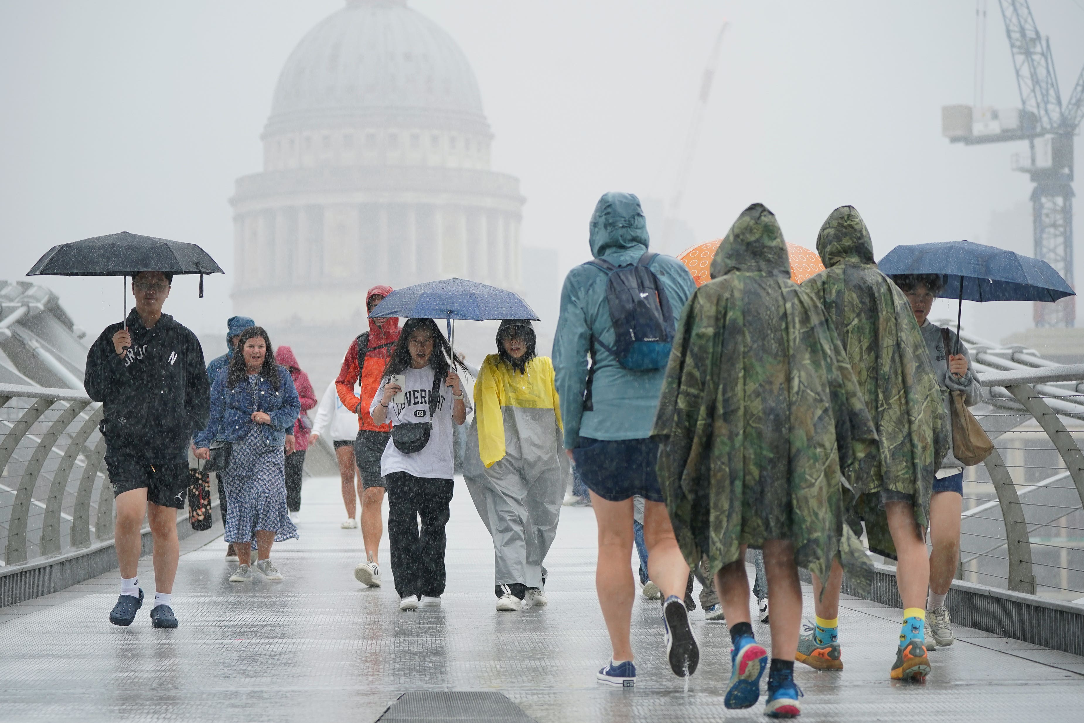
Your support makes all the difference.Heavy showers and thunderstorms are set to drench Britons until the end of the week after parts of the country saw flooding.
Between 25 to 30mm of rain fell across parts of the north-east of England on Wednesday, while areas in London saw around 20mm, the Met Office said.
Meanwhile, the south-coast was battered with 45 to 50mph winds, as the Needles on the Isle of Wight saw 60mph gusts.
Around one square mile in Wembley, north-west London, was left under one-metre deep flood water, with firefighters called to rescue a man from a van and evacuate 19 people.
Some train services were also affected across the country.


However, despite most of the wet weather clearing away overnight, there will still be patches of rain and thunderstorms until the end of the week, becoming heavier over the weekend.
Amy Bokota, a Met Office forecaster, told the PA news agency: “Thursday’s going to be quite a grey day and quite breezy as well, but winds are not expected to be as strong and with that there will be some showers, which could be heavy at times.
“There’s not expected to be any impacts or warnings on the back of that, there could be up to five to 10mm of rainfall in an hour, and maybe 20 to 25mm over a couple of hours if rain becomes persistent in places.
“But generally it’s going to be a lot better, most places a little bit brighter and those showers will be less widespread.
“Heading into Friday, areas in the south-west will see an improvement, parts of Cornwall and Wales will see a decent day with sunny spells, although along the east coast there will be a risk of showers and the odd rumble of thunder too.
“In the evening a low pressure system will start to show it’s cards in Northern Ireland before it’s all change on Saturday, turning much wetter and windier across many parts of the country.”
The Environment Agency had 37 flood alerts in place across the country on Wednesday evening, while warning that flooding was expected in Hornsea, Yorkshire.