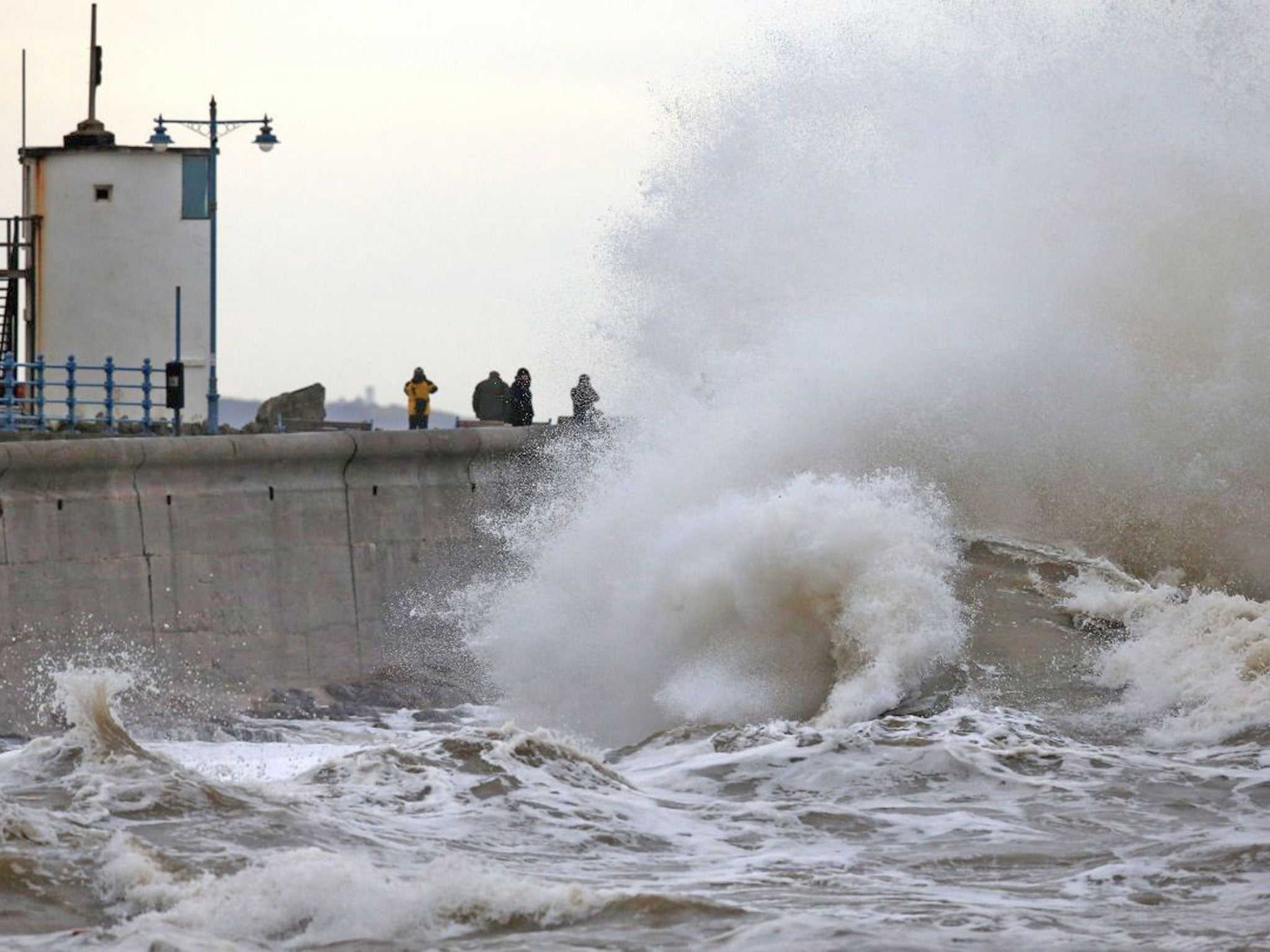
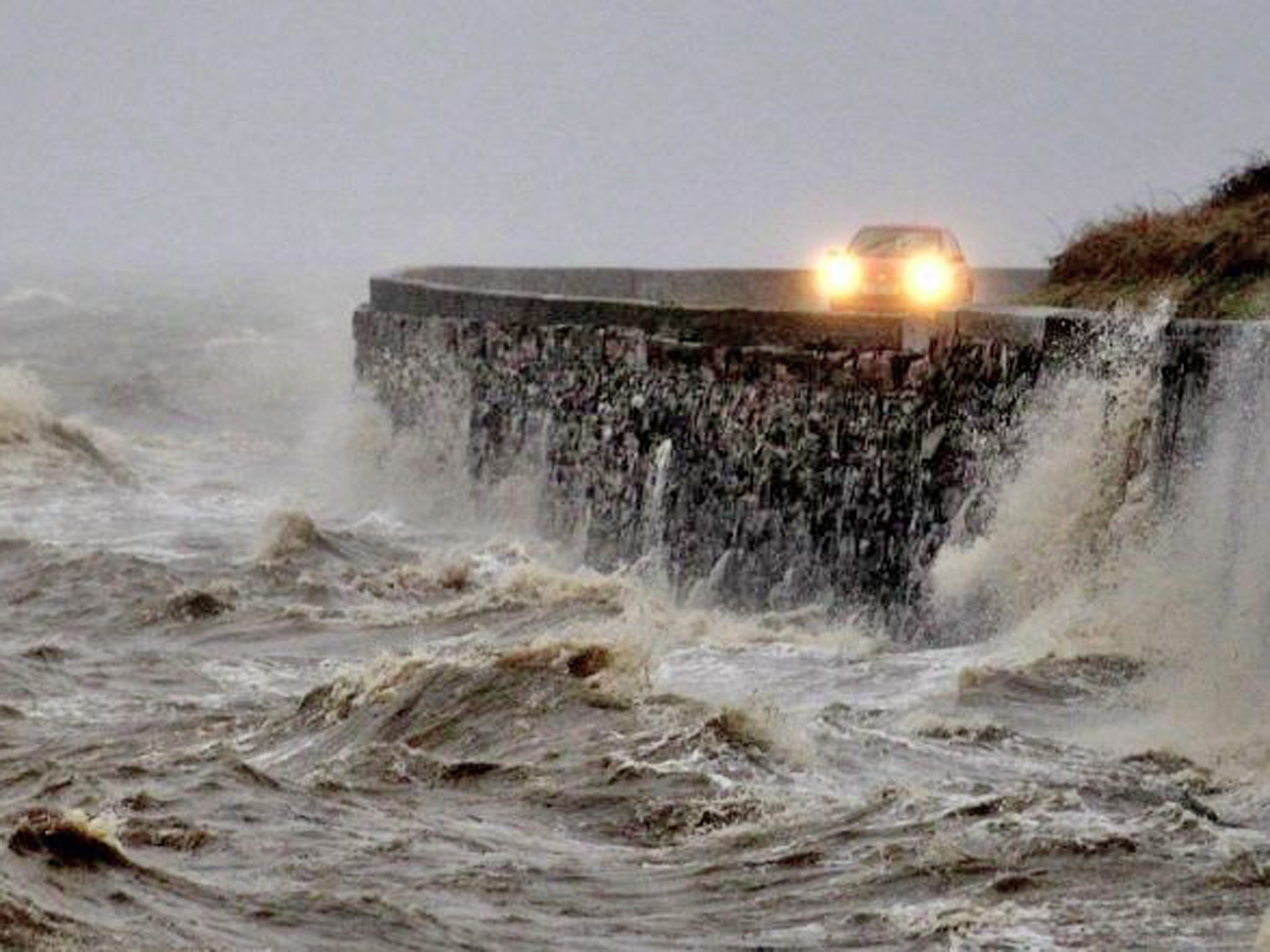
UK weather: Britain faces another barrage of rain as coastal regions count cost of 'worst storms in 20 years'
Two dead, a teenager missing, damage to homes and businesses, transport disrupted. And it isn't over. More rain, high tides and gale-force winds are on the way
Your support helps us to tell the story
From reproductive rights to climate change to Big Tech, The Independent is on the ground when the story is developing. Whether it's investigating the financials of Elon Musk's pro-Trump PAC or producing our latest documentary, 'The A Word', which shines a light on the American women fighting for reproductive rights, we know how important it is to parse out the facts from the messaging.
At such a critical moment in US history, we need reporters on the ground. Your donation allows us to keep sending journalists to speak to both sides of the story.
The Independent is trusted by Americans across the entire political spectrum. And unlike many other quality news outlets, we choose not to lock Americans out of our reporting and analysis with paywalls. We believe quality journalism should be available to everyone, paid for by those who can afford it.
Your support makes all the difference.Areas of southern England and Wales already devastated by floods will be battered by another barrage of rain over the next 24 hours, the Met Office has warned.
After a series of winter storms described by experts as the worst to hit Britain in more than 20 years, between 10mm and 15mm of rain, and up to 30mm on higher ground, is expected in southern England before moving north-eastwards. Heavy rain is also expected in parts of Northern Island and Scotland.
The Environment Agency has issued 96 flood warnings throughout England and Wales urging people to take immediate action, while a further 244 areas are on flood alert.
Coastal areas - particularly in southern England - are most at risk as they cope with a combination of unusually high tides and another Atlantic storm today.
Forecaster Matt Dobson for MeteoGroup said the rain "simply has nowhere to go" after weeks of severe weather has saturated the ground and swelled rivers.
He added: "It's very unusual to have so many powerful storms come in one after the other in such a short space of time, we haven't seen anything like this since about 1991.
"The nasty weather of the last few days is going to continue across the UK, with the combination of high tides and a powerful storm putting coastal areas particularly at risk.
"Any rain will mean more flooding as the ground is saturated and swollen rivers are coming up against strong waves. The water simply has nowhere to go.
The Met Office has issued yellow weather warnings of ice and rain, predicting river and surface flooding as well as travel disruption mainly in south Wales and the south west and south east of England. Up to 40mm of rain could fall in higher ground.

Inland rainfall will put pressure on rivers, endangering nearby communities including those along the River Medway in Kent. the River Thames in Oxford and Osney and the River Severn Estuary in Gloucestershire.
More than 200 homes have been flooded from Cornwall to Scotland, with miles of coastline battered and roads and fields across the country left under water.
Bad weather yesterday afternoon and into the early evening across many areas of the UK caused the Met Office to issue severe ice warnings for North Wales, Scotland, north-west England and down into parts of the Midlands overnight.
Last night, Environment Secretary Owen Paterson insisted that flood defences had so far "worked well" but that the "worst" of the bad weather was not yet over.

Jonathan Day, flood risk manager at the EA, said "The risk of flooding to the coast will continue over the next few days, especially on the south and west coast and along the Severn estuary. In addition, wet conditions have left the ground saturated in many areas, increasing the risk of river and surface-water flooding."
He added: "We would urge people to be prepared by checking their flood risk, [and] signing up to free flood warnings."
The MeteoGroup forecaster Matt Dobson said the coming rain "simply has nowhere to go" after two weeks of rain over the Christmas and New Year period.
He said: "It's very unusual to have so many powerful storms come in one after the other in such a short space of time, we haven't seen anything like this since about 1991."
Coastal flooding occurred overnight on Friday, with people waking up to scenes of devastation on sea fronts around the country.
Harry Martin, 18, was still missing yesterday, having last been seen approaching a Devon coastal path on Thursday. It is believed the teenager had been going to take weather-related photos near his home in Membland, Newton Ferrers. More than 100 people joined search and rescue teams yesterday to look for him.
The lure of spectacular waves still proved too much for some yesterday, despite repeated requests from government agencies, police and ministers to stay away from coastal areas. A man had to be rescued by lifeboat after he photographed waves from a harbour jetty in Aberystwyth on the west coast of Wales. Another man was pulled from the sea at Newquay in Cornwall by police officers early yesterday morning.
Two people have already died in the storms. A 27-year-old man from Surrey was found on Porthleven Sands beach in Cornwall after he was swept out to sea on New Year's Eve, and a woman died after being pulled from the sea in Croyde Bay, north Devon.
The holiday resort town of Aberystwyth was particularly hard hit by Friday's flooding, with images coming out yesterday morning of the sea-front having been damaged by tidal surges. Aberystwyth University deferred the start of its exam period for a week. Around 90 properties are believed to have been flooded since Friday, bringing the total to around 220.
There were also more than a dozen flood warnings in Scotland. The EA said parts of the north-east coast, including Whitby and South Shields, could also be flooded overnight, while parts of the south coast, including Portsmouth and Newhaven, might have more coastal flooding today and tomorrow. Rivers in Dorset, Hampshire and Wiltshire could also rise.
The EA said the coastal surge in recent days had tested over 3,000km of flood defences in England, but that more than 205,000 properties have been protected.
Flooding from the deluges during the Christmas break is still affecting rail travel in certain regions including areas of Wales, Gloucester, Southampton and Carlisle. Although many services are expected to be back to normal by today, there are long-term closures on the Isle of Wight.
Prime Minister David Cameron praised the "great work" of the emergency services and the EA in tweets yesterday. Mr Paterson, however, remains under pressure over job losses in roles connected to floods work at the agency. He has insisted that "frontline services" would be protected, but the EA chief executive, Paul Leinster, has admitted roles in flood-risk management are likely to be among 1,500 job losses.
The losses come after more funding was pumped into flooding and coastal risk management over the past year and into the next two, after the Government cut funding when it come into power in 2010.
An EA spokeswoman said: "We are currently consulting on new structures for the organisation. It is forecast that the 11,250 staff members will remain until the end of March and it is expected that numbers will be cut to 9,700 by October."
Anne McIntosh, the chair of the Commons Environment, Food and Rural Affairs Select Committee, told Sky News: "To be honest with you, I don't think this is the time to look at an agency that is working flat out, as to how it will spend its future resources."
Join our commenting forum
Join thought-provoking conversations, follow other Independent readers and see their replies
Comments