Follow super Typhoon Mawar’s path as Philippines brace for world’s most powerful storm
Eye of the storm passed Guam on Wednesday night as trajectory turns toward the Philippines and Taiwan
Your support helps us to tell the story
From reproductive rights to climate change to Big Tech, The Independent is on the ground when the story is developing. Whether it's investigating the financials of Elon Musk's pro-Trump PAC or producing our latest documentary, 'The A Word', which shines a light on the American women fighting for reproductive rights, we know how important it is to parse out the facts from the messaging.
At such a critical moment in US history, we need reporters on the ground. Your donation allows us to keep sending journalists to speak to both sides of the story.
The Independent is trusted by Americans across the entire political spectrum. And unlike many other quality news outlets, we choose not to lock Americans out of our reporting and analysis with paywalls. We believe quality journalism should be available to everyone, paid for by those who can afford it.
Your support makes all the difference.Super Typhoon Mawar is heading towards the Philippines after its eye narrowly passed by Guam, leaving behind floods, damages and power outages.
The storm is one of the most powerful to hit the US Pacific in two decades. President Joe Biden has approved an emergency declaration and residents who aren’t in fully concrete structures — many homes on the far-flung island are made of wood and tin — have been urged to seek safety elsewhere.
The National Weather Service upgraded the storm to a “super typhoon” on Wednesday night, equivalent to a Category 4 hurricane, and warned of a “triple threat” of winds, torrential rains and a life-threatening storm surge on Guam, which is a day ahead of the US mainland.
The eyewall of the typhoon passed by north of Guam on Wednesday evening into Thursday morning. But even without a direct hit, the island the size of Chicago still suffered damages.
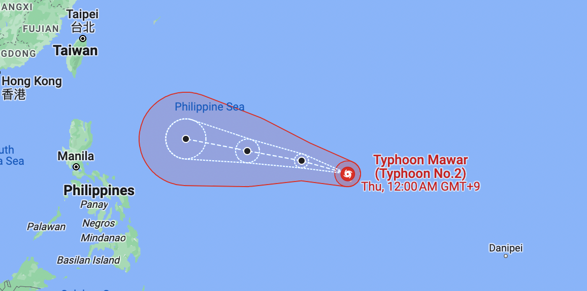
The storm is now on a path to reach the Philippines by Friday night or Saturday morning. It is then expected to move toward south China and Taiwan.
Typhoon Mawar’s path so far:
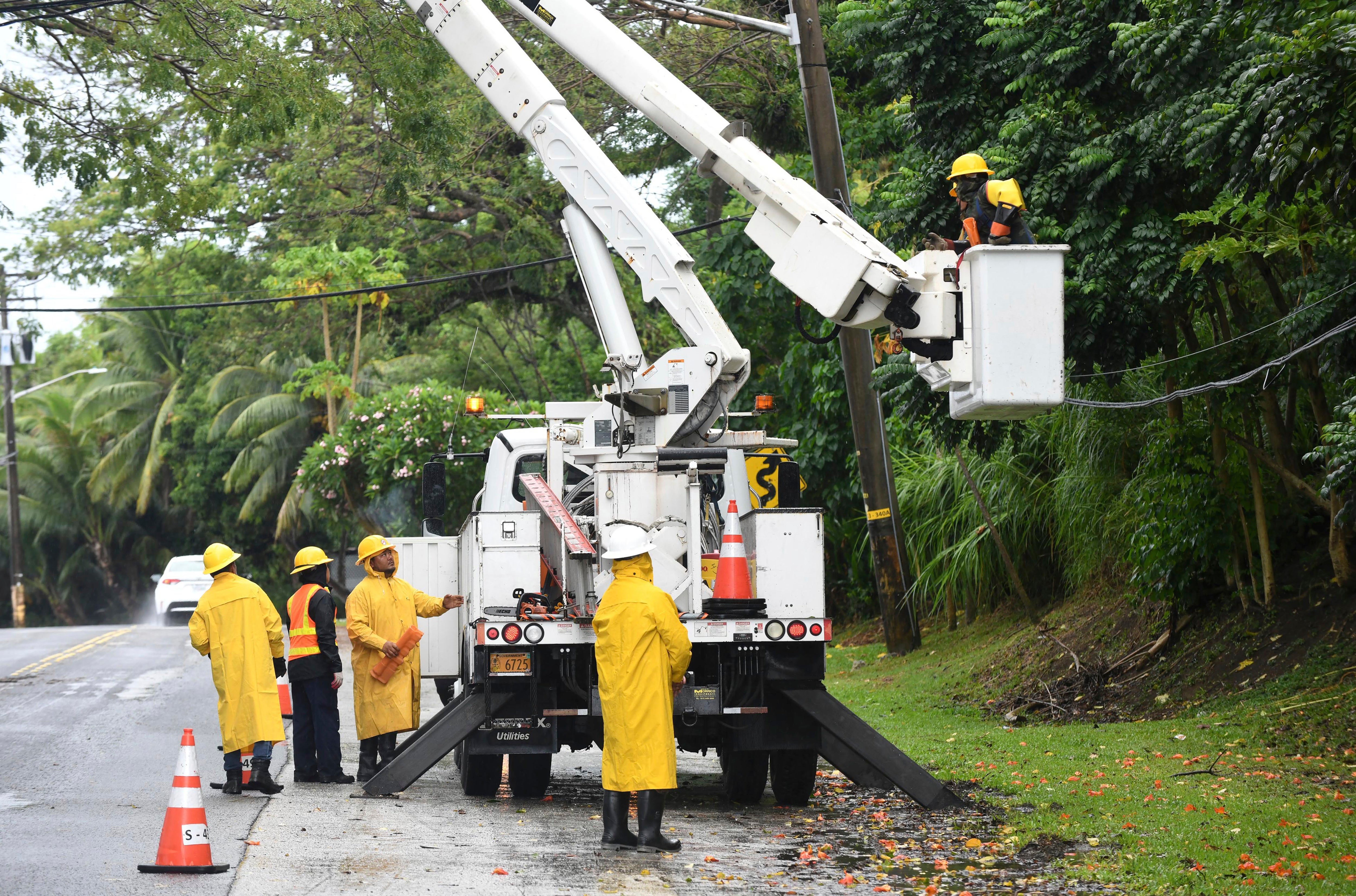
The storm hit Guam on Wednesday night equivalent to a Category 4 hurricane, causing power and water outages islandwide.
Super Typhoon Mawar is the ninth storm in its category or stronger to hit the United States or its territories since 2017, according to Yale Climate Connections meteorologist Jeff Masters.
The eye of the storm passed slightly north of Guam with sustained winds of 142 miles per hour.
Residents of Guam experienced strong winds, lightning and heavy rainfall as Mawar moved about eight miles per hour on Wednesday night.

One meteorologist with the National Weather Service described the night as “long” and “scary” during a news briefing in Guam saying some of the island did not have electricity.
The National Weather Service issued flash flood warnings for Dededo, Yigo and Tamuning and advised residents to move to higher ground and to avoid driving or walking through flood waters.

Only one plant on the island is functioning and serving specifically Andersen Air Force Base (AAFB), Camp Blaz Marine Base and a small portion of Dededo village, the Guam Power Authority said in a statement. Restoration will begin once the weather conditions are improved.

Typhoon Mawar’s expected path:
After parts of the typhoon passed over Guam, the storm headed west toward the Philippines and Taiwan after intensifying to the equivalent of a Category 5 hurricane.
Typhoon Mawar has become the most powerful storm of 2023 globally, according to the Joint Typhoon Warning Centre (JTWC).
The typhoon was last spotted 1,705 kilometres east of southeastern Luzon, located over the Philippine Sea, moving west at 20 kmh, the Philippine Atmospheric, Geophysical, and Astronomical Services Administration (PAGASA) said at 11am local time on Friday.
The storm is expected to reach the geographical region of the ocean monitored by the county, called the Philippines Area of Responsibility, Friday night or Saturday morning.
While the current projections show the typhoon may not make a direct landfall in the Philippines, the state weather agency PAGASA is not ruling out the possibility.
The weather agency said the storm can take a southern turn from its projected path and can make a landfall in the northern region of Luzon.
However, the chances of that happening are currently “slim”, according to Ana Clauren-Jorda, PAGASA weather specialist quoted by CNN Philippines.
After the Philippines, the storm is expected to move towards south China and Taiwan.
PAGASA said Mawar may slow down as it begins to move closer toward the waters east of extreme Northern Luzon.
However, Jim Yang, a researcher at the China Meteorological Association, said the “the likelihood of Mawar making landfall” in China or Taiwan is increasing.
“If Mawar finally lands in Taiwan, it will become the first typhoon to land in Taiwan in May in 33 years; if it lands in Fujian, it will become the first typhoon in history to land in Fujian in May,” he said in a Twitter post.
Mr Yang added that Mawar can “maintain high intensity for 2 to 3 days”.


Join our commenting forum
Join thought-provoking conversations, follow other Independent readers and see their replies
Comments