First polar vortex of 2025 will bring dangerously frosty temperatures for millions of Americans
Bitter cold sweeping across the majority of the US could bring storms that result in power outages and ‘significant’ travel disruptions
Your support helps us to tell the story
From reproductive rights to climate change to Big Tech, The Independent is on the ground when the story is developing. Whether it's investigating the financials of Elon Musk's pro-Trump PAC or producing our latest documentary, 'The A Word', which shines a light on the American women fighting for reproductive rights, we know how important it is to parse out the facts from the messaging.
At such a critical moment in US history, we need reporters on the ground. Your donation allows us to keep sending journalists to speak to both sides of the story.
The Independent is trusted by Americans across the entire political spectrum. And unlike many other quality news outlets, we choose not to lock Americans out of our reporting and analysis with paywalls. We believe quality journalism should be available to everyone, paid for by those who can afford it.
Your support makes all the difference.The beginning of 2025 will be marked by the year’s first polar vortex, bringing snow, storms, and frigid temperatures that will impact the majority of the country and millions of Americans.
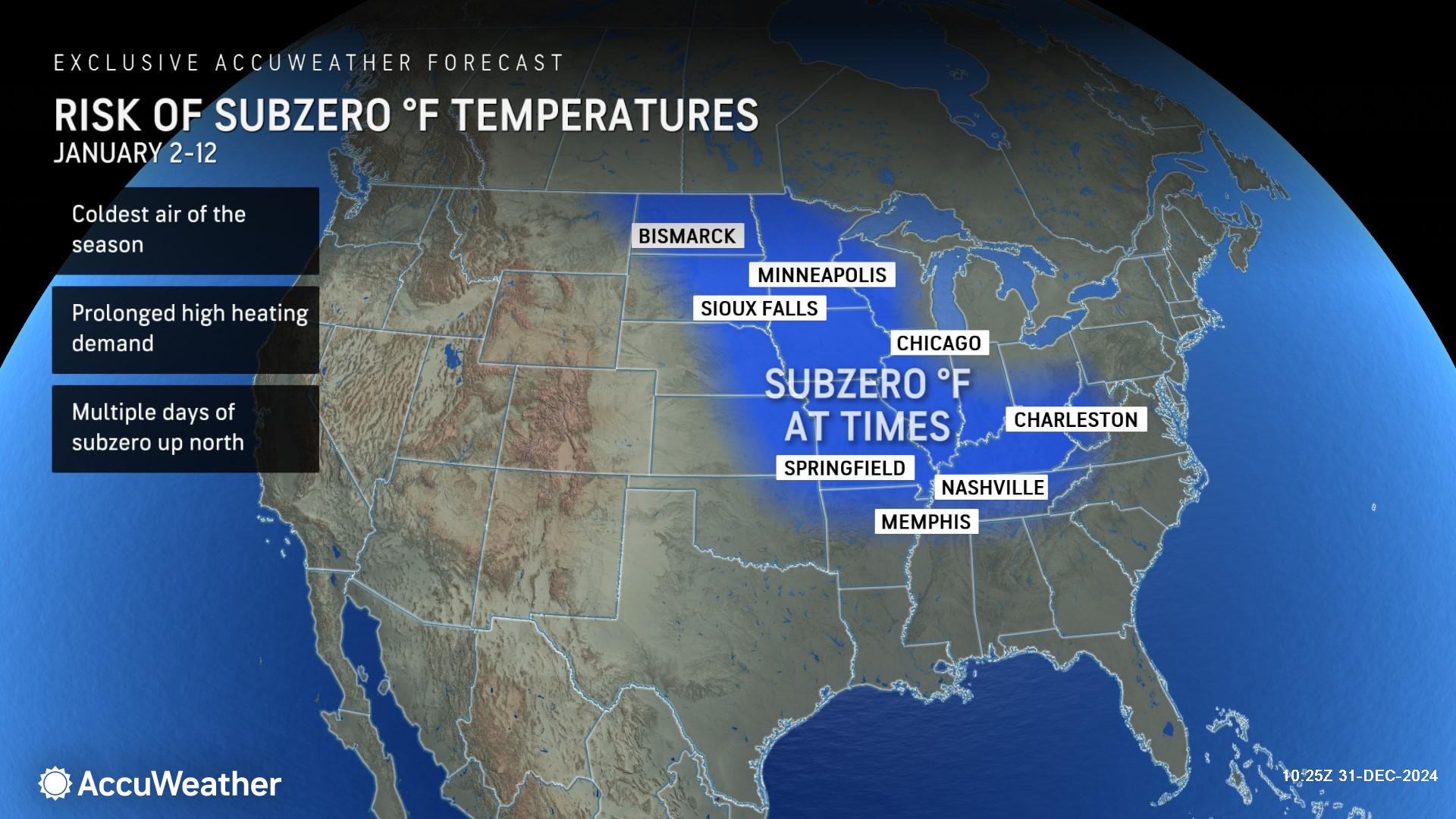
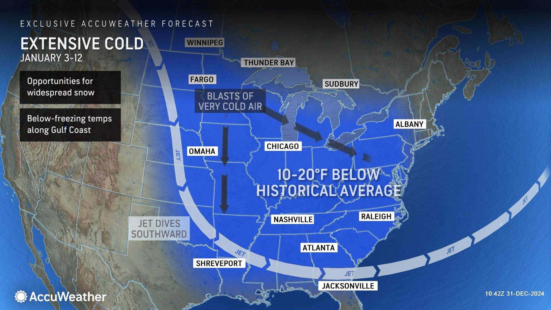
During the year’s second week, the coldest air of the season and dangerous wind chills will affect the Southeast, with below freezing temperatures possible as far south as the Gulf Coast and Florida Peninsula. Frozen precipitation is possible across the region and southern Plains.
Some areas could see temperatures plummet to nearly 30 degrees below average, according to FOX Weather.

The cold may be so extreme that “this could end up being the coldest January since 2011 for the U.S. as a whole,” AccuWeather Lead Long-Range Expert Paul Pastelok said in a statement.
The media forecasting company said that it is expected to create a surge in demand for heating, and warned cold air in the Southeast could result in rolling blackouts and power grid issues.

“The last two Januarys in the Upper Midwest (Minnesota, Iowa, Wisconsin and Michigan) have been well above the historical average spanning 1991-2020,” AccuWeather Senior Director of Forecasting Operations Dan DePodwin said, “January 2023 was 6.3 Fahrenheit above and January 2024 was 4.2 above. This January will end up below normal in this region for the first time since 2022.”
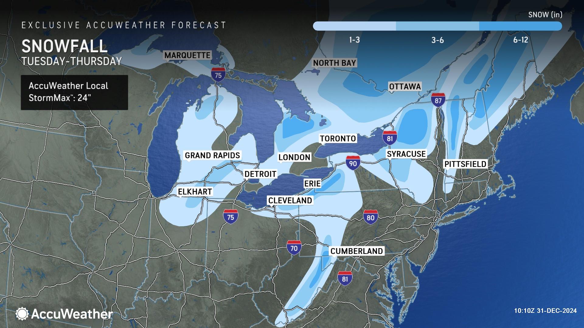
The Arctic outbreak will spread from the northern Plains to the south and east, with heavy snow expected to fall over the Appalachians, Ohio Valley, Mid-Atlantic, Great Lakes, and Northeast. Forecasters warn snowfall could result in “significant” travel disruptions.

AccuWeather noted that snow could impact major metro areas, including, New York City, Boston, Chicago, Philadelphia, and Washington, DC.
A winter storm is expected to begin impacting the Central Plains by Saturday night, and heavy snow will spread eastward to the Mid-Atlantic by early next week.
Lake effect snow is also likely for areas downwind of the Great Lakes.

This week, as a cooling trend expands eastward, between 6-12 inches are forecast in that region by Saturday morning.
The same amount is also possible over the Central Appalachians, as the system moves there on Friday.

While the term “polar vortex” is relatively recent, the phenomenon itself is nothing new. It’s a large region where the atmospheric pressure is lower than its surrounding locations and cold air that surrounds both of the Earth’s poles. It always exists near the poles, but strengthens in the winter.

Join our commenting forum
Join thought-provoking conversations, follow other Independent readers and see their replies
Comments