UK weather: Met office predicts hottest day of year as ‘heatwave’ brings Mediterranean heat
Britain set to be warmer than Majorca as May raises the temperature

Sign up to the Independent Climate email for the latest advice on saving the planet
Get our free Climate email
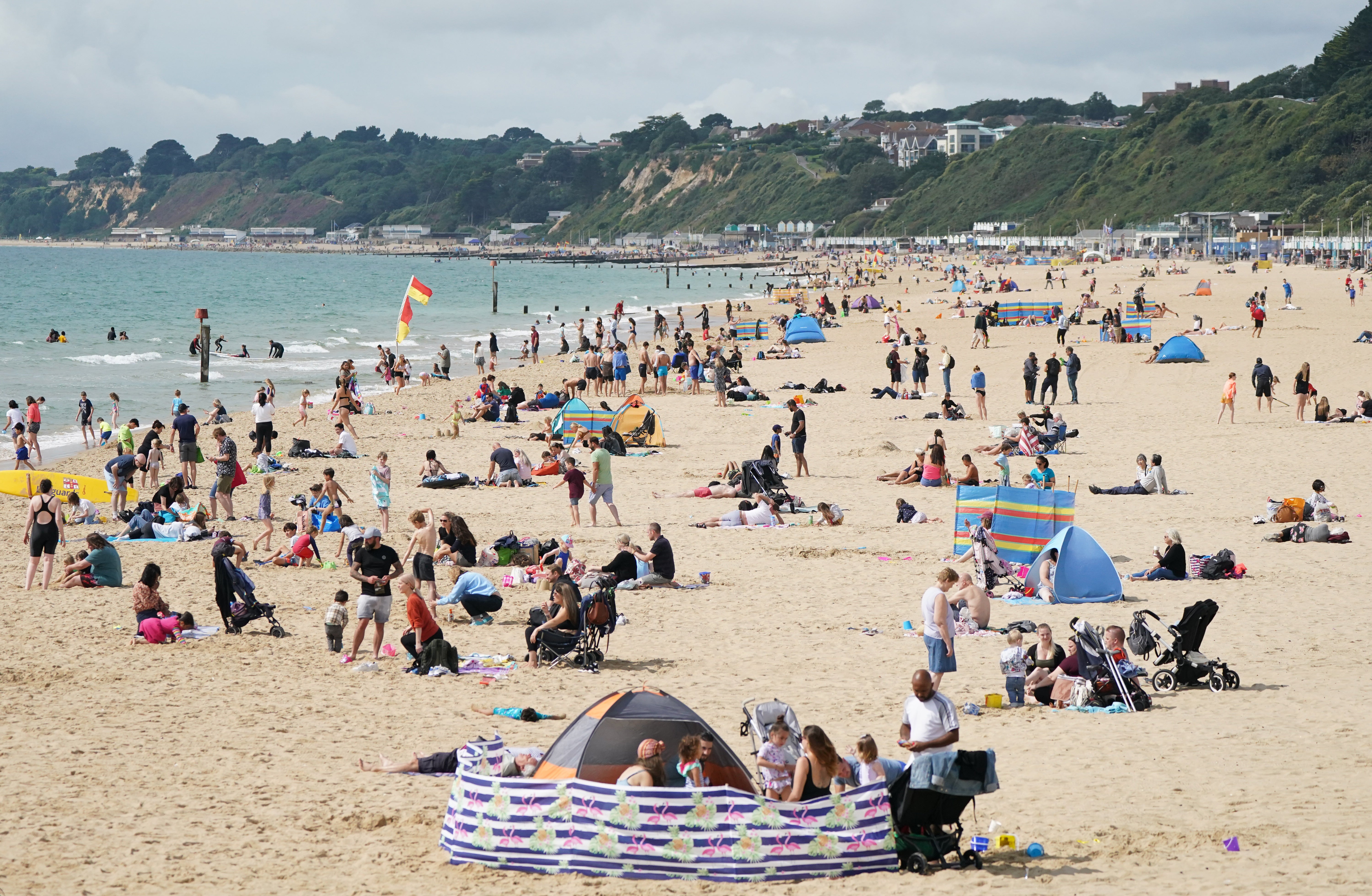
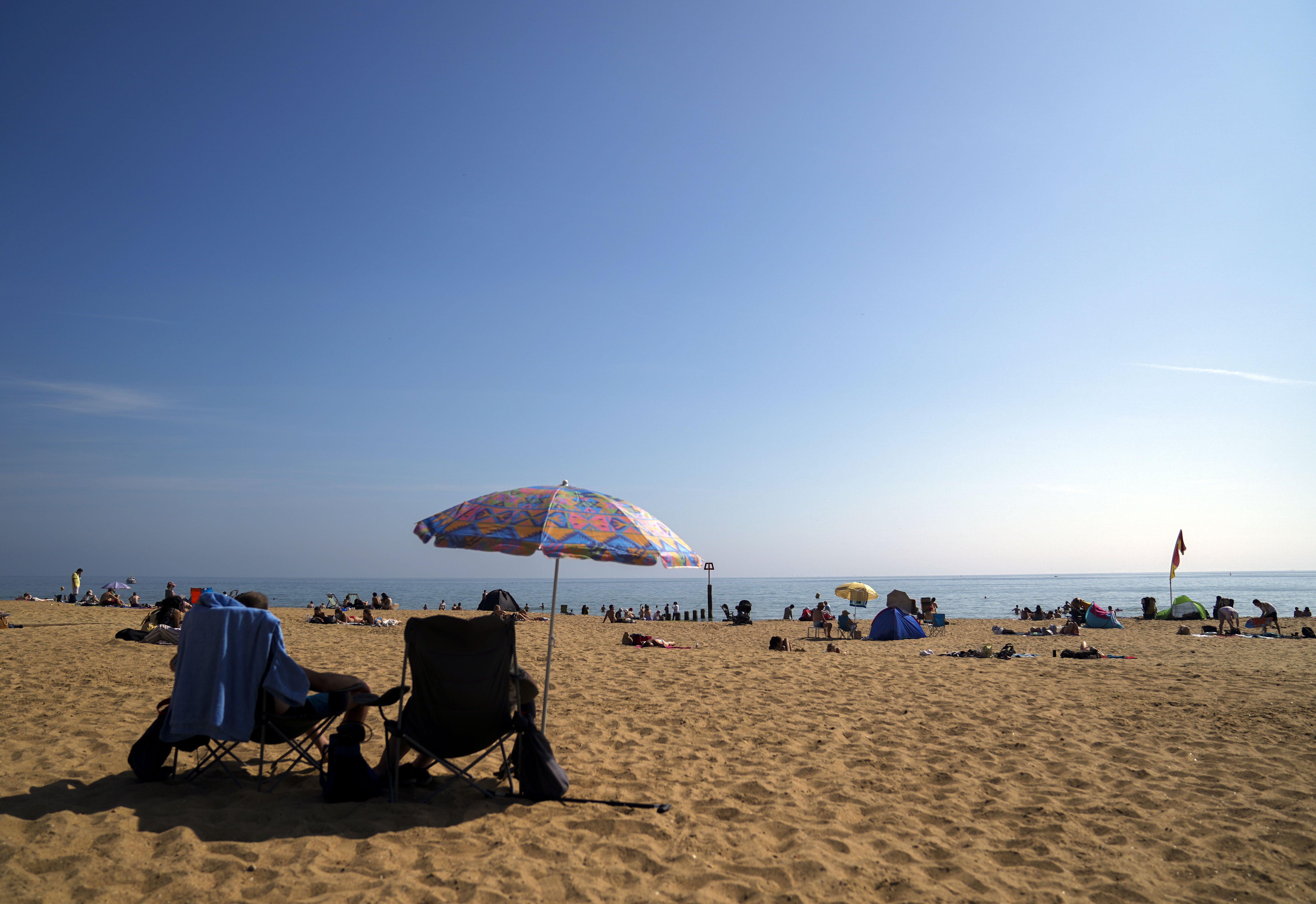
Today could be the hottest day of the year so far, with more ‘Mediterranean’ weather on the way.
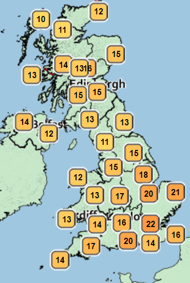
Parts of the capital are expected to hit 24C on Friday, a temperature far higher than the average of 16.2C for the month in England, and parts of the South East set to be hotter than Majorca.
Met Office meteorologist Annie Shuttleworth said that if peak highs aren’t seen, it is likely the year’s record will be broken at some point during the week.
A high of 23.4C was recorded in St James’s Park, London, on April 15, the hottest of 2022 so far.
Met Office meteorologist Richard Miles said that Friday’s temperatures were “particularly surprising” as it is so early in the month.
He said: “The average maximum temperature for May is 15.13C in the UK and 16.2C in England, so it’s quite a bit above that.
“But obviously May tends to be quite a lot cooler at the start than at the end.”
However the temperatures remain some way off the record temperature for the month, with the hottest May day ever reaching 32.8C in 1944.
Ms Shuttleworth said that temperatures are expected to be “much warmer than average” through May.
She added: “Average temperatures at this point in early May is about 17C for London and somewhere around 15C outside of that.
“It’s quite likely we’ll see those warm and much warmer than average temperatures across the UK.”
High temperatures are expected to stay for several days before dropping around the middle of the month.
Ms Shuttleworth also issued a warning to Britons who might be looking forward to making the most of the hot weather.
“UV levels will likely be high,” she said. “Some protection is advised, and long periods in the sunshine not recommended.”

MET OFFICE OUTLOOK
Today:
A fine and dry morning, with patches of low cloud early in western parts but plenty sunshine elsewhere. The sun will turn hazy, with some cloud in the west, but it’ll remain dry and bright until late. Feeling warm. Maximum temperature 22 °C.
Tonight:
Cloud thickening from the west during the evening and night, with an increasing risk of patchy light rain or drizzle in the west but remaining largely dry elsewhere. Minimum temperature 10 °C.
Saturday:
Rain and drizzle clearing southeast during the morning. Coastal fog developing in Kent where cool, but warm with sunny spells and showers elsewhere. Largely cloudy in the evening. Maximum temperature 20 °C.
Outlook for Sunday to Tuesday:
Dry and warm with variable cloud and sunny spells Sunday. Dry and warm with hazy sunshine on Monday. Cloudier and breezy on Tuesday, but remaining largely dry and warm.
Subscribe to Independent Premium to bookmark this article
Want to bookmark your favourite articles and stories to read or reference later? Start your Independent Premium subscription today.