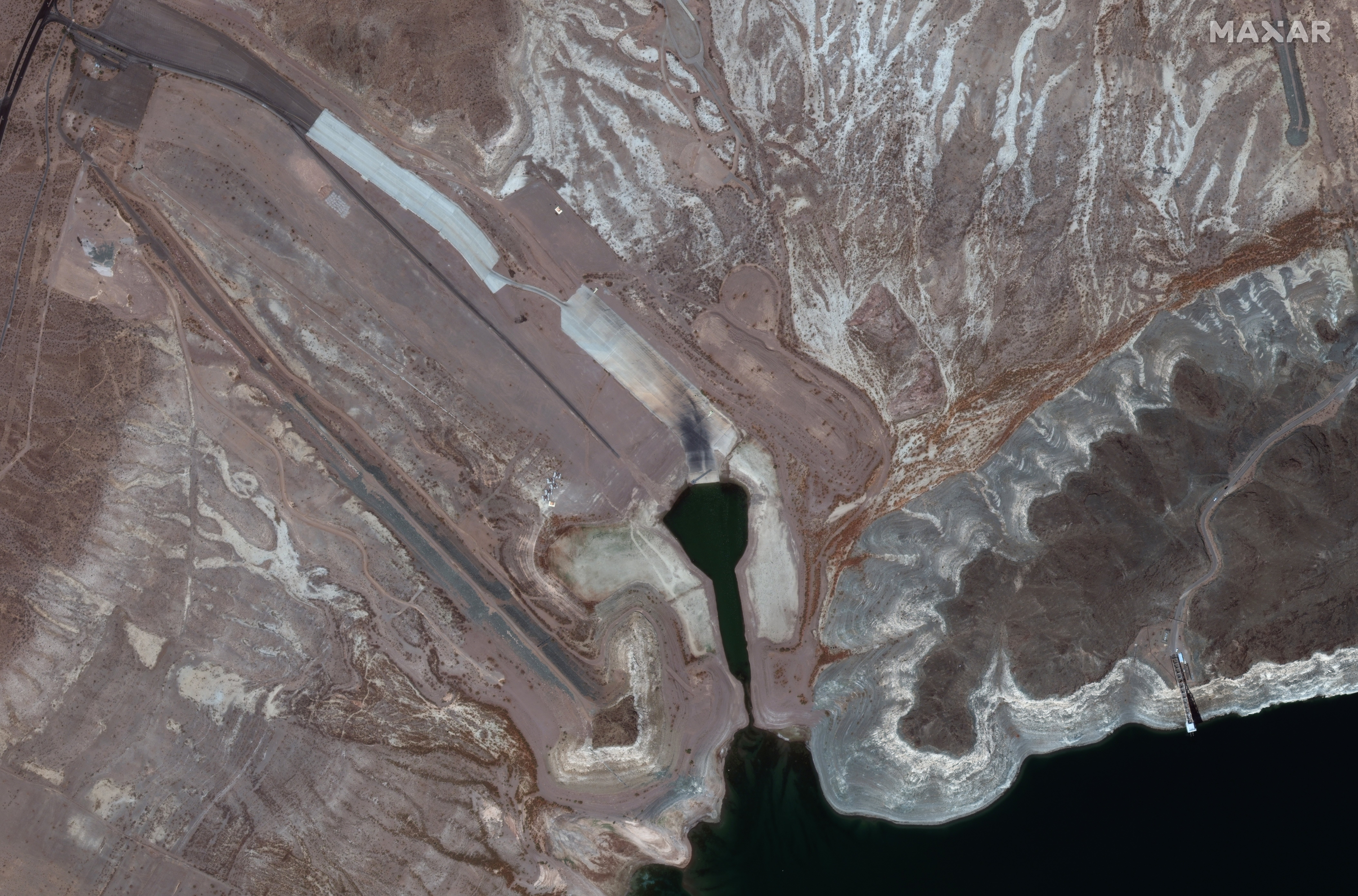
Satellite reveals before-and-after images of historic megadrought on Colorado River
The pictures were taken amid a climate crisis-fueled megadrought impacting wide areas of the American West
Your support helps us to tell the story
From reproductive rights to climate change to Big Tech, The Independent is on the ground when the story is developing. Whether it's investigating the financials of Elon Musk's pro-Trump PAC or producing our latest documentary, 'The A Word', which shines a light on the American women fighting for reproductive rights, we know how important it is to parse out the facts from the messaging.
At such a critical moment in US history, we need reporters on the ground. Your donation allows us to keep sending journalists to speak to both sides of the story.
The Independent is trusted by Americans across the entire political spectrum. And unlike many other quality news outlets, we choose not to lock Americans out of our reporting and analysis with paywalls. We believe quality journalism should be available to everyone, paid for by those who can afford it.
Your support makes all the difference.New aerial images of Lake Mead in Boulder City, Nevada, revealed a stark difference in water levels just one year apart.
The pictures, captured by Maxar Technologies’ satellite on 18 May 2020 and 21 July 2021, show the stark contrast between the Boulder Harbor launch ramp in over a year after the water had receded from a large circular depth to a sliver.
The pictures were taken amid a historic, climate crisis-fueled megadrought that is impacting broad areas of the American West.
On Monday the US government for the first time declared a water shortage along the dams and reservoirs fed by the Colorado River.
The announcement triggered water cuts, which will begin in January and could affect more than 25 million people in the southwestern states, tribal nations, and Mexico.
Water levels in Lake Mead, America’s largest reservoir by volume, are at their lowest since the 1930s, when the reservoir was first filled in following the construction of the Hoover Dam.

The water cuts will be deepest in Arizona, which will see a nearly 20 per cent reduction in its share of Colorado River water.
The state’s farmers, rather than cities, will bear the brunt of the reductions, and many have reported planting less or different crops in anticipation.
“As this inexorable-seeming decline in the supply continues, the shortages that we’re beginning to see implemented are only going to increase,” Jennifer Pitt, who directs the Colorado River program at the National Audubon Society, told The New York Times. “Once we’re on that train, it’s not clear where it stops.”
One of the primary drivers of the shortage is the climate crisis, and the way it exacerbates naturally existing drought cycles.
Last week, ahead of the Department of Interior’s announcement about the river, the US Drought Monitor declared 95 per cent of the West to be in a drought, the highest level ever recorded. Though unprecedented, the water shortage announcement isn’t a surprise.
The states along the upper basin of the Colorado River—Wyoming, Colorado, Utah and New Mexico—along with the states in the lower basin—California, Nevada, and Arizona—negotiated the cuts in 2019, alongside tribal nations and Mexican officials.
The cuts announced on Monday will only affect states in the lower basin.
However the rest of the West cannot be complacent. If water levels continue to fall, as they are expected to, deeper cuts could be on the way for the numerous communities that depend on both the natural and man-made features of the Colorado’s watershed, home to roughly 40 million people.
“It’s such a significant river,” Sarah Porter, director of the Kyl Center for Water Policy at Arizona State University, told CBS.
“It used to be called the Nile of the West, which is almost impossible to believe these days.”

Join our commenting forum
Join thought-provoking conversations, follow other Independent readers and see their replies
Comments