Hurricane Nigel tracker: What is the projected path of the storm?
Nigel is a fast-spaced storm that is expected to rapidly intensify to a Category 3 major hurricane
The rapidly intensifying storm Nigel in the Atlantic has developed into a hurricane and could intensify further, according to the National Hurricane Center.
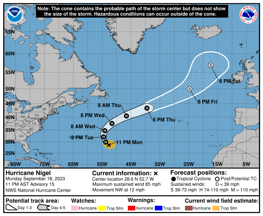
On Monday night, Hurricane Nigel was a Category 1 storm with sustained wind speeds of 85mph.
NHC said Nigel is a fast-spaced storm that is expected to rapidly intensify to a Category 3 major hurricane by Tuesday – this means it will have sustained winds of at least 111mph.
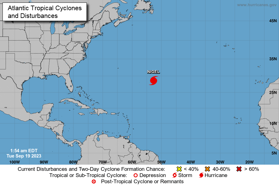
Hurricane Nigel was about 875miles (1,410km) east-southeast of Bermuda and was moving northwest at a speed of 12mph (19 kph).
The hurricane centre said there were no coastal watches or warnings in effect. The storm was not expected to make landfall.
Here is the projected path of Hurricane Nigel over the next few days.

A gradual weakening trend could start late Wednesday after an intensification in the next 24 hours, according to NHC.

Nigel developed shortly after Hurricane Lee landed in Nova Scotia as a post-tropical storm and it is the 14th named storm to form in the Atlantic in this year.
The storm initially formed in the centre of the Atlantic on Saturday but quickly picked up power, developing into a Category 1 hurricane on Monday morning.
The National Oceanic and Atmospheric Administration (NOAA) had predicted that there would be 14 to 21 named storms this year, a number that makes 2023 an above-average year for storms.
The increased number of storms this year is partly due to an El Niño pattern, which natural cycle in the Pacific associated with an increased number of hurricanes which started in June.
The phenomenon can have wide-ranging effects on weather around the world.
However, experts have also pointed at the role of warming ocean temperatures, that help boost storms’ size and speed. As the Earth becomes warmer, ocean temperatures rise and contribute to fueling hurricanes.
This year, heatwaves on land and ocean have broken several records amid what is now found to be the hottest summer in the Northern Hemisphere in over 120,000 years.


Join our commenting forum
Join thought-provoking conversations, follow other Independent readers and see their replies
Comments