Tropical Storm Franklin strengthens into first major hurricane of 2023 Atlantic season
‘Swells generated by Franklin are beginning to affect Bermuda,’ National Hurricane Center says
Your support helps us to tell the story
From reproductive rights to climate change to Big Tech, The Independent is on the ground when the story is developing. Whether it's investigating the financials of Elon Musk's pro-Trump PAC or producing our latest documentary, 'The A Word', which shines a light on the American women fighting for reproductive rights, we know how important it is to parse out the facts from the messaging.
At such a critical moment in US history, we need reporters on the ground. Your donation allows us to keep sending journalists to speak to both sides of the story.
The Independent is trusted by Americans across the entire political spectrum. And unlike many other quality news outlets, we choose not to lock Americans out of our reporting and analysis with paywalls. We believe quality journalism should be available to everyone, paid for by those who can afford it.
Your support makes all the difference.Both Hurricane Franklin and Tropical Storm Idalia are intensifying as the Atlantic hurricane season is beginning.
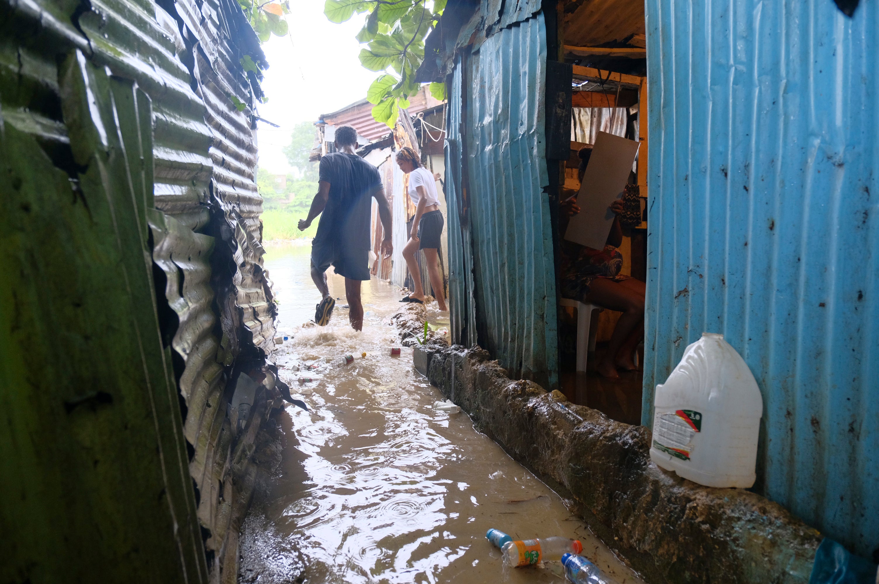
Idalia was off the coast of Cuba on Monday, potentially on a path to strike the Southern US as a major hurricane, according to the National Hurricane Center.
Hurricane Franklin has been gaining in power and grew into the first major hurricane of the Atlantic season, increasing in strength overnight.
At 8am ET, it had winds of 130 mph, meaning that it had become a Category 4 storm. It would begin to lose power on Tuesday afternoon, forecasters said, according to CBS News.
While there were no coastal warnings or watches published regarding Franklin, it’s still expected to lead to “life-threatening surf and rip current conditions” along the eastern coast of the US, the hurricane center added. “Swells generated by Franklin are beginning to affect Bermuda.”


At 8am on Monday morning, Franklin was about 490 miles southwest of Bermuda and it was moving northwest at about 8 mph.
Florida Governor Ron DeSantis said at a press briefing on Monday that “we do expect Hurricane Idalia to be a major hurricane that will strike the state of Florida”.
He told Floridians to prepare for “major impacts” along the state’s Gulf coast.
Earlier on Monday, President Joe Biden spoke with Mr DeSantis, approving an emergency declaration for Florida, according to the White House.
At 11am ET on Monday, Idalia was around 80 miles south of the western end of Cuba. It had maximum sustained winds of 65 mph and was moving north at 8 mph.
The hurricane center said that a warning had been sent out from the centre of Longboat Key north to the Ochlockonee River, as well as for Tampa Bay.
A number of counties around Tampa issued evacuation orders early on Monday, according to WTSP.
Idalia is set to grow into a hurricane on Monday and will become a “dangerous major hurricane over northeastern Gulf of Mexico by early Wednesday,” the hurricane center said. It noted that Idalia may reach the Gulf Coast of Florida on Wednesday.
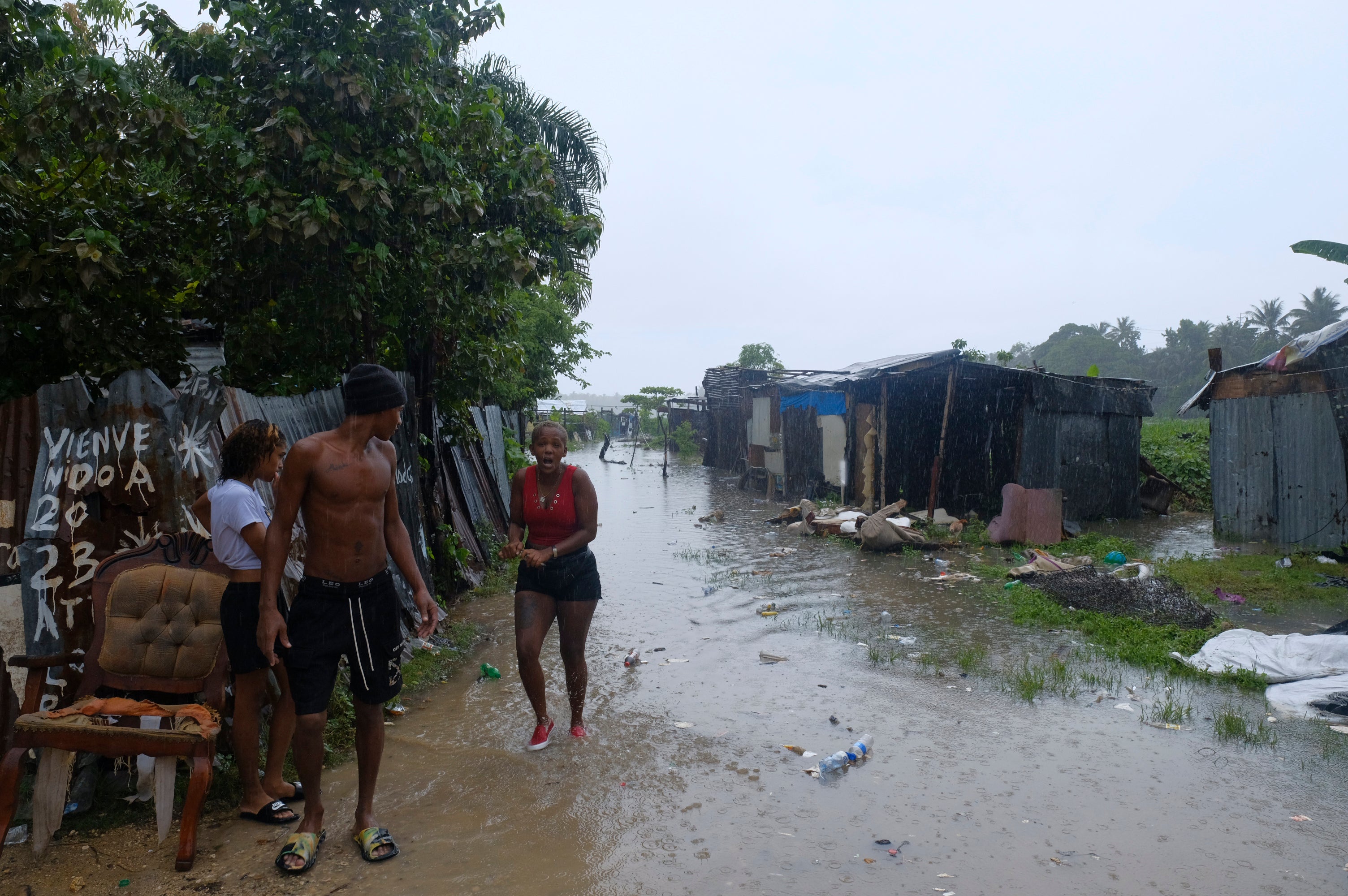
“Life-threatening storm surge and dangerous winds” are “becoming increasingly likely for portions of Florida,” the center said.
Usually, major hurricanes are above a Category 3 on the Saffir-Simpson scale, which goes up to five. These storms may cause “devastating” and “catastrophic” damage, the hurricane center has said.
On the west coast of Florida, as much as 11 feet of ocean water could crash ashore.
Mr DeSantis said on Sunday that “this thing hasn’t even gotten to Cuba yet, and the water in the Gulf is very, very warm and so that will provide some fuel for this thing to pick up some more speed”.
The deputy director of the National Hurricane Center, Jamie Rhone, said on Sunday that large swathes of western Florida are vulnerable to storm surges.
“So it will not take a strong system or a direct hit to produce significant storm surge,” he said, according to CBS. “So if you’re anywhere along the Florida Peninsula, western Florida Peninsula, so let’s say from about Fort Myers northward to the Panhandle, you’ve really got to be paying attention.”
The Florida Division of Emergency Management urged residents on social media to keep at least half a tank of gas in their cars. “This will ensure you can evacuate tens of miles inland to a safe location should the need arise,” they said.
As many as 1,100 members of the National Guard have been mobilized in the state and “they have at their disposal 2,400 high-water vehicles, as well as 12 aircraft that can be used for rescue and recovery efforts,” the governor said.
“If you are in the path of this storm, you should expect power outages,” he added. “So please prepare for that, particularly if this storm ends up coming in the Tallahassee region, there’s a lot trees that are going to get knocked down, the power lines are going to get knocked down – that is just going to happen, so just be prepared for that and be able to do what you need to do.”
Florida’s emergency management agency said that 33 counties in the state are under a state of emergency.
The National Oceanic and Atmospheric Administration has said that this year’s hurricane season will be more active than previously thought, in part because of the high ocean temperatures.
The hurricane season lasts until 30 November, with the peak usually hitting in August or September.
Join our commenting forum
Join thought-provoking conversations, follow other Independent readers and see their replies
Comments