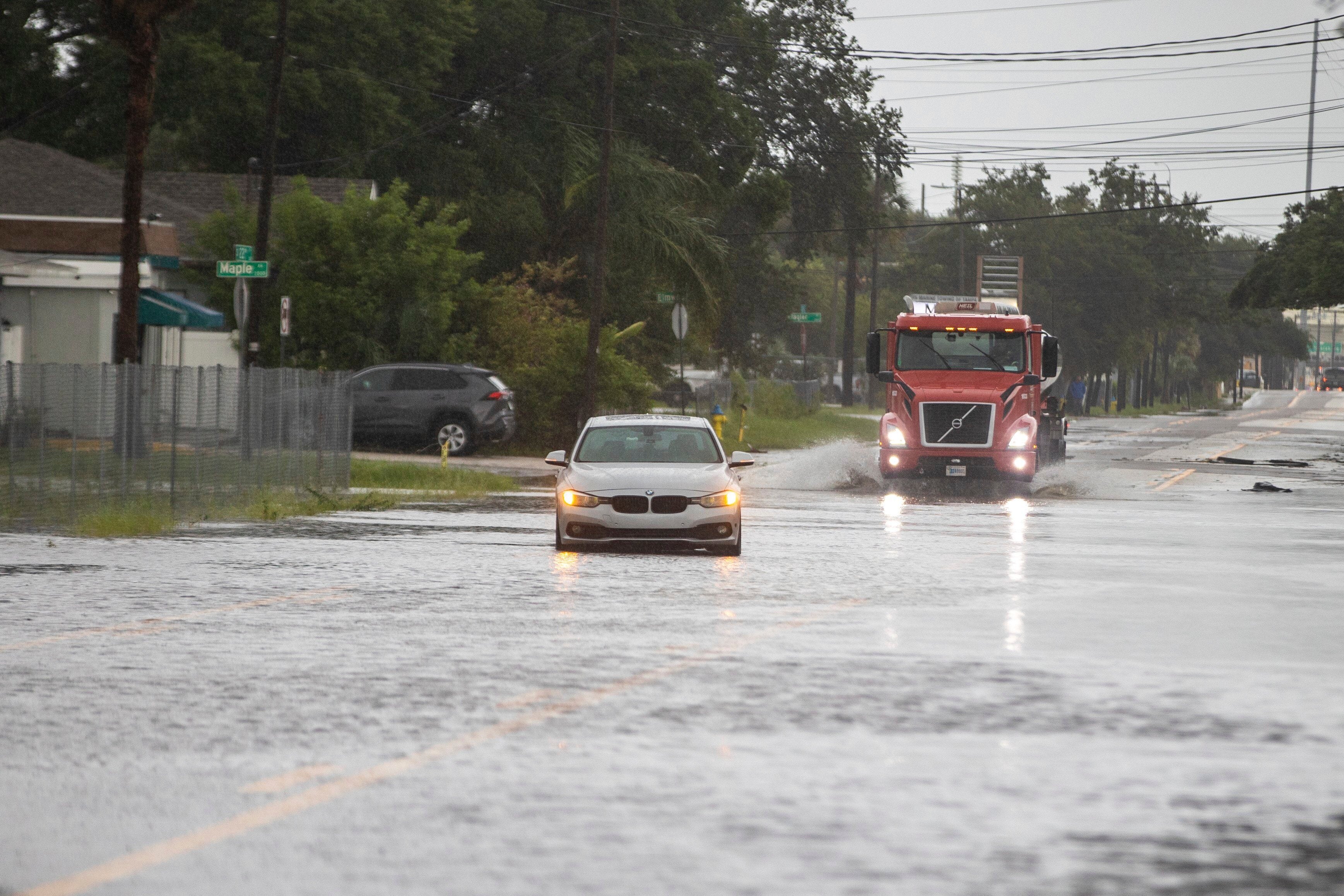
Tropical Storm Debby could prove just as dangerous as a major hurricane
Tropical Storm Debby came ashore in Florida as a Category 1 hurricane and quickly downgraded, but the storm still poses serious threats as it slogs on toward Georgia and South Carolina
Your support helps us to tell the story
From reproductive rights to climate change to Big Tech, The Independent is on the ground when the story is developing. Whether it's investigating the financials of Elon Musk's pro-Trump PAC or producing our latest documentary, 'The A Word', which shines a light on the American women fighting for reproductive rights, we know how important it is to parse out the facts from the messaging.
At such a critical moment in US history, we need reporters on the ground. Your donation allows us to keep sending journalists to speak to both sides of the story.
The Independent is trusted by Americans across the entire political spectrum. And unlike many other quality news outlets, we choose not to lock Americans out of our reporting and analysis with paywalls. We believe quality journalism should be available to everyone, paid for by those who can afford it.
Your support makes all the difference.Tropical Storm Debby came ashore in Florida as a Category 1 hurricane Monday and quickly downgraded, but the storm still poses serious threats as it slogs on toward Georgia and South Carolina.
Tropical storms can be deadlier than some of the strongest hurricanes. In Debby’s case, the storm was expected to slow to a crawl and dump up to 30 inches (76 centimetres) of rain over several days along coastal Georgia and South Carolina. Winds won’t be the biggest danger, making the storm's category far less important than the potential for catastrophic flooding.
The Saffir-Simpson Scale measures only the strength of a hurricane’s winds from Category 1 to Category 5, the strongest. The circumference of a storm, how fast it’s moving, the amount of rain it delivers, storm surge and high tides are all other factors that matter.
Geography plays a role
Where a storm hits and its inland path are also important. Geography, population, quality of infrastructure and the age of homes and businesses in an area can also factor into how much damage a storm can bring. Also, it’s important to remember that tornadoes can form regardless of a storm’s size.
It was fortunate that Tropical Storm Debby landed in the region where Florida's main peninsula meets the Panhandle in the north, one of the least populated areas of the state, but major cities like Savannah, Georgia, and Charleston, South Carolina, need to take the storm very seriously.
Although historic downtown Savannah sits on a bluff comfortably above the Savannah River, the surrounding area, including Tybee Island, contains low-lying marshes. Charleston and surrounding areas are very susceptible to flooding — especially if the storm pushes water inland and prevents the myriad of creeks and marshes from draining heavy rains into the Atlantic.
Weaker storms can still be dangerous
As an example of a weaker storm causing major problems, look to Hurricane Beryl, which hit Texas last month as a Category 1 storm yet still knocked out power to 2.7 million customers. The storm has been blamed for at least 36 deaths in Texas, including people who died in their homes from sweltering heat after power in many areas stayed out for days.

Tropical Storm Fay in 2008 may be a good comparison to Debby. Fay didn’t even register on the scale of dangerous storms before it made four separate landfalls in Florida. In this case, it was not Fay’s strength, but its speed — or lack thereof — that turned out to be key. The listless storm parked itself over the state for days, dumping as much as 25 inches (64 centimetres) of rain in some places. Floods killed crops and destroyed homes. Roads were so flooded that alligators swam alongside first responders as they rescued people stranded in their homes.
When monitoring storms, “Don’t focus on the category,” advises Craig Fugate, former director of the Federal Emergency Management Agency who also was emergency management director in Florida during some of the state’s worst storms.
Think local — don't just rely on the national forecast
Fugate also advises resident to seek out local weather information instead of relying too heavily on advisories from the National Hurricane Centre and national news and weather channels.
“Everyone focuses on the Hurricane Centre,” he said. “They’re responsible for storm intensity and track. They’re not necessarily going to have all the local impacts.”
A better place to go, Fugate says, is the National Weather Service’s homepage, where you can type in a ZIP code and see what’s happening in your area.
“Your (regional) National Weather Service office is taking all that information and they’re localising it so they can tell you what kind of wind you can expect, what kind of flooding you can expect,” Fugate said. “Are you in a storm surge area? When are the high tides?”
Relying on FEMA flood zone maps to determine a storm’s potential impact is as ill-advised as depending solely on the Saffir-Simpson scale, Fugate warns.
“People think, ‘Well, it’s a flood map. If I don’t live in the zone, I don’t flood.’ No! It’s an insurance rate map. Not being in that special risk area doesn’t mean you don’t flood, it just means the insurance is cheaper,” he said.
