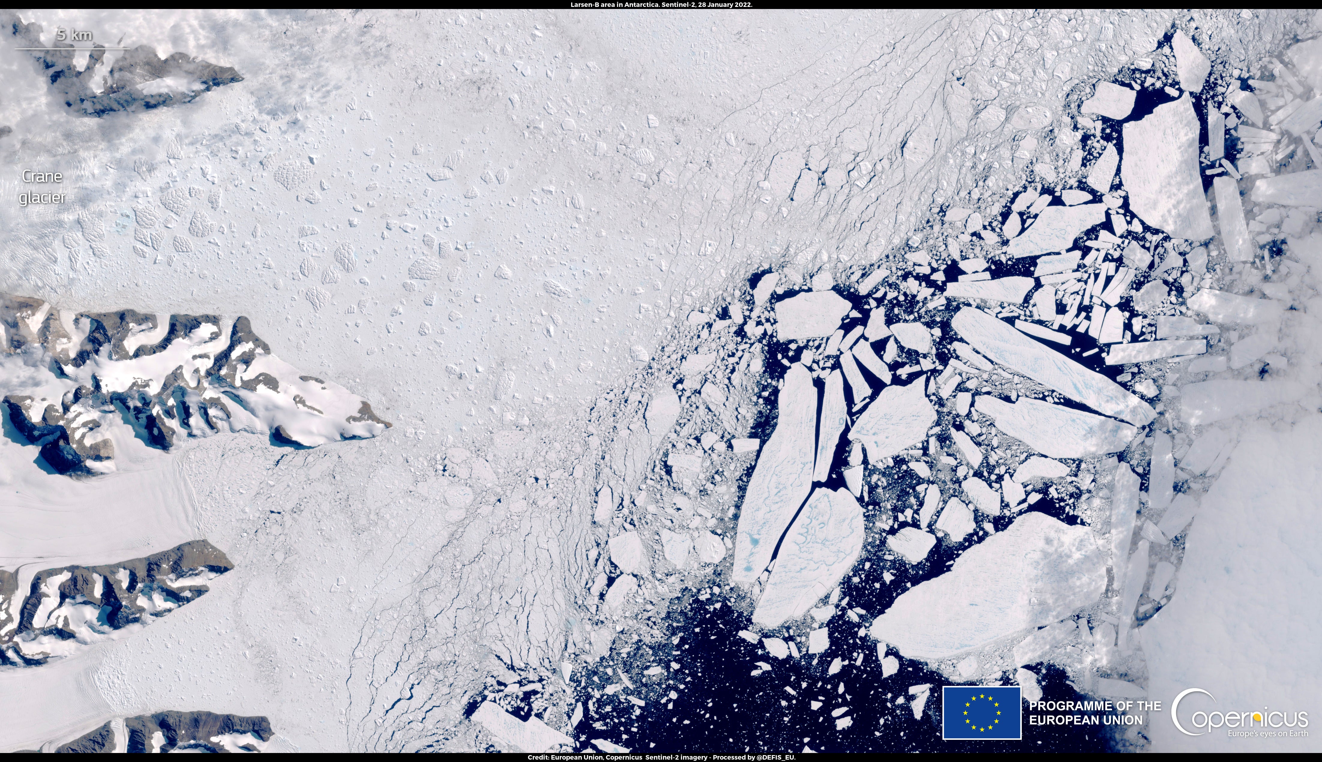
Dramatic satellite pictures show rapid break-up of Antarctic ice the size of Barbados
Sea ice was a part of a large glacial shelf extending along the east coast of the Antarctic Peninsula
Your support helps us to tell the story
From reproductive rights to climate change to Big Tech, The Independent is on the ground when the story is developing. Whether it's investigating the financials of Elon Musk's pro-Trump PAC or producing our latest documentary, 'The A Word', which shines a light on the American women fighting for reproductive rights, we know how important it is to parse out the facts from the messaging.
At such a critical moment in US history, we need reporters on the ground. Your donation allows us to keep sending journalists to speak to both sides of the story.
The Independent is trusted by Americans across the entire political spectrum. And unlike many other quality news outlets, we choose not to lock Americans out of our reporting and analysis with paywalls. We believe quality journalism should be available to everyone, paid for by those who can afford it.
Your support makes all the difference.A huge chunk of polar ice shelf the size of Barbados disintegrated in a matters of days, dramatic new pictures show.
Satellite images revealed 154 square miles (400 sq km) of sea ice, on the Antarctic Peninsula, cracking into hundreds of smaller pieces.
The sea ice was a part of Larsen Ice Shelf, a large glacial shelf extending along the east coast of the Antarctic Peninsula. Between 16 and 21 January, the sea ice section crumbled.
Researchers studying this area divide it into four sections: Larsen A (the smallest ice shelf), Larsen B, Larsen C (the largest), and Larsen D.
A report following the ice breakup noted that it is the latest rapid disintegration of Larsen B which already “dramatically collapsed” in 2002.

The breakup has likely been caused by a warmer-than-average summer and a series of weather events, called Foehn storms, characterized by warm, dry, downslope winds.
The foehn often replaces a retreating cold air mass which can lead to dramatic temperature rises reaching 10 degrees Celsius, but which can top 20C, in a matter of minutes.
The images were captured by the Sentinel-2 satellites of the Copernicus Climate Change Service (C3S), the European Union’s Earth observation programme.
Last month Antarctic sea ice extent - the area of ocean where at least 15 per cent of the surface is frozen - was 19 per cent below the 1991-2020 average, the fourth lowest on record.
In the Arctic region, sea ice extent was only 1 per cent below the 1991-2020 average, the largest January extent in more than a decade. However it was still smaller than any January extent prior to 2005.
The climate crisis is impacting Antarctica but due to its vast size, effects are varied.
Some parts of the continent have seen increases in sea ice extent. However the Antarctic and Southern Ocean Coalition reports that the West Antarctic Peninsula is among the fastest warming areas on the planet, with only some areas of the Arctic Circle experiencing faster rising temperatures.

Join our commenting forum
Join thought-provoking conversations, follow other Independent readers and see their replies
Comments