Trending: Cross the road, then turn left at rotting flesh...
The inevitable and potentially imminent Zombie Apocalypse continues to excite software programmers everywhere. Following the release of "Zombies, Run!", an app that helps iPhone users get fit by simulating hordes of the undead from which to flee (see Trending, 28 March), we now have Map of the Dead (mapofthedead.com), a new aid to post-apocalyptic survival from Jeff Merrick of the Doejo digital agency.
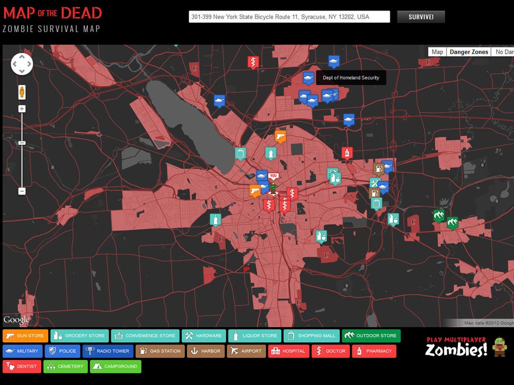
Adapted from Google Maps, it provides the still-living with a handy, colour-coded guide to the nearest essential services in the event of an infestation of flesh-eaters: gun shops, pharmacies, grocers, radio towers and so on. It also points out areas to avoid, such as hospitals and police stations, traditionally considered favourite meeting points for zombies. The most highly populated zones – which are also the most likely to be overrun – are marked in red.
Of course, should the zombie plague occur, and should you survive, you'd have limited time to check the map before the electricity grid went down, not to mention the internet. Best make a printout while you can.
Join our commenting forum
Join thought-provoking conversations, follow other Independent readers and see their replies
Comments
Bookmark popover
Removed from bookmarks