Apple Maps gains indoor airport mapping to make travelling less stressful
They can offer a sense of calm in a busy, sometimes daunting, environment

Apple has added a whole new layer of information for Heathrow, Gatwick, JFK and other airports to Apple Maps.
It’s one thing to use your phone as a sat nav to guide you to the airport before you fly off for the holidays. But once you’ve stepped off the Heathrow Express or climbed out of the cab, wouldn’t it be good to get some further guidance?
After all, airports are stressful places and anything that can make your time there a little bit easier is to be welcomed.
Ahead of Christmas, Apple added a big list of airports. I’ve been to Heathrow to try it out on the ground.
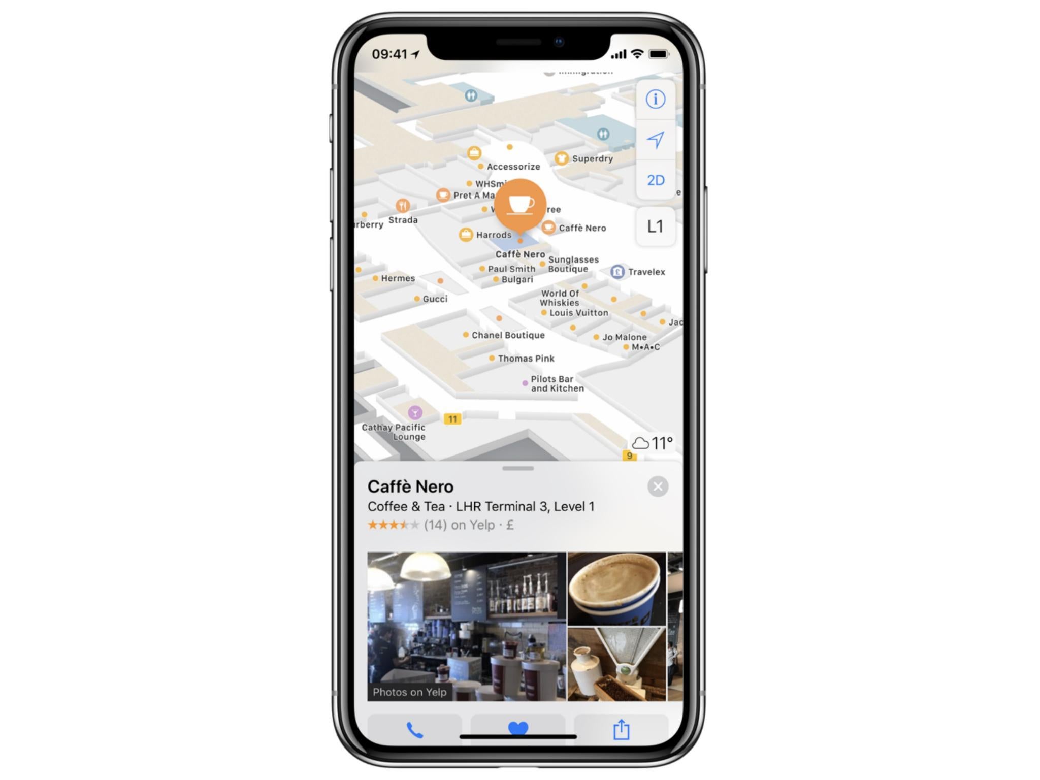
When you look at one of the airports in the Maps app, either in advance or when you’re there, each bears the legend, “Look inside” in blue letters.
Tap that and the area outside the airport shades out and a wealth of information reveals itself.
You’ll see an indicator for where in the terminal you are, even down to which level you’re on – which is useful if you’re arranging to meet someone.
You’re indoors, so obviously the phone doesn’t have line of sight to satellites above you. Instead, Apple has worked with the airport and created a connection between Wi-Fi access points and co-ordinates on the floors.
This creates a “Wi-Fi fingerprint” which is said to be accurate to within five metres, though you don’t have to connect to the airport Wi-Fi for it to work. Apple takes care of those details and you’re presented with a clear, easy-to-use map.
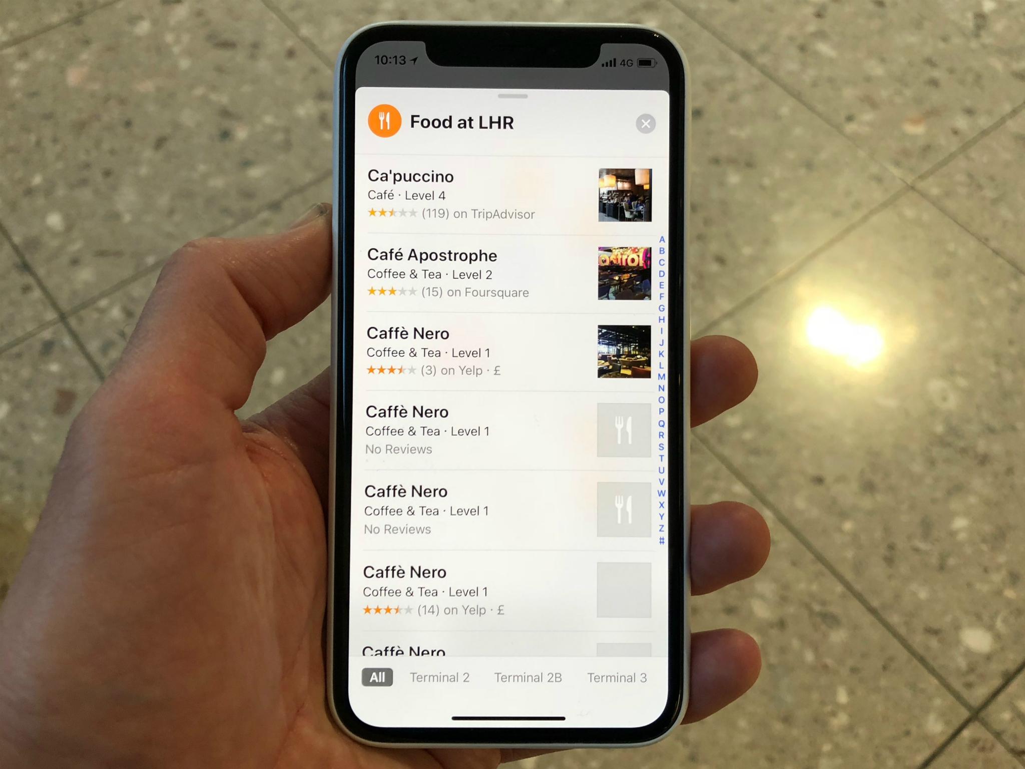
It shows security check-in, boarding gates, restaurants and shops. Because it’s been set up in conjunction with the airport, there’s plenty more it can do. Choose to browse the airport and you’ll see a list of what’s available, presented alphabetically and using the same colour coding Apple uses for bars and restaurants, say, in the rest of Apple Maps.

When you’re browsing, which is done via the airport’s website, you have access to more features. Click on a shop and if you see an item you want, you can reserve it. This is handy if you realise on the way to the airport just what it was you forgot this time. Pick it up when you’ve gone through security, or leave it at the airport to collect on your way home if you’d rather.
You can also check out how busy certain restaurants are, order takeaway or in some cases a picnic service, again so you can maximise your time in the airport.
And knowing your way around an airport is especially useful in somewhere like Berlin’s Tegel airport, for instance, where there are lots of facilities before you go through security, but precious little airside.
Testing the app for around an hour, I found it responsive and very easy to use, knowing I’d switched from one level to another as I stepped off the escalator.
Google Maps has had airport information for some time now but, crucially, not for every airport. For Heathrow and JFK, for instance, Apple Maps are where you’ll need to head.
Apple has launched these detailed maps at more than 30 airports. These include Heathrow, Gatwick in London, LaGuardia and JFK in New York, Newark New Jersey, Los Angeles LAX, Las Vegas, Denver, Detroit, Miami, San Diego, Seattle and many more US destinations. Plus Hong Kong, Geneva, Amsterdam Schiphol, Vancouver and others.
Covent Garden in London is the first UK mall to have indoor mapping, too.
The sophistication of the indoor mapping and the simplicity of its presentation work well together, and can offer real benefits, whether it’s working out where to head for your gate or just knowing whether there’s a Boots or WHSmith on the way.
If you’re in an airport you’ve never visited before, these new maps can offer a sense of calm in a busy, sometimes daunting, environment.
Join our commenting forum
Join thought-provoking conversations, follow other Independent readers and see their replies
Comments
Bookmark popover
Removed from bookmarks