UK weather: Drier day ahead for most Britons but some showers remain
Met Office forecast shows clear skies and sunshine for most of UK
Your support helps us to tell the story
This election is still a dead heat, according to most polls. In a fight with such wafer-thin margins, we need reporters on the ground talking to the people Trump and Harris are courting. Your support allows us to keep sending journalists to the story.
The Independent is trusted by 27 million Americans from across the entire political spectrum every month. Unlike many other quality news outlets, we choose not to lock you out of our reporting and analysis with paywalls. But quality journalism must still be paid for.
Help us keep bring these critical stories to light. Your support makes all the difference.
A drier and milder day is ahead for most of the UK as weather maps from the Met Office show a brief respite from rainfall.
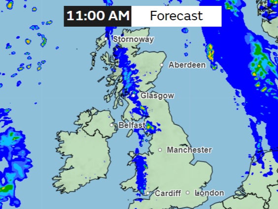
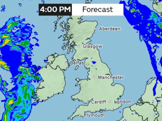
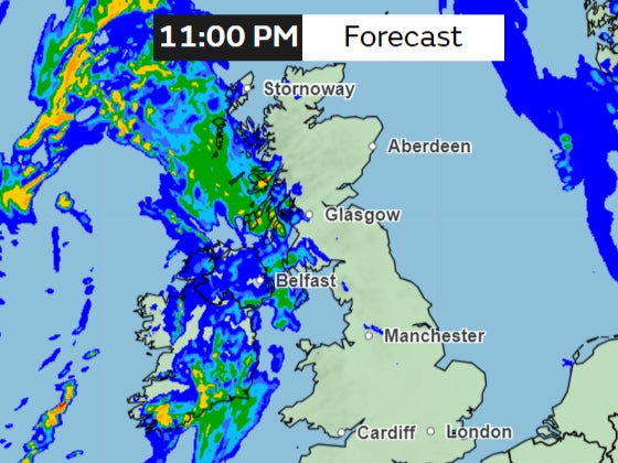
On Monday, the Met Office forecast shows clear skies and sunshine even though some scattered showers will remain in places, with a band of rain entering the country later in the evening.
“There has been mild weather over the weekend, and that mild theme will continue as we get into the new working week,” Met Office meteorologist Craig Snell said.
“We will start the day with some sunshine across parts of East Anglia, the Midlands, Yorkshire and Lincolnshire.”
“But the cloud further west will spread its way that little bit further eastwards,” Mr Snell said. “As the day goes on, any rain really weakens.”
For most of the country, temperatures will remain mild, with 16-17C down south.
However, some fragmented bands of cloud and showers will move across Scotland, England and Wales, the forecast shows.

This band of rain will weaken as the day progresses, leaving a brighter and sunny spell over the afternoon.
But later, wet and windy weather will arrive from the west bringing some rainfall overnight.

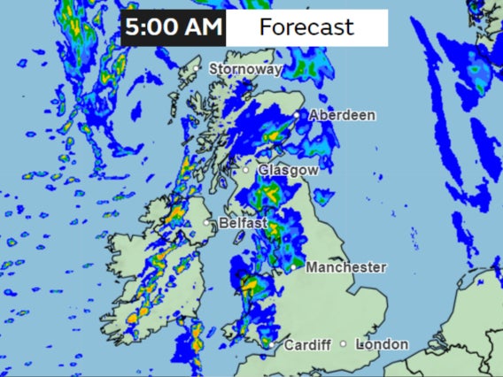
This band of rain will bring heavier showers to Northern Ireland, Scotland and later Wales before clearing out on Tuesday morning.

Southeast England will have a largely “dry night with clear spells”, the Met Office says.
However, the wet and windy weather in the far west will “gradually move eastwards across remaining areas and slowly weaken”.
On Tuesday, clouds and some showery rain will “continue to move east across England and Wales, dying out during the afternoon”.

Over Wednesday and Thursday, conditions are set to become a little cooler, the forecast shows. However, scattered showers are set to continue throughout the week.

Join our commenting forum
Join thought-provoking conversations, follow other Independent readers and see their replies
Comments