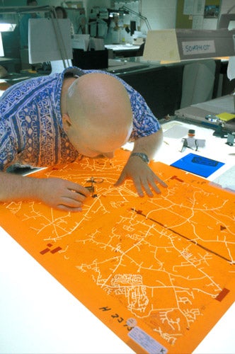
How to map out a new role for yourself as a cartographer
If you like geography, are good on detail and have ace computer skills, you should consider a career as a cartographer

You might be forgiven for thinking that most of the world has been mapped by now. But, because of the constantly changing landscape and the growing amount of information about the earth available through technological advances, there's still a need for skilled cartographers to sift the data and turn it into something meaningful for the rest of us.
"Cartography involves assessing and amalgamating bits of geographic information and presenting them in a map form that's relevant for a particular user," says Mick Ashworth, a former editor of The Times Atlas Of The World who now runs his own company, Ashworth Maps and Interpretation. This can mean producing anything from maps to keep ramblers on track to surveys for oil and gas exploration.
It's a diverse field. There are opportunities in mapping agencies such as the Ordnance Survey, national and local government departments, and in industries such as utilities, and commercial map publishers. Britain also has some important map collections, and cartographers can choose to specialise in historical maps.
Map production involves a mixture of art, science and technology, with the latter becoming more important in recent years. The job now often involves the use of geographic information systems (GIS), which store data digitally and, as well as outputting maps, allow it to be analysed in different ways. The varied nature of the industry means cartographers come from a range of backgrounds including IT and graphic design. But Ashworth says it's important to have an interest in geography and some background in the subject. Attention to detail and good research skills are essential.
Most people's image of the Ordnance Survey stems from school geography lessons spent poring over trig points and gradients, but Ed Mainwaring's job in a cartographic design team involves creating maps in varied styles. He'll be designing spectator maps for the London stage of the cycling Tour of Britain one day and charts showing land levels for newspaper articles on the risk of flooding the next.
"I source the data and do the design work in graphics packages, drawing freehand on a computer," he says. Mainwaring came to the job via a degree in robotics and intelligent machines, and his interest in mapping was sparked when he designed a robot that used a GPS receiver to navigate. He now uses his IT expertise to programme GIS systems to output data for other cartographers. Imagination is important, he says, as you need to be able to visualise how the data can be translated on to paper.
"You have to create symbols that work with each other. There's a hierarchy of information for each map and you have to make sure the important things stand out," he adds. This involves communicating well with clients.
Above all, he enjoys the job's technical and creative challenges. "The Tour of Britain wanted little graphics rather than just symbols to represent major sites," he says. "I had to work out how to draw St Paul's Cathedral and Westminster Abbey so they're recognisable at one inch across."
But will internet mapping sites such as Google Earth lessen the need for cartographers? No, says Ashworth, adding: "Those things have raised people's awareness of maps, and made them question what a good map is. There will always be a need for cartographers to show them."
Cartography facts
* A degree in geography is a good starting point but other relevant subjects include art and design, IT, sciences, surveying and GIS. There are also opportunities to work overseas, so knowledge of a foreign language can be useful.
* For more information, visit the British Cartographic Society at www.cartography.org.uk where you can find a list of undergraduate and postgraduate courses.
* See the Association for Geographic Information, www.agi.org.uk, for a list of GIS degrees.
* Starting salaries for graduates are in the region of £20,000. A senior cartographer can earn £35,000 to £40,000.
Join our commenting forum
Join thought-provoking conversations, follow other Independent readers and see their replies
0Comments