Indonesia earthquake: Tremor measuring 6.3 strikes off eastern coast near Molucca islands
There were no immediate reports of damage or casualties

For free real time breaking news alerts sent straight to your inbox sign up to our breaking news emails
Sign up to our free breaking news emails
An earthquake with a magnitude of 6.3 has struck off the eastern coast of Indonesia.
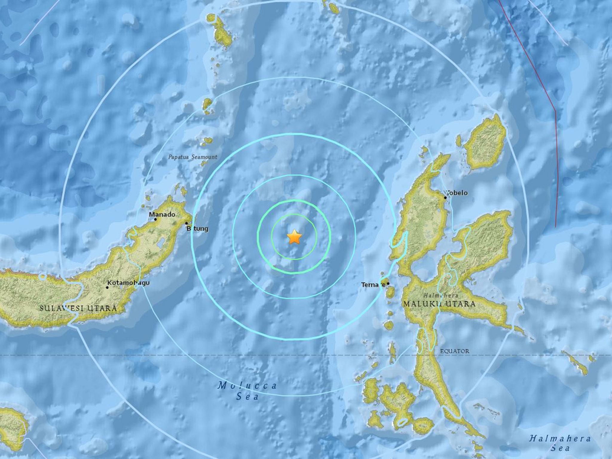
The epicentre of the quake was 38.8km (24 miles) deep, about 126km (80 miles) west-northwest of Kota Ternate, the US Geological Survey said.
The USGS initially estimated the quake had a magnitude of 6.6.
Local media reports the earthquake was widely felt by residents throughout the region, but there were no immediate reports of damage or casualties.
The NOOA Pacific Tsunami Warning Center said it saw no tsunami danger from the quake.
The biggest earthquakes in the world since 1900
Show all 10Indonesia is prone to earthquakes due to its location on the Pacific "Ring of Fire," an arc of volcanoes and fault lines in the Pacific Basin.
In December 2004, a massive earthquake off Sumatra island triggered a tsunami that killed 230,000 people in a dozen countries.
Subscribe to Independent Premium to bookmark this article
Want to bookmark your favourite articles and stories to read or reference later? Start your Independent Premium subscription today.
Join our commenting forum
Join thought-provoking conversations, follow other Independent readers and see their replies