Your support helps us to tell the story
From reproductive rights to climate change to Big Tech, The Independent is on the ground when the story is developing. Whether it's investigating the financials of Elon Musk's pro-Trump PAC or producing our latest documentary, 'The A Word', which shines a light on the American women fighting for reproductive rights, we know how important it is to parse out the facts from the messaging.
At such a critical moment in US history, we need reporters on the ground. Your donation allows us to keep sending journalists to speak to both sides of the story.
The Independent is trusted by Americans across the entire political spectrum. And unlike many other quality news outlets, we choose not to lock Americans out of our reporting and analysis with paywalls. We believe quality journalism should be available to everyone, paid for by those who can afford it.
Your support makes all the difference.Tropical Storm Fay continued its erratic path today, moving north along the Florida coast but not going out over the Atlantic Ocean, where many had feared it could strengthen and curve back toward the state as a hurricane.
The storm first hit the Florida Keys, veered out to sea and then traversed east across the state on a path that would have taken it over the ocean before it curved toward the Florida-Georgia border. Forecasters expected the storm to get a dose of energy Wednesday when it moved over the Atlantic Ocean, where it could linger and possibly reach hurricane strength.
But the storm's center remained just inland early Wednesday, and forecasters said it may not go over the ocean until the afternoon. The chances of Fay becoming a hurricane were shrinking, the National Hurricane Center said.
But a hurricane watch remained in effect for parts of north Florida and Georgia. A tropical storm warning was extended, covering an area from north of Jupiter Inlet to Altamaha Sound in Georgia.
"This storm is going to be with us for a while. That's obvious now. It looks like it could be a boomerang storm," Gov. Charlie Crist said Tuesday, urging residents to be vigilant for what could be the storm's third hit to the state.
The storm was on Florida's east coast at 5 a.m. EDT (0900GMT) Wednesday, about 15 miles south of Cape Canaveral. Its maximum sustained winds remained near 50 mph. The storm was moving toward the north near 5 mph.
And while forecasters warned rainfall from the storm could just as easily be catastrophic as benign, many farmers cautiously optimistic, hoping a soaking would boost crops hurt by a lingering drought.
"It's very seldom we're hoping for a hurricane, but we are," said Randy Branch, a farmer in southeast Georgia where lingering drought has left about a third of his cotton and peanut crops bare this summer.
"We need some rain pretty bad."
US National Weather Service meteorologist Steve Letro said it's possible southern Georgia could receive 10 to 20 inches (25 to 51 centimeters) of rain — enough to cause severe flooding — if it makes a second landfall.
"I know people hate drought, but when you're talking about a tropical cyclone relieving drought conditions, be careful what you wish for," said Letro, the chief meteorologist in Jacksonville, Florida.
In Duval County, which surrounds Jacksonville, officials prepared shelters, cleared drainage areas that could flood and readied emergency response teams. Public schools canceled Wednesday and Thursday classes, and mobile home residents were encouraged to find sturdier shelter.
"Our biggest concern is complacency. Jacksonville has a history of being shielded from storm systems. While we don't want anyone to panic, we want everyone in the area to take this storm seriously," said Misty Skipper, a county spokeswoman.
In Georgia's southeastern corner, Camden County had public works crews cleaning out storm drains and ditches in preparation for possible flooding. The Georgia Emergency Management Agency also began 24-hour operations Tuesday afternoon to monitor the storm.
A National Hurricane Center forecast late Tuesday projected that the storm's path would take it through Alabama over the weekend. However, projections varied widely, prompting some in South Carolina to hope for crop-sating rain.
"I just came in from the fields. Everything is burning up," said farmer Charles Campbell of Belton, South Carolina. "If a storm is brewing down there, just send it up I-26."
Fay formed over the weekend in the Atlantic and was blamed for 20 deaths in the Caribbean before hitting Florida's southwest coast, where it fell short of predictions it could be a Category 1 hurricane when it came ashore.
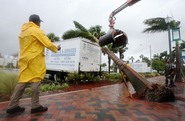
Though it flooded streets in Naples, downed trees and plunged some 95,000 homes and businesses in the dark, most Floridians thought they had dodged a bullet. The worst of the storm's wrath appeared to be 51 homes hit by a tornado in Brevard County, southeast of Orlando. Nine of the homes were totaled, said Brevard County Emergency Operations Center spokesman David Waters.
Brevard County sheriff's deputies arrested three men for looting in the mobile home park, and a trapper was called to remove an alligator discovered wandering there.
Two injuries were reported in the Brevard County tornado, and a kitesurfer who was caught in a gust of wind Monday was critically injured when he slammed into a building in front of the beach near Fort Lauderdale. Kevin Kearney, 28, was still in critical condition Tuesday, Broward General Medical Center officials and his family said.
Flooding remained a concern as Fay heads up the Florida peninsula, with rainfall amounts forecast between 5 and 15 inches. The storm could also push tides above normal and spawn tornadoes. Counties in the storm's path called off school for Wednesday and opened shelters.

Join our commenting forum
Join thought-provoking conversations, follow other Independent readers and see their replies
Comments