Satellite images show airfield damage in eastern Ukraine
One picture, from US Earth observation company Planet, shows smoke rising from a site in Chuhuiv.

For free real time breaking news alerts sent straight to your inbox sign up to our breaking news emails
Sign up to our free breaking news emails
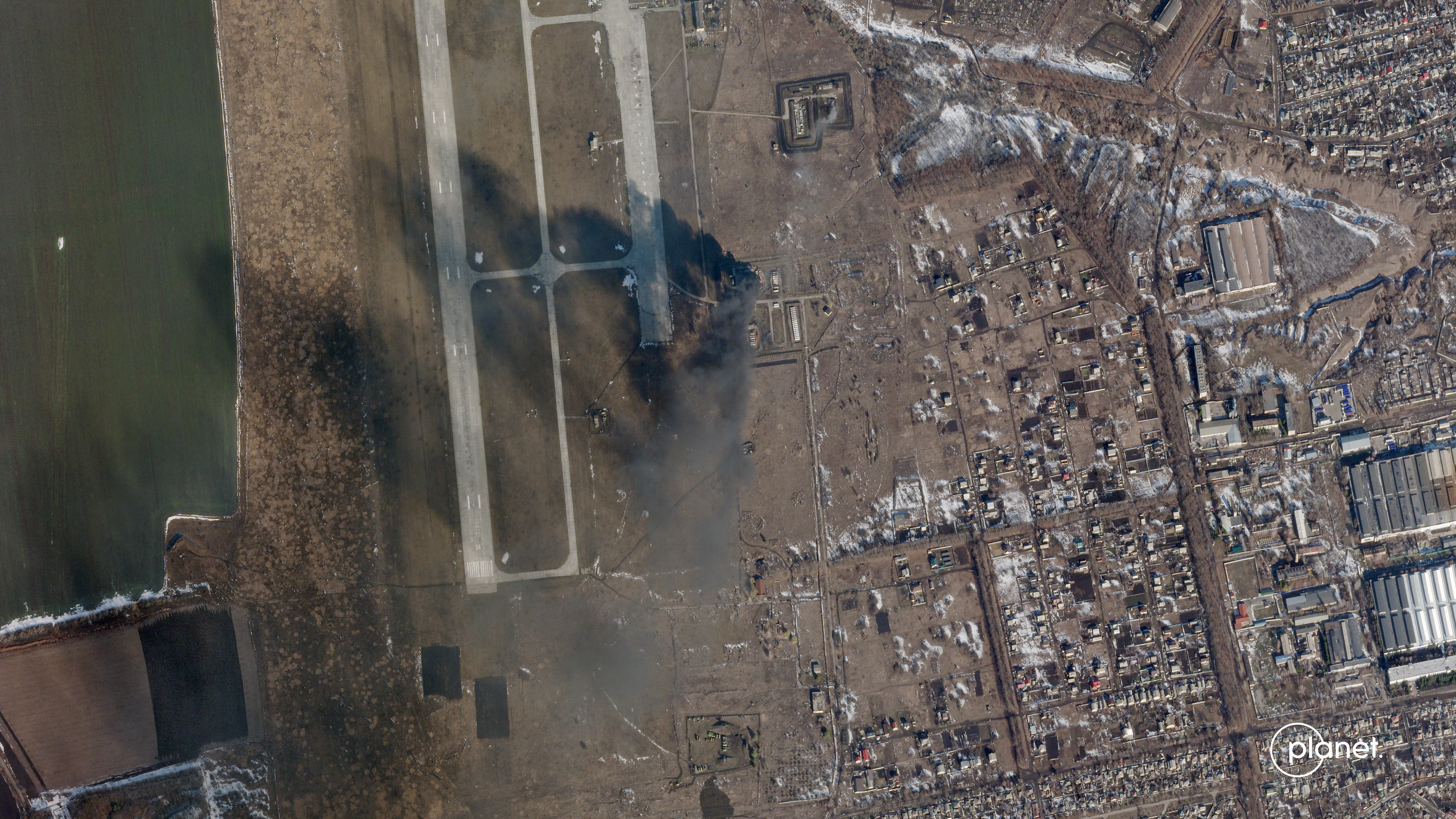
A satellite image which appears to show damage to an airfield in eastern Ukraine has been shared by an Earth observation company on the day Russia launched an attack on its neighbour.
American company Planet, which says it “processes and distributes a global, near-daily stream of satellite data” shared pictures on Twitter of an airfield in Chuhuiv on Thursday afternoon.
It says the first image shows an airbase in Chuhuiv in Ukraine on Monday, while a second image showing smoke rising from the ground was taken on Thursday.
“Latest from Chuhuiv Airbase in Ukraine. Imagery captured on February 21 and today, February 24, 2022,” Planet tweeted.
The company said the images were captured by their fleet of SkySat high-resolution satellites.
“Sad to see the tragic and deteriorating events in Ukraine,” Planet tweeted.
“We have and will continue to provide imagery from the region to our partners, aid, relief and human rights organizations, and the media to expose the situation as events unfold.
“Our thoughts are with the people of (Ukraine).”
Subscribe to Independent Premium to bookmark this article
Want to bookmark your favourite articles and stories to read or reference later? Start your Independent Premium subscription today.