Northwest ice storm power outages could last through weekend
A winter storm has blanketed the Pacific Northwest with ice and snow, leaving hundreds of thousands of people without power and disrupting travel

For free real time breaking news alerts sent straight to your inbox sign up to our breaking news emails
Sign up to our free breaking news emails
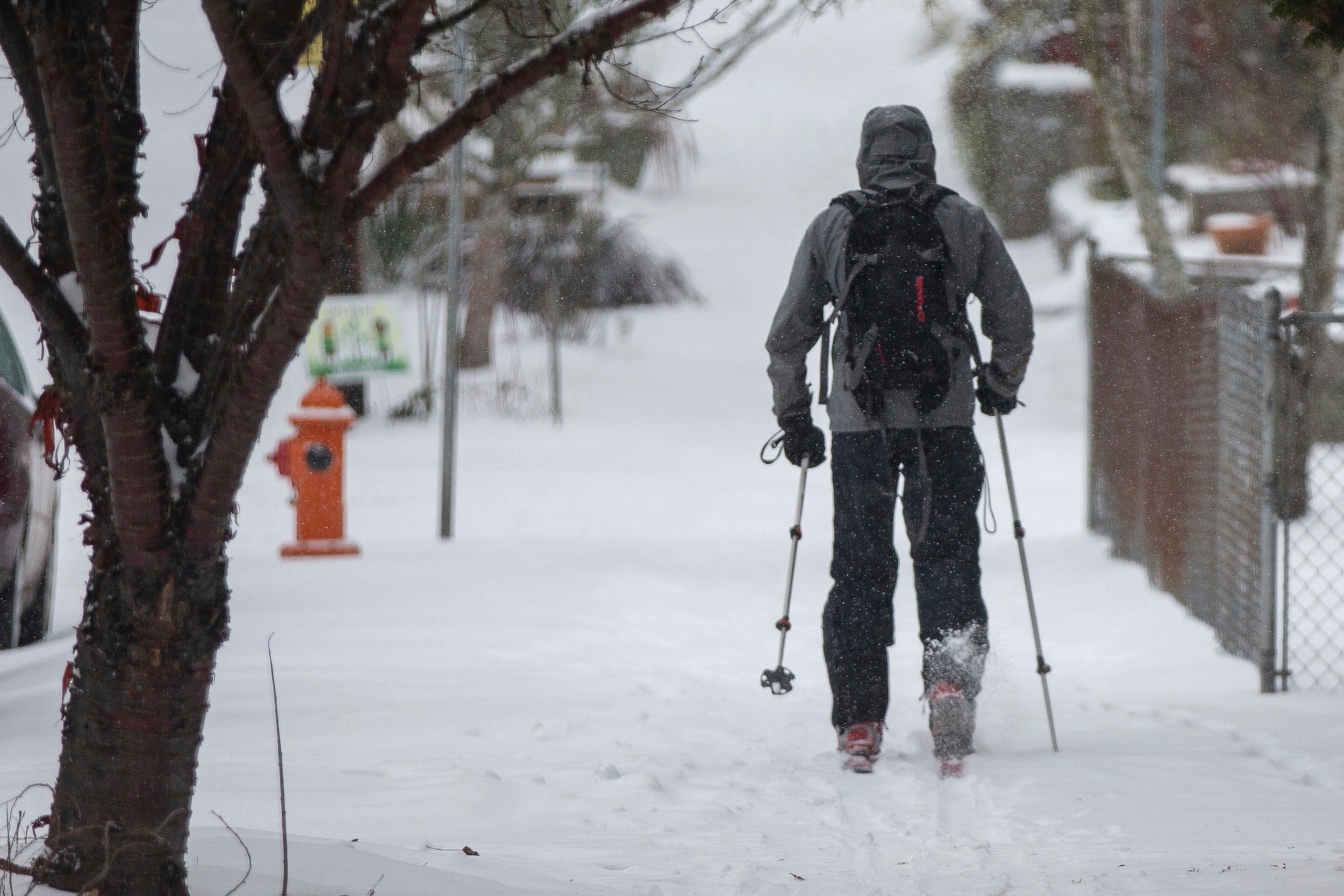
A winter storm blanketed the Pacific Northwest with ice and snow on Saturday, leaving hundreds of thousands of people without power and disrupting travel across the region.
Freezing rain left roads, power lines and trees coated in ice in the Portland, Oregon region, and by Saturday morning more than 270,000 people were without power. The outages could extend throughout the weekend for some, said Elizabeth Lattanner, a spokeswoman for PGE, one of the major electricity providers in the region.
“In storms like these, restoration takes time given all of the challenges our crews face in getting to restoration sites and repairing those outages,” Lattanner said. “We have more than 600 PGE and contract personnel responding to the storm — it's all hands on deck.”
Many ice-laden trees snapped under the weight, falling on power lines and causing some transformers to blow out in showers of blue and orange sparks. By noon on Saturday, more than 1,200 PGE power lines were down, Lattanner said.
Brian Zevenbergen watched Saturday as a crew sawed up two large, ice-covered trees that had crashed across his driveway overnight, narrowly missing two cars parked in his driveway. His house in Lake Owego had also lost power overnight. Just around the corner, another massive tree blocked the street in the suburb south of Portland and had taken out a city street light.
“Last night, everything was standing and this morning the two trees had me blocked in the driveway and were blocking at least half the street,” he said. “Friends on the lower levels have power so I have invites to go hang out there.”
The ice and lost power didn’t stop children from rejoicing at a second straight day of sledding in a place that rarely sees sustained snowfall. Residents blocked streets with cones and shooed snowplows away so kids could sled down ice-slicked hills.
The ice and snowfall caused treacherous driving conditions, forcing Oregon transportation officials to close Interstate 84 in the Columbia River Gorge, and the regional transit agency TriMet suspended all bus and train service in the region.
TriMet spokesperson Tia York asked people to avoid all travel unless it's an emergency.
“It is too dangerous out there,” York wrote in a prepared statement.
Police in Salem, Oregon, also warned residents in Marion and Polk counties to watch for downed power lines and falling tree limbs, and the Oregon State Police said fallen trees blocked several roads across the region.
Some Washington state residents were also socked in by the weather, with snow falling throughout the Seattle region on Saturday morning and freezing rain falling along the coast in Grays Harbor County. The city of Seattle activated its Emergency Operations Center Saturday morning to coordinate the city's winter storm response.
Heavy snowfall also led to dangerous driving conditions in parts of eastern Oregon and southwestern Idaho, with Malheur County, Oregon and Boise, Idaho expected to get as much as 6 inches (15 centimeters) of snow by Saturday afternoon.
The National Weather Service said all three states should brace for another surge of winter moisture to hit the Northwest Sunday night, potentially leading to more heavy snowfall through Monday. The “unsettled winter conditions” would likely continue throughout the week, the National Weather Service said Saturday morning.
Western Washington was expected to get an additional 3 to 6 inches (8-15 cm) of snow on Saturday, with another 2 inches (5 cm) possible on Sunday and Monday. Rain falling on accumulated snow raised the possibility of urban flooding happening Sunday night or Monday in some areas, according to the National Weather Service.
The heavy snow made for dangerous avalanche conditions in the many areas across the Olympics and Cascades mountain ranges, with large avalanches possible. Officials with the Payette Avalanche Center in west-central Idaho also warned of increasing avalanche risk in the days ahead.
Idaho's neighbors to the east were blasted by brutally frigid weather, with the National Weather Service warning of dangerous wind chills in Montana and Wyoming. The wind chills were expected to reach as low as 50 degrees below zero in Billings and near Missoula, Montana, and nearly as low across parts of Wyoming. Wind chills that low can cause frostbite on exposed skin in just a few minutes. The bitter cold was expected to last throughout the weekend.
The National Weather Service warned that the wind chill could be dangerous for pets and young livestock, at a time when calving season is beginning for many cattle ranchers.
The Colorado Avalanche Information Center also warned of dangerous avalanche conditions in zones around Apsen, Steamboat and Flat Tops, Grand Mesa and Gunnison. Frigid temperatures with lows below zero were expected to last through Monday morning in Denver and across the Colorado plains, according to the the National Weather Service.
___
Boone reported from Boise, Idaho.
Subscribe to Independent Premium to bookmark this article
Want to bookmark your favourite articles and stories to read or reference later? Start your Independent Premium subscription today.