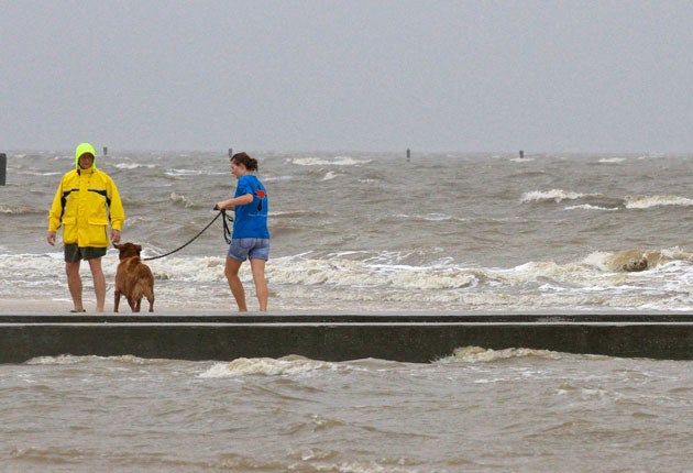
Louisiana prepares for 20 inches of rain as Lee storms in

Your support helps us to tell the story
From reproductive rights to climate change to Big Tech, The Independent is on the ground when the story is developing. Whether it's investigating the financials of Elon Musk's pro-Trump PAC or producing our latest documentary, 'The A Word', which shines a light on the American women fighting for reproductive rights, we know how important it is to parse out the facts from the messaging.
At such a critical moment in US history, we need reporters on the ground. Your donation allows us to keep sending journalists to speak to both sides of the story.
The Independent is trusted by Americans across the entire political spectrum. And unlike many other quality news outlets, we choose not to lock Americans out of our reporting and analysis with paywalls. We believe quality journalism should be available to everyone, paid for by those who can afford it.
Your support makes all the difference.Heavy rains from Tropical Storm Lee were falling in southern Louisiana and pelting the US Gulf Coast yesterday as the storm's centre trudged slowly towards land, where businesses were already beginning to suffer on what would normally be a bustling holiday weekend. With floods from the storms of last weekend's Hurricane Irene still evident in New England, Lee could bring up to 20 inches of rain to some areas.
Tropical storm warnings were in effect from Mississippi to Texas, and flash-flood warnings extended along the Alabama coast into the Florida Panhandle. The storm's slow forward movement means that its rain clouds should have more time to disgorge themselves on any cities in their path.
The outer bands of Lee, the 12th named storm of the Atlantic hurricane season, began dumping rain over south-eastern Louisiana, southern Mississippi and Alabama on Friday. The storm was expected to make landfall on the central Louisiana coast late on Saturday, local time, and turn east towards New Orleans, where it would provide the biggest test of rebuilt levees since Hurricane Gustav struck on Labor Day 2008.
The National Hurricane Center said the centre of Lee was expected to cross the Louisiana coast by Saturday night and pass into the southern portion of the state on Sunday. Forecasters said that its maximum sustained winds had increased slightly by early Saturday morning to 50mph, and could get stronger.
Lee's biggest impact so far has been in the Gulf of Mexico oil fields. About half the Gulf's normal daily oil production has been cut as rigs were evacuated. Oil prices had already fallen sharply on Friday on sour economic news. Federal authorities said 169 of the 617 staffed production platforms had been evacuated, along with 16 of the 62 drilling rigs.
Lee comes less than a week after Hurricane Irene brought destruction to the Caribbean and the US eastern seaboard, killing more than 50 people. It was too soon to tell if Hurricane Katia, out in the Atlantic, could endanger the US. It was expected to pass north of the Caribbean Leeward Islands.
Join our commenting forum
Join thought-provoking conversations, follow other Independent readers and see their replies
Comments