Antarctic sea ice could be thicker than thought, robot submarine finds
Political situation has made submersible surveys tricky

Your support helps us to tell the story
From reproductive rights to climate change to Big Tech, The Independent is on the ground when the story is developing. Whether it's investigating the financials of Elon Musk's pro-Trump PAC or producing our latest documentary, 'The A Word', which shines a light on the American women fighting for reproductive rights, we know how important it is to parse out the facts from the messaging.
At such a critical moment in US history, we need reporters on the ground. Your donation allows us to keep sending journalists to speak to both sides of the story.
The Independent is trusted by Americans across the entire political spectrum. And unlike many other quality news outlets, we choose not to lock Americans out of our reporting and analysis with paywalls. We believe quality journalism should be available to everyone, paid for by those who can afford it.
Your support makes all the difference.The floating sea ice surrounding the South Pole may be thicker than previous estimates have suggested, according to a study based on a submersible robot that has mapped the sea ice in three key regions of the Antarctic.
Past estimates of Antarctic sea ice were based on satellite measurements from space, which can measure its overall surface area, and ice cores drilled through the sea ice from ice-breaking ships to measure its thickness, which have tended to concentrate on thinner ice regions.
However, unlike the Arctic sea ice, there are no military submarines allowed under the Antarctic Treaty, which means that large regions of thicker sea ice have effectively remained unexplored from below, scientists said.
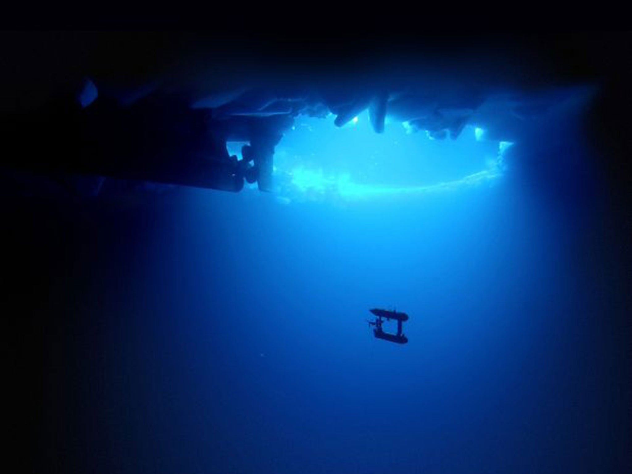
With the help of a 2m twin-hulled autonomous underwater vehicle, scientists from the United States, Australia and the British Antarctic Survey have drawn up the first detailed, high-resolution 3D map of Antarctic sea-ice in areas that were in the past considered too difficult to study.
“The AUV missions have given us a real insight into the nature of Antarctic sea ice, like looking through a microscope. We can now measure ice in far greater detail and were excited to measure ice up to 17m thick,” said Jeremy Wilkinson of the BAS.
“It gave us a really good basis for what the ice thickness is at present. Over time we hope to make repeat measurements and build up a time series to see how it is changing,” Dr Wilkinson said.
The robotic submersible used upward-looking sonar to map the thickness of the sea ice over an area of 500,000 square miles equivalent to about 100 football pitches, in three locations – the Weddell, Bellinghausen and Wilkes Land sectors of Antarctica.
While the sea ice in the Artic has decreased in surface area by about 40 per cent over the past 40 years, the sea ice in the Antarctic has increased for reasons that are still under debate. Dr Wilkinson said that one cause could be a change in wind patterns that is blowing sea ice further out to sea.
Join our commenting forum
Join thought-provoking conversations, follow other Independent readers and see their replies
Comments